
The gravel road to the trailhead is in the process of being regraded and is in good shape until the final 1/2 mile. I'd recommend a vehicle with some clearance to avoid hitting bottom.
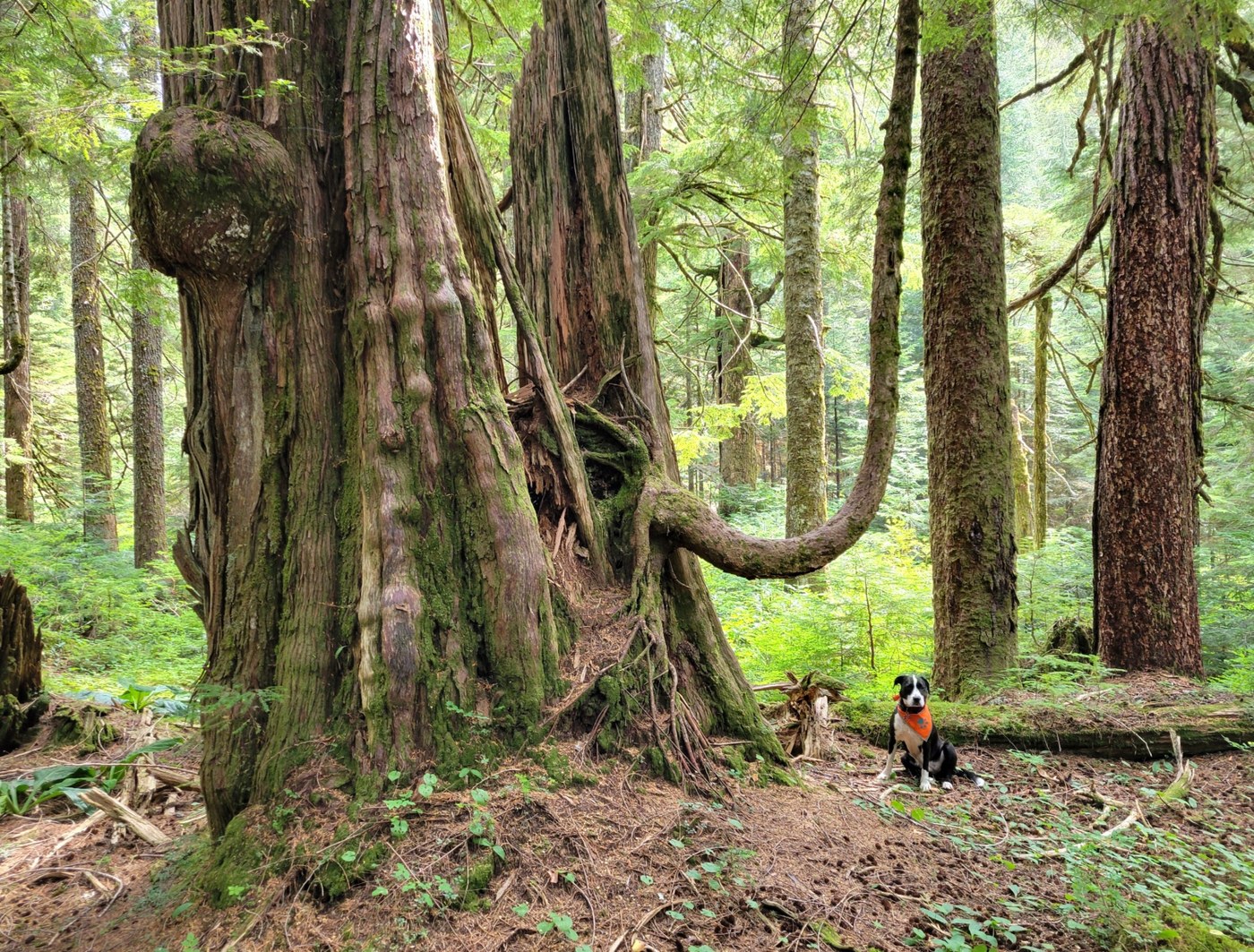
The trail starts off on a decommissioned logging road. The first mile of trail traverses a fairly uninteresting 2nd growth forest. The old growth forest starts off with an old Hemlock forest with occasional big Red Cedar. As you get closer to Upper Ashland Lake the there are many more big old gnarly Cedars with some interesting grotesque features. The trees are so old that many are half dead and partially rotting. It really gives the forest a lot of character. The largest Cedar that I found measured a respectable 9 feet in diameter.
About a third of the trail is on raised boardwalks and puncheon because this area is very wet most of the year. It must have been a very expensive trail to build. Unfortunately it is falling into disrepair with broken planks and tilted walkways.
The trail beyond Lower Ashland Lake to Twin Falls has been abandoned by DNR. We did it in 2018 and it was a rough go.
Of the 3 lakes, I thought that Beaver Plant lake was the nicest. Upper Ashland has interesting beaver tree felling. Lower Ashland has the gnarliest old Cedars.
RT 6.3 mi, 900ft


Comments
Muledeer on Ashland Lakes
Good news about the road!! I have been wanting to get back up there for a few years now. Too bad about the neglect of that trail system, the boardwalks, trail to the falls and the Bald Mtn traverse. That's what budget cuts get you, sadly
Posted by:
Muledeer on Jul 31, 2025 05:54 PM
BIPS on Ashland Lakes
Sad on the trail not being maintained to Twin Falls Lake. This is the most interesting of the lakes here. When this trail was built there was a story board at the lake telling the geological history of it. When you look at it now, you wonder how it got so smooth and carved out with such a small water flow. When the ice age was breaking up this was a major river that went over the hill at this point. If you go past the lake a bit and go up the hill you will see more rocks that still have minimal growth on them and are smooth from water rushing over. Through the years I have kept working on this trail, but it needs a little more manpower now to get it cleaned up. If you look at a map you will see that it is basically flat from the trail head to Twin Falls Lake if you take a direct route. This was the route of the river. In the 60’s my Dad found a picture of this lake in “Lakes of Washington, volume 1, Western Washington, Second Edition” page 456. There was no trail there in the 60’s. Logging was fresh then and we just took a direct line to it. I believe the trail was built sometime in the 80’s.
Posted by:
BIPS on Jul 31, 2025 07:13 PM
Maddy on Ashland Lakes
Thanks for those very interesting comments. There's some good information about the ancient spillway Harvey Mannings 1990 edition of Footsore 3. Apparently the massive Cordilleran Ice Sheet filled Puget Sound with up to 5000 feet of ice about 15,000 years ago. It dammed up all the major rivers coming out of the Cascades including the Skagit, Sauk and Stillaguamish. This created a huge lake. The outlet for this lake, as you said, was around where Wilson creek is now. This ancient spillway may have been as large as the Columbia River. Hard to imagine. If you look at Google Earth you can clearly see that this is the low point in the mountain ridge between Mt Pilchuck and Bald Mountain so it makes sense but is still hard to wrap your brain around.
Harvey said that the lower area was logged in the 60's. DNR built the trail between 1972 and 1975. Apparently it was costly and a bit controversial.
Posted by:
Maddy on Jul 31, 2025 08:28 PM