Since not too many people reach the shelter, I thought I'd make a trip report (or caveat) on the full hike.
This hike is harder than the specs would have you believe. My GPS gave me 18.5mi, with 2500ft gain on the way in and 700 on the way out. But that's not the whole story.
The first 6 miles of trail are great. A few overgrown spots and lots of mountain beaver or tree erosion holes with overgrown brush over them, boggy mud pits and slippery rock-hops over streams, so you have to watch your feet, but nothing terrible.
The river crossing was chest-high on me (5'3") but I chose the calmest spot right where the trail lets out at the beach, and where I could see the trail began again on the other side. On the way back I went a little downstream and the water was only waist-high. It definitely tested the waterproofing on my Hyperlite gear, and the backpack passed the test, though the fanny pack did not (luckily none of my electronics fritzed out). It was nice and warm, so the water felt great, and I stopped again at the swimming holes about 1/3mi past the first crossing. A group of swimmers told me about a hornet's nest on the left side of the trail within about a mile past the swimming holes but I never saw it. They were 4 people, and I was solo, so the crowd may have ticked off the hornets. Still, I was super careful for the next couple miles.
The stretch of trail between the swimming holes and the 2nd crossing seemed to go on forever, but it was nice and cool, up and down but never too much, and very pleasant.
The 2nd crossing was shin-deep and the trail on the other side was visible. Switchbacking up from there, I saw 2 cat latrines! Scraped out divots with a pile of dirt behind them and a poop in the middle. Not sure if they were cougar or bobcat, but still, I had eyes in the back of my head (literally lined up my water shoes to look like eyes and my Kula cloth to look like a nose on the back of my pack. :-D).
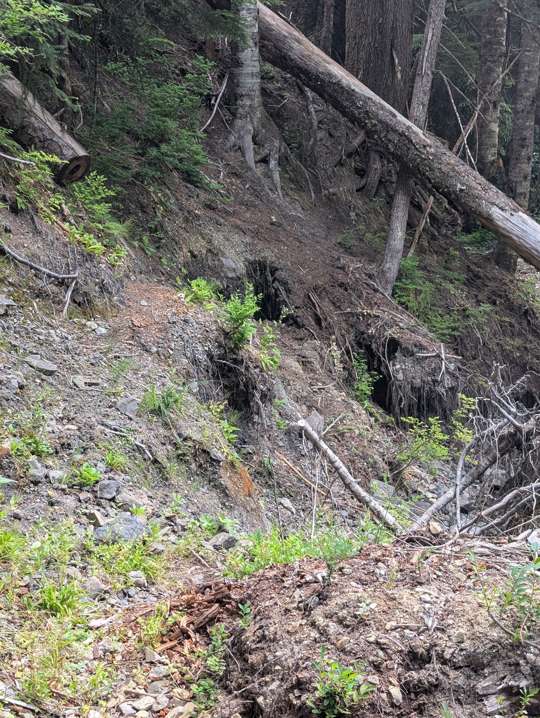
The 3rd crossing was where things started to get interesting. I walked up and down the river about 50ft in my water shoes (shin high) looking for clues from previous trip reporters - a piece of survey tape, a cut step in a log, sawed off logs, a fire ring, 2 cairns, a metal orange tag on a tree. I did find them all, but some of them I only found on the way back :-) I used GAIA GPS, which wasn't entirely accurate, but between the clues and GPS, I was able to find the trail to the river and finally figure out the trail on the other side. Between the 3rd, 4th and 5th crossings, in the last 1.25 miles to the shelter, there were some sketchy parts where the riverbank had eroded and the trail was running over an undercut bank. I am small and my gear is light, so I tiptoed across holding onto trees that were firmly rooted (gave a couple tugs because some were not solid handholds), in case the soil gave way. The trail down to the last crossing may not have been the actual trail. I got across that crossing on 2 logs, found the trail easily and continued almost 1/2mi to the shelter. It took me 6.5hrs to get there.
Almost no one ever goes to the shelter, but there were 2 local Pt. Angeles guys staying there before bushwhacking up to Aurora Ridge and over to Boulder and Blue lakes. They had the 2 rocky tent spots outside, so I put my ground cloth down on a bunk and slept like a log. As far as I could tell, I had no rodent company, though we all kept a clean camp with our bear cans far enough away to not attract critters. Between the delicious ripe salmon, blue huckle, thimble and native blackberries, and the giant purple bear scats we saw, we knew they were out there. I did see a tiny mouse or a muskrat swimming in the river in front of the shelter.
It took me 5.5hrs to get back the next day, having recorded a track I could follow, which included a dip in the swimming holes.
All in all, a lovely trip that honed my water fording and routefinding skills and included a nice evening with fellow travelers.
PS: I saw one campsite at about 3 miles, but never saw the one at 6.7. Lots of fallen trees, so maybe a tree took out the one at 2.3 and 6.7mi. At one point, worrying that I might not find the shelter, I set a waypoint for a meadow near the 3rd crossing, but it wasn't a durable surface, so it would have been an emergency measure only.


Comments