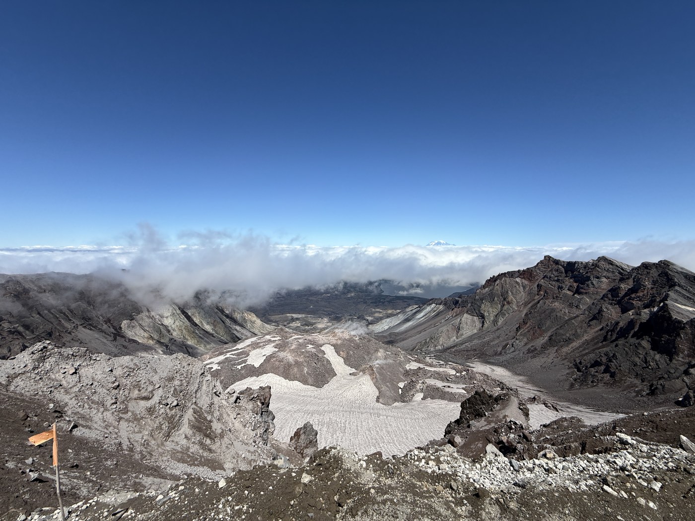
After finally securing permits after a few years of admittedly lax planning, our group of three hiked St. Helens this year.
We arrived the evening before - me around 3:00pm and the others around 6:30pm. It was rainy and unseaonably chilly at camp, but that did not deter others from doing the same. After setting up our tents and eating dinner in the rain, we settled in for the night.
Given the low temperatures and forecast for clouds and potential rain in the monring, we decided on a later start than originally planned - around 5:00am we hit the trail.
We reached the ridge proper after about 1 hour 30 minutes. While we certainly weren't setting any land speed records, we plodded along, going up along the ridge at a steady pace. I agree with some other reports saying the boulder fields go on for quite a while, certainly longer than we expected. I would argue that gloves are really something to consider given the amount of time spent scrambling and especially given it was still wet in some sections from the previous day's rain.
Most of the morning and into the early afternoon the trail from about halfway up the boulder field to the ash field was in the clouds. Routefinding wasn't bad, but as a result we stayed up on the boulders instead of taking the path to the left because we weren't sure if or when we'd lose sight. I can see how taking the trail up would save some time. When in doubt, trend up and right.
The ash field wasn't too bad for us - I think because of the rain from the previous day kept it matted down some. We all brought gaiters but didn't use them.
We spent about 30 minutes at the crater rim then turned around for the hike down. It was nice having trekking poles and again the gloves were lifesavers. All in it took us about 12 hours 20 minutes, as we definitely took it slow and steady most of the hike.
I carried 3 L of water but only needed about 1.75 liters. Given it was chilly the day we went up, I could see wanting more especially if it's hot. I hiked South Sister Mountain four days later and drank 3.5 liters on a 100 degree day.
On a separate note, we encountered the best of the hiking community. Near the end of the trail, we ran into a man named Alex, who was going back UP the trail - yes, after going up and down earlier in the day - stopped to chat with us for a second. He was going back up to help some other hikers who were going slow and didn't have flashlights. He had also overheard us mentioning how one in our party lost their phone on the hike. He saw the phone and said he'd bring it back, unless someone else happened to grab it, which they had. The phone was back to us about 2 hours later. Thanks to Alex and the other two hikers - a father and his daughter - to assisting us in getting back our phone.


Comments