This is a strenuous but doable hike, and well worth the effort if you are able. We did Mailbox Peak old route multiple times this summer, and found the effort to be similar, though clearly very different terrain.
It was quite warm, we didn't get much of a reprieve at elevation and obviously the trail is quite exposed to sun. There is a lot of haze, I assume from fire smoke. We barely could see Mt Rainier, just an almost invisible outline, and Mt Adams was only a smidge better. Locally though, no smell of smoke and we had a great view of the dome and Spirit Lake from the top.
Snow is still present to the sides of trail in some spots, but not much there and glissading seemed out of the question due to exposed rock, large depressions, and what looks might snow bridges collapsing.
There are lots of details in other recent reviews which were quite useful, the most notable after our hike:
1. There is a LOT of scrambling, maybe 7 or 8 boulder fields to go up, each one becoming progressively shorter/easier.
2. Some reviewers mention white poles marking a trail. You are looking for full size fence timbers, 6" wide and 4-6 feet tall. Most are not white, just light colored wood. (You are not little plastic driveway markers with reflectors).
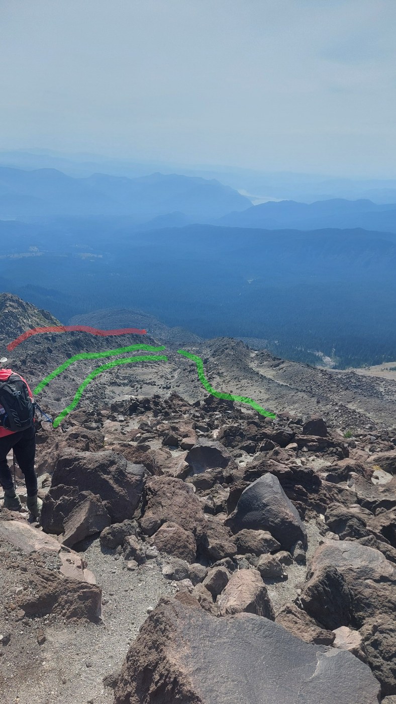
3. As reviews have said, if you closely follow the poles up the long valley after the first ascent out of the forest, you will be taken up a ridge that appears to involve unnecessary scramble over rocks. We didn't go that way, so we can't confirm, but no one else was going that way. We and others mostly followed the right side of the valley about 50 feet below the marked ridge. Once up above, you can turn back and see all the different paths clearly, a picture showing what appear to be popular routes is below. These routes are not necessarily easy either, there is plenty of loose small rocks to deal with, its a just preference of terrain you want to cover.
4. At the end of the chute, and through the remaining 7 or so scrambles, take your time to plan your route. We often found a much easier path just a few feet to the side that had a quick, smaller step path to the top.


Comments
DRDana on Mount St. Helens - Monitor Ridge
Very helpful report. I did this hike last September, and I preferred mostly staying on top of the ridge (red in your photo), because lower down the ridge the sand was looser and wanted me to slide laterally down the slope. Though maybe the track you took is more established and firm than it was last year.
Posted by:
DRDana on Aug 26, 2025 12:29 PM
HotterOtter on Mount St. Helens - Monitor Ridge
It is a great point, thanks for highlighting! There were certainly parts in the chute that were loose and we did find ourselves looking for the less loose paths. Several times we caught ourselves going towards the wall, if I can call it that, and it definitely was loose there. None of it was as crazy as the last 500 feet at the very top, we were very glad when that part was done.
Posted by:
HotterOtter on Aug 26, 2025 07:53 PM