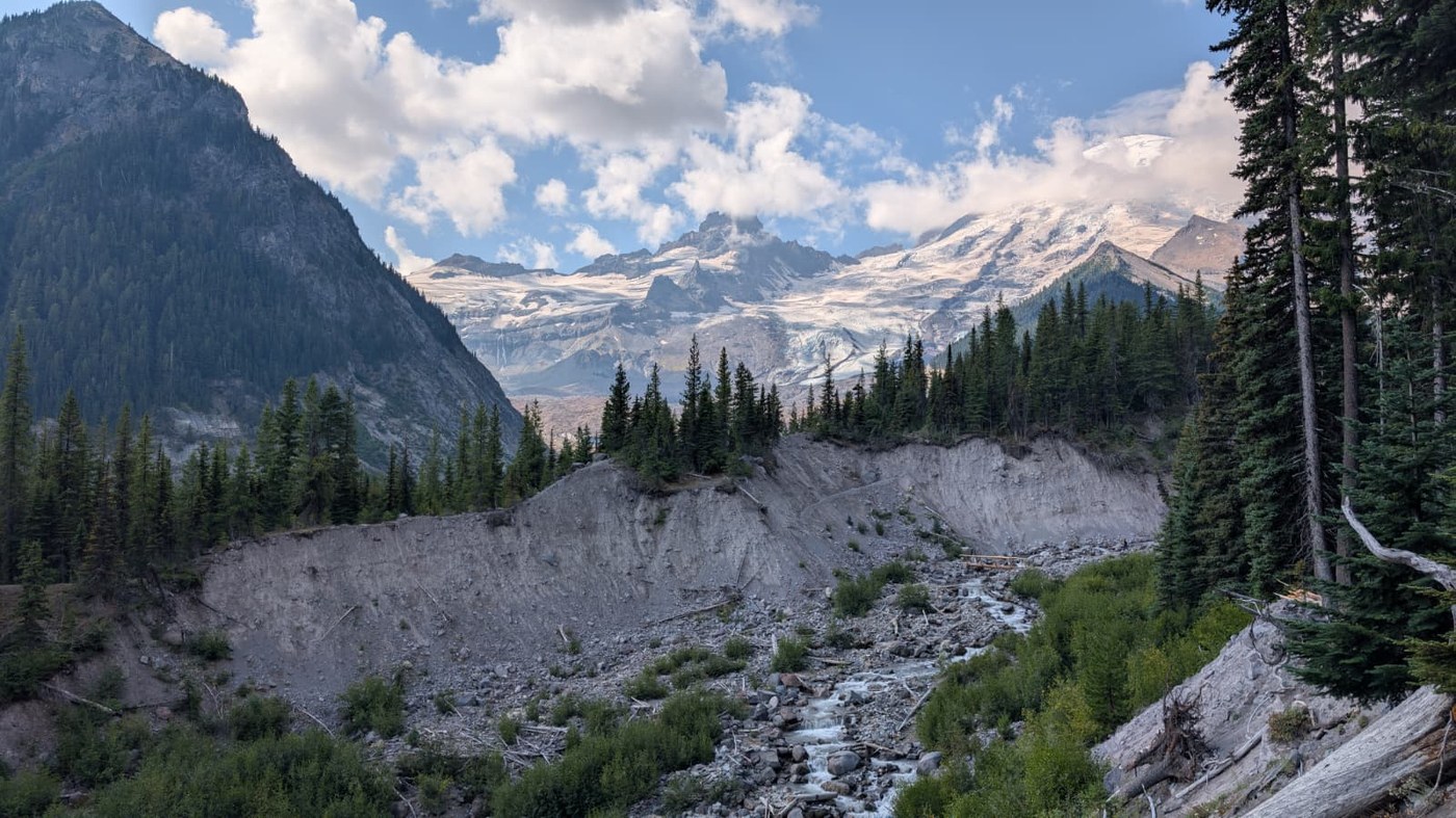
Did a quick overnight camp at Glacier Basin, with an ambition to ascend to Steamboat Prow as a day hike, inspired by this trip report:
Steamboat Prow, Mount Ruth, Glacier Basin & Emmons Moraine — Thursday, Aug. 21, 2025
I write this report from and for the perspective of a fairly experienced trail hiker looking to experiment with negotiating some climbers' tracks.
Alas, we didn't make it quite as far the Prow, topping out at just around 8000 ft, a few hundred feet below the climber's track around Mt. Ruth. However, the views of the Emmons Glacier and Little Tahoma up close and personal, as well as the sights and sounds of crackling ice, rockfall, and meltwater gushing into the White River were more than satisfactory as consolation prizes.
The trail up to Glacier Basin is well-trod and popular, if a bit steep on its last 1/2 mile -- it's the beginning of an "easy" route to summiting Rainier, as well as having a history of acting as a road to a defunct copper mining claim.
To get to the climber's track to achieve the ridgeline heading to Ruth, exit the Glacier Basin camp towards Inter Glacier and hang a left just after the "Trail Unmaintained Beyond This Point" sign towards Inter Fork. You'll see a cairn below marking a great spot to scout your crossing route, as well as soak your feet after you come back down.
Negotiate as safe a rock-hop route as you can across the Inter Fork's three channels towards an obvious bootpath, and begin the ascent after passing abandoned mining equipment on your left. There's a much clearer stream (vs. filling from the glacial flour-filled Inter Fork) to filter water from just past this point.
The next half mile or so is very steep, with extremely loose volcanic rock, sand, and lightly packed pebbles covering the route that snakes up through and past the tree line. It's certainly tiring going up, but much more dangerous coming down. Trekking poles and concentration are necessities. The track becomes slightly gentler as you climb higher towards the ridge, but still demands careful, deliberate steps.
After achieving the ridgeline, Little Tahoma and the Emmons Glacier rush into view. The path farther up is obvious here, and much more tame. Take your time and absorb all the sounds and sights, enjoying the light reflecting off the numerous crevasses and cracks in the ice.
We stopped just short of the three small snowfields still remaining under Mt. Ruth and headed back to camp, citing fatigue from trekking over choss and scree, diminishing daylight, and a potential for rain rolling in -- which fortunately did not materialize. For further ascent guidance, refer to the earlier mentioned trip report above as well as topographic maps like CalTopo or GaiaGPS.
Before departing Glacier Basin the next day, we did a quick morning hike up to Sherpa Rock, an excellent and rewarding viewpoint with just 1000 ft of ascent, to view the Inter Glacier (or what is left of it) and gaze down into the basin itself. As we headed back to the trailhead at the White River Campground, we did a quick look into the Emmons Moraine spur trail, but after seeing the glacier from above and up close, it was fairly underwhelming. Perhaps it's wiser to check out this diversion before trying the same ascent.


Comments
DRDana on Glacier Basin, Mount Ruth, Emmons Moraine
Thanks, this is a very timely report for me, since I'm considering going to Mt. Ruth for the first time in a few weeks. Looking over all the past Mt. Ruth reports, I've noticed very few from this late in the summer. Perhaps people prefer when there's snow covering the choss and scree?
Posted by:
DRDana on Aug 29, 2025 08:42 PM
the writ on Glacier Basin, Mount Ruth, Emmons Moraine
That could definitely be the case! For me, not having much experience with snow travel, I think it's a perfectly doable ascent in current conditions.
Posted by:
the writ on Aug 29, 2025 11:03 PM
DRDana on Glacier Basin, Mount Ruth, Emmons Moraine
I also notice that most others just pass Mt. Ruth on their way to higher up, so they're usually equipped for snow. But I'm happy to do without the complication. Thanks again.
Posted by:
DRDana on Aug 29, 2025 11:11 PM
jrod on Glacier Basin, Mount Ruth, Emmons Moraine
Ruth is essentially a loose rock pile, so I’d imagine snow would make the hike more pleasant. Still a worthy summit imo, and only a 5-minute mellow side trip off the main route to Steamboat Prow.
Posted by:
jrod on Sep 05, 2025 10:14 AM
slo go on Glacier Basin, Mount Ruth, Emmons Moraine
If you are looking to expand your horizons on some hikes not included in most trip reports check out WILLISWALL.com and you will find hikes that few have done. One is Mt. Ruth from the end of the Emmons Moraine Trail. https://www.williswall.com/grand-tour-mrnp?rq=mt%20ruth. You can spend countless hours looking at his videos. My hiking partner Georg actually met him a few weeks ago on trail and asked him about Mt. Ruth. He said it was just like the video says. Go straight through the forested sections and keep going.
Posted by:
slo go on Aug 30, 2025 09:14 AM
the writ on Glacier Basin, Mount Ruth, Emmons Moraine
Thank you for the link and the recommendation. I've visited his site before for some intel on campsites, but need to explore the wealth of info on there more fully. Cheers
Posted by:
the writ on Aug 30, 2025 11:35 PM