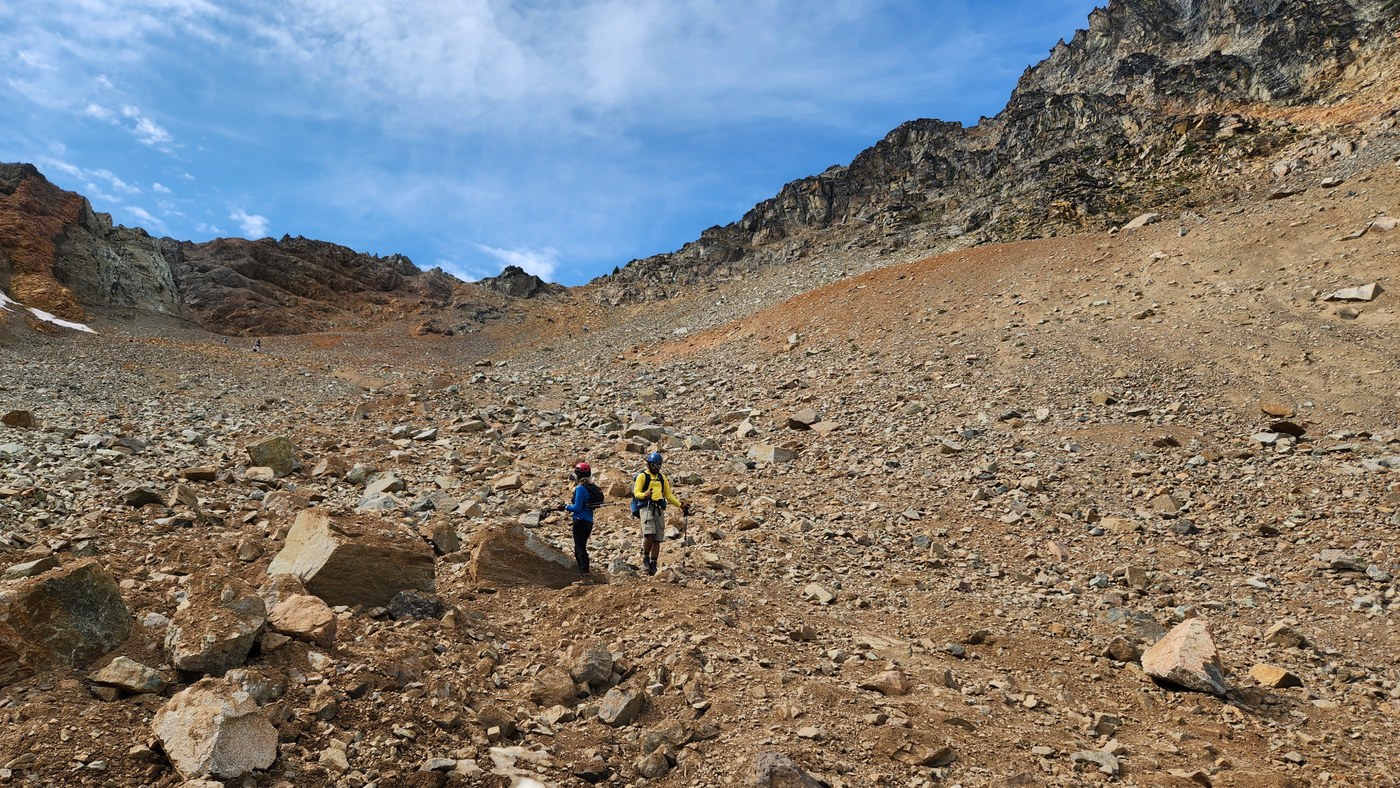
The existing info on this route is pretty good, but I'll give a quick run-down of our trip yesterday in case it helps anyone. Tldr: there are a few spots with significant rockfall hazard, most of the route is pretty well-marked, but particularly near the top you could end up in trouble if you're off-route. Strongly recommend having a GPS track and helmet. Very fun scramble with amazing views!
Trailhead to Heather Pass: started at 6:20 am on the PCT. This was quick and straightforward, and the turn-off toward Lewis Lake, Wing Lake and Black Peak is obvious.
Heather Pass to Lewis Lake: trail for a little bit (where you get your first view of Black Peak and Lewis Lake), then descending on a mixture of talus and trail for about 600 vertical feet, then traversing talus to get to more trail that takes you up to Lewis Lake. There are cairns to follow. On the way back, we ended up doing most of the ascent on a dirt side trail we hadn't spotted before, skipping the talus.
Lewis Lake to Wing Lake: the trail is pretty clear and generally in good shape. We ran into a few parties who had camped at Wing Lake heading out (one of which had just seen a bear).
Wing Lake to col: the first part of the way up is on a rougher but clear trail, which flattens out briefly into a tiny snowfield. Then you have the dreaded scree bowl. We were fortunately to have no parties above or below us on the way up, and there aren't too many large rocks to kick down in the section. We tended to be on the left side of the main gully for most of the way up, following a rough trail that then traverses toward climber's right, then back left to gain the ridge. Stunning views of Goode Mountain, Sahale, Eldorado and more!
Col to summit block: first part has a clear climber's trail, then you get to go up a gully fully of loose rocks. There *are* solid sections you can navigate between to find better footing. I was more or less going up the middle of the gully, looking for the least-loose parts, before veering left toward the top of the gully (where the climber's trail re-emerges). The climber's trail takes you just below the summit block.
Getting to the top: traversed around the right of the summit block, following the trail. Toward the end of the traverse, you can look up to the left and see a couple of pieces of rope and webbing running along some bolts near the top. We scrambled up this section (staying mostly left) to reach the summit a bit after 11 am. Couldn't find a register.
Descending to the col: we got off the summit block by going northwest down a less-technical but nontrivial scramble to get back on the trail. I assume this is the standard way up as well. (Possibly the "class 3 ramp" mentioned in Smoot's guidebook, but that's not how I would describe it...) Navigation on the way down was harder than I anticipated. It's very easy to get started down the wrong gully and get cliffed out. We had a few false starts before ended up back in the gully we had taken on the way up. There is a significant rockfall hazard here: I had to dodge a couple of kicked-down rocks, and we paused about halfway down to let an ascending group get past us because I was worried about kicking stuff down on them. It generally seems to be easier to avoid kicking down rocks when you're on the way up than on the way down.
Back on trail after the gully, we heard yelling to us a from solo climber we had met descending as we were reaching the summit block, coming from off-trail a little above us. She told us gotten significantly off-route and ended up in some cliffs with loose rock. We stayed with her for the rest of the descent to Wing Lake.
Descending the scree: this is exactly as much fun as you think it will be when you're going up (not). At this point in the day, there were several parties going up and down, so we had to coordinate to stay out of each others' fall lines. We started out in the more stable rock on skier's left, then traversed right to reach the trail we had taken on the ascent. Most of the other parties stuck more to climber's right/skier's left, so this worked out OK.
The rest of the way back was uneventful. We filtered water at the stream crossing below Lewis Lake and made it back to the trailhead around 5 pm.
Very fun day with absolutely spectacular views despite some haze.


Comments