
Owyhigh Lake/Tamanos mountain - Decided to take the Owyhigh trail up to Tamanos mountain Wednesday. I heard that there were some good views up there. The trail to Owyhigh is as perfect as you can get. Very well used with minimal rocks & roots to deal with. At the Tamanos Creek campground, they put in a new toilet. Once at Owyhigh, the lake is really not that spectacular. The rock formations above it were interesting. Now onto Tamanos.
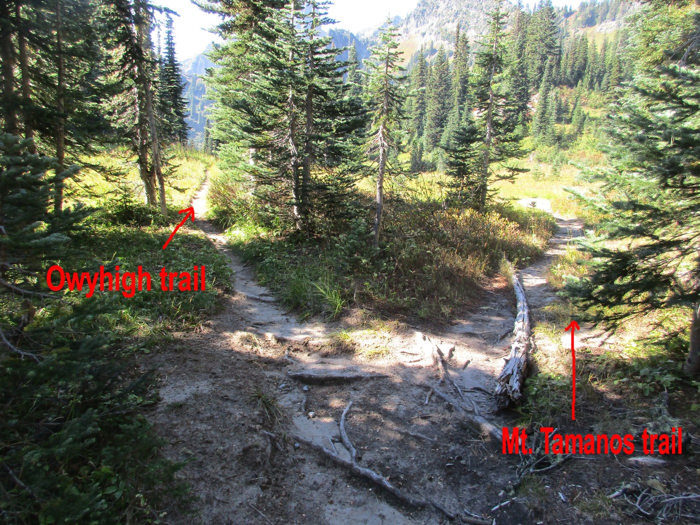
To get to Tamanos, you have to hike an extra 1/4 mile past the lakes. There is a very obvious Y in the trail. The left trail is the Owyhigh one that continues onto hwy 123 another 4+ miles away. The right trail heads up to Tamanos. This is clearly an unmaintained trail. You'll be stepping over roots, rocks and sometimes walking in a trench. Once you get out into the open, it's all uphill without a switchback or even a few feet of level ground. I'm old. It took me 3 hours to get to the top. I used a 12 step program. Take 12 steps, rest for 30 seconds and take 12 more. It was a grind for sure. Warning - You will be out in the open with minimal shade. You'll absolutely bake in the sun. Probably be best to do it when temps are under 75. There was a nice cool wind to take the edge off the heat.
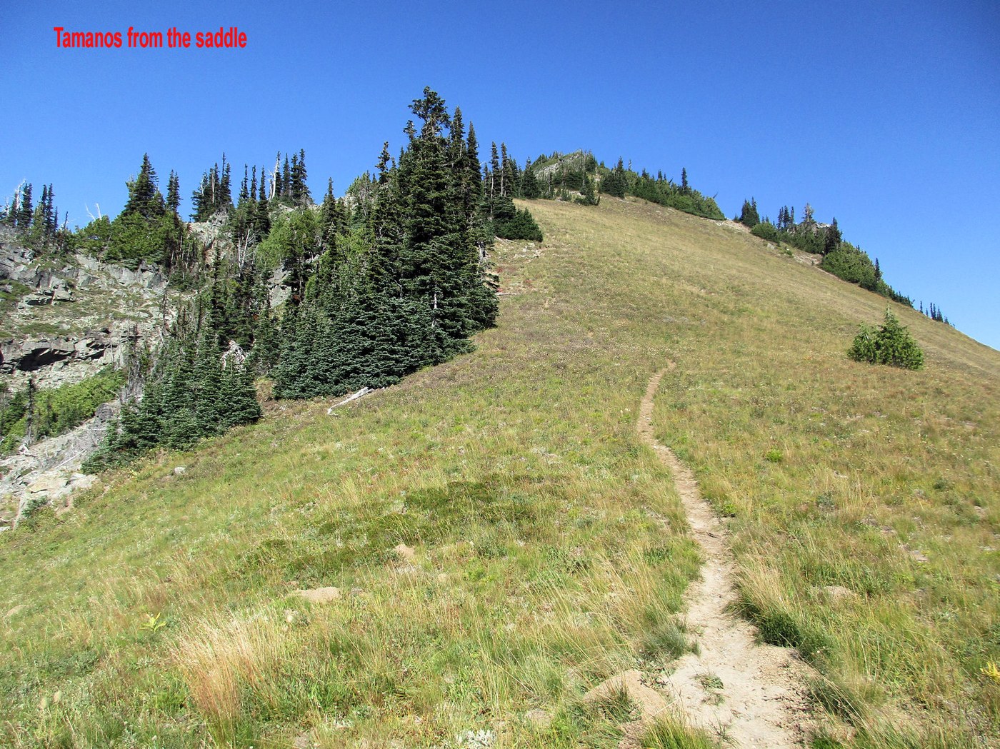
The higher you go, the better the views. Make sure to stop and turn around and take it all in. The trail doesn't go directly to Tamanos. It stops at a saddle. This is where all that effort pays off big time. Rainier is front and center and HUGE. Clearly one of the top 5 views of the mountain. One could stop here and call it a day. There's a trail to the left that heads up to a slightly higher viewpoint with some shade areas to take a break. The trail up to Tamanos is full of roots and loose rock. Near the very top is a place to take a break. There were thousands of ladybugs flying about. It was cute and magical up until they were landing all over you on your pack, your clothes, your food, etc. To get to the final 6,790 foot tippy top, you will have to do some sketchy scrambling which I decided it wasn't worth it. The views here were about the same as back at the saddle. Something to keep in mind if you want to avoid the extra climb.
Started at 8am and didn't get back to the van until 7pm (your times will be MUCH shorter). Ran into 9 people on the trip. 5 hikers, one trail runner (who started at 5:30pm), one park ranger and two trail maintenance workers.

Comments
travelerkaty on Owyhigh Lakes, Tamanos Mountain
Very helpful, thank you! How long does it get to the saddle from Owyhigh?
Posted by:
travelerkaty on Oct 01, 2025 01:02 PM
DayHiker50 on Owyhigh Lakes, Tamanos Mountain
I'm the wrong person to ask. It took me forever to get to the saddle. Two people blew right by me while I was taking it one step at a time. It was almost 4 miles of easy hiking from the parking lot to the start of the Tamanos trail. From there, maybe another mile (+-) to get to the saddle, but the trail is unmaintained and all uphill. The view is worth it though.
Posted by:
DayHiker50 on Oct 01, 2025 10:32 PM
travelerkaty on Owyhigh Lakes, Tamanos Mountain
Thanks, I'll try it!
Posted by:
travelerkaty on Oct 04, 2025 07:50 PM