
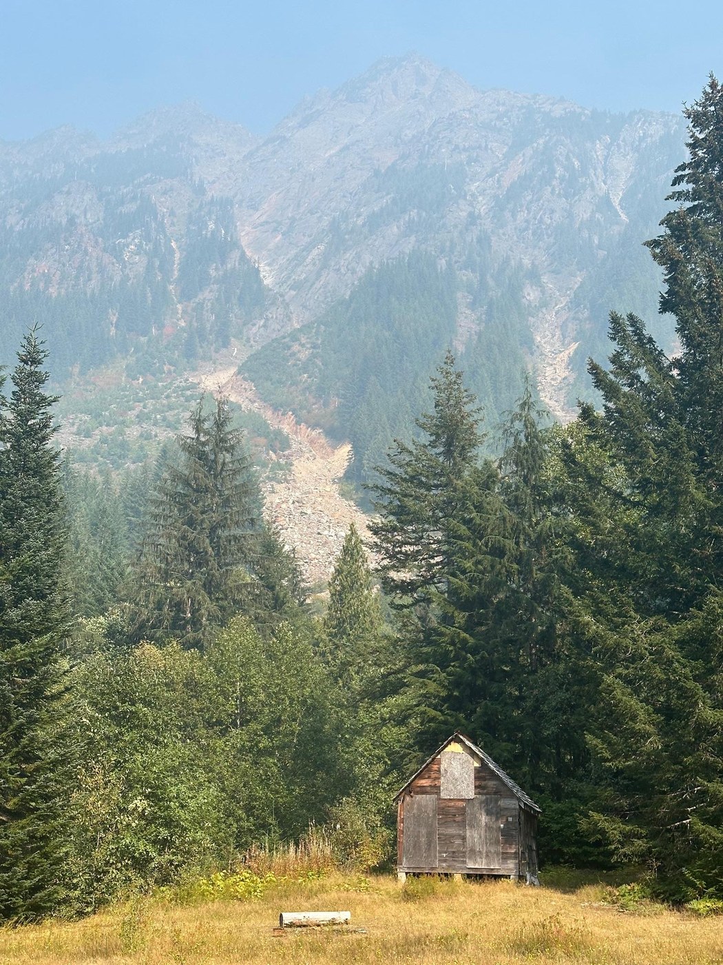
Originally I was going to hike Sahale Arm today, but as I got closer and closer, the smoke got worse and worse. I decided to bail around Darrington and opt for a hike that was less view-dependent. Since doing Gothic Basin in 2021, I've been wanting to come here and check this out.
You hike along the same road walk from Barlow Pass that you do for Gothic Basin, but after less than a mile you diverge as the other trail beings to climb. The trail becomes narrower and soon you must cross the Sauk River South Fork. You'll see an old outhouse & bulletin board with the trial splitting. Go left here where the trail is heavily flagged/blazed. This way you can cross the braid of the Sauk here easily as the braid goes underground. If you follow the trail straight past the bulletin board (the correct way based on the map) you'll reach a large tree you have to walk over as a bridge over the braid. Maybe this is necessary at other times of the year, but late in the summer like now, you can bypass this tree-walk. Reducing your chance of injury is always a good thing. Both routes spit you out onto an rocky river bar that leads to an island in the braids. If you turn around here, you can see the original bridge that has been displaced. It's huge. Amazing the power of water. The second of the "twin bridges" is still in place and easily accessible from this island to cross the final Sauk braid. The trail then is a pretty boring road walk with long, straight-as-an-arrow sections that are up to 0.5 miles long. I always find these types of sections creepy when hiking solo, like I'm going to see a cat cross a quarter mile ahead or behind gives me the heebie-jeebies.
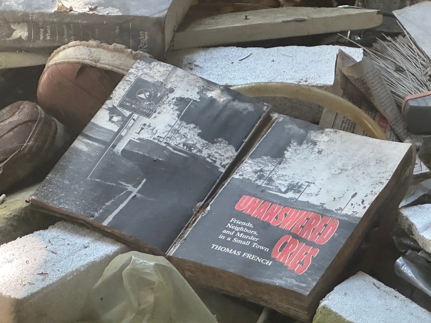
About 2.5 miles from the trailhead you hit the bypass road junction, which I think is how they get cars back here now. Quite a few private properties back here! Some interesting waypoints along the road before the town, like the Weden House, The Repository, a brand new WA Dept of Ecology "Unique Well" (which I assume is monitoring aquifer quality downstream of The Repository), a ruined cabin with an ominous book page turned to (glad it wasn't night, pictured). The town itself is huge and really fun to explore. I lingered here for probably an hour exploring all the nooks and crannies. Went down to the Concentrator, learned that this whole site is pretty much a superfund site. Basically the Concentrator not only concentrates the precious metals to be freighted to Everett, but also concentrates the heavy metals for disposal (e.g. arsenic). These toxic byproducts were then dumped into the Sauk river or the local soil (upstream of the town). Reminds me of the saying "regulations are written in blood."
I went to hike up towards Silver Lake, but after about a half mile I realized that the air was only getting more and more smoky so I turned around. Had a snack in the rail yard, and headed for the car. I saw a few garter snakes, a cascade frog, a fingered dagger caterpillar, plus the usual suspects. All in all, a little over 12 miles today.


Comments