Dang, I love this hike. The drive in is... challenging. With a bridge out eliminating access to the NW corner of the park, this is the next closest MRNP access for me, but it's worth considering (if you're coming from the Seattle area) that the SR 169 Green River Bridge, known as the Dan Evans Bridge south of Black Diamond, is closed for repairs all Sept and maybe part of Oct. That resulted in a detour that gobbled up 20 minutes or so in each direction. On the way to the hike, I used the truck detour that I thought was pretty efficient (2-3 turns, maybe 10 miles on 45 mph roads, and then I was back on SR-169), but on the way back home I tried the car detour that seemed excessively complicated--many turns, 35 MPH roads, etc. So be aware--not a deal killer, but a minor hassle. Normally this is a 1:45 drive from my house, but today it was about 2:05.
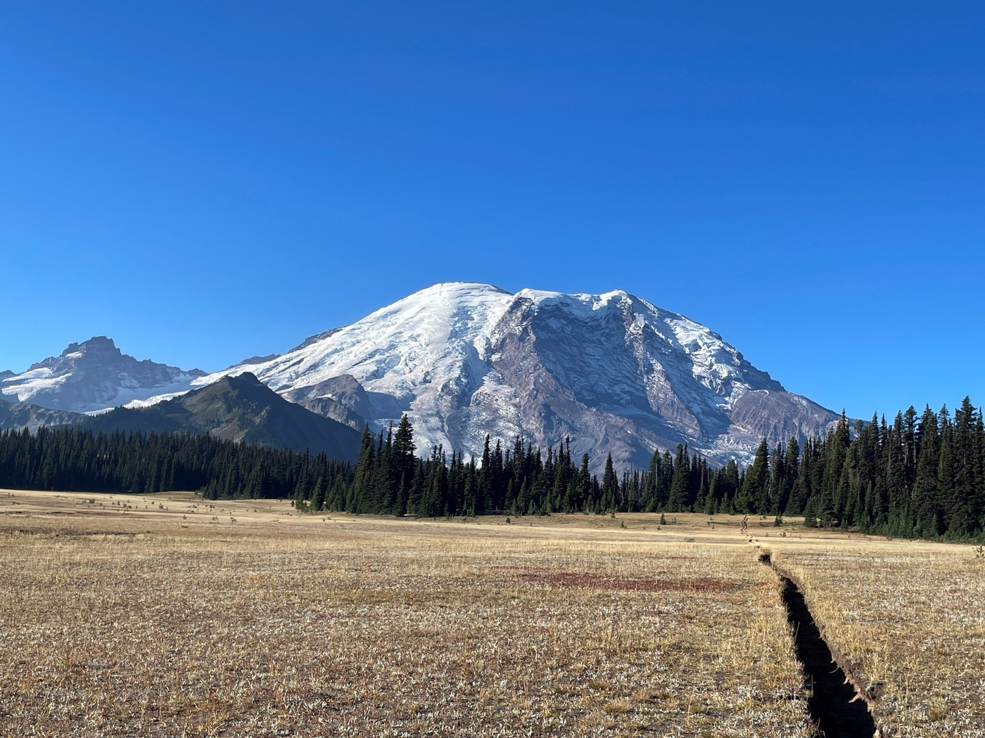
Left home at 5:30, started hiking at 7:40. Warmer than expected at about 50 degrees to start--lovely day (high of about 72 and full, glorious sun). Some smoke smell in the afternoon, but the skies remained perfect. Delightful forest hike in the first mile to Lake Eleanor--mirror flat and perfect. And then another half mile to what I'll call the first meadow--a few acres of grass past which you can see the top of Rainier. Just a taste. You don't hit Grand Park for another couple miles of up and downs all in forest, but once you are there, you just can't look away from that giant, looming mountain. I still say this is the perfect place to propose to somebody--great photo backdrop, and a really nice gentle hike.
At the T (4.5 miles in), I turned left for Berkeley Park, hoping to see the flock/herd(?) of goats that was in evidence in last week's trail notes, but no luck. Still, BP is just as gorgeous as GP, mainly due to the splashing stream all along the way. At 7.75 miles (2:50 hiking time) I turned around and backtracked. No surprises. I did cross paths with two foursomes who were overnighting somewhere, and one couple just out for a day hike from Sunrise. Peaceful. The loudest thing while out there was my tinnitus. Back to the car after 5:26 on trail. It is a beautiful, magical place--the lake, the wide open fields, the mountain, and Berkeley Park and its stream.
The road: Turn off SR-410 6 miles past Greenwater onto Forest Road 73. Wow, my Outback did great, but it is getting more challenging, especially with strong afternoon sunlight dappling the road, obscuring the bathtub-sized potholes. (cauldron holes?) Some parts are 30 MPH-able, and then you slow to 10 MPH or less to weave through the minefield. At one point on the way down, I stopped and backed up to try the other side of the road rather than take on two bathtubs in rapid succession that weren't easy to spot in the strong sun/shadows. Even with a decent SUV, which should be fine, there is still a burden on the driver to deal with the crappy sections. I think it was about 40 minutes to drive the 10 miles up, and the same going down.
Stats: 15.53 miles total distance; only 2,580 ft gained in elevation (many ups and downs); 5:26 on trail (with 7 minutes stopped time). No cars when I arrived, and two others when I left. NB: If you need them, I think there are pit toilets at the Lake Eleanor camping area and at the Berkeley Park camping area. Because there's nothing at the trailhead.


Comments
kascadia on Grand Park via Lake Eleanor, Berkeley Park
There's a detour in Black Diamond that is considerably quicker. It's by the gas station, turn to the east (left) as you are going to the park. It's a loop that drops you out by that noticeably large, wooden fenced property/homes on the hill. The area where you cross the river is interesting. It's quick easy to discern on a map.
Posted by:
kascadia on Sep 25, 2025 09:45 AM
Bobman on Grand Park via Lake Eleanor, Berkeley Park
Thanks for the tip! I may have to check that out int eh coming weeks.
Posted by:
Bobman on Sep 25, 2025 12:41 PM
Bobman on Grand Park via Lake Eleanor, Berkeley Park
Ah, just looked at it on the map. I think that's the more streamlined detour for trucks. Left turn at the Cenex station onto Lawson St, becomes SE Green River Gorge Rd, and once you cross the river, a right on Enumclaw-Franklin Rd, which brings you out to SR-169 3/4 mile north of Krain Corner.
Posted by:
Bobman on Sep 25, 2025 12:52 PM