

The notice on an earlier WTA hiking guide page for Cutthroat Pass via PCT stated: ‘The Rainy Pass north parking lot will be closed Sept 8-25 for trailhead repairs.’ When we first passed it on Monday, Sept. 29th, and now approached it again on Wednesday, Oct. 1, the access road to the trailhead lot was still blocked. We noted that the left lane of the road had been repaved, but the right had not. We hiked the extra third of a mile to the trailhead and spoke to one of the construction workers. The asphalt crew was late as they had to finish a paving job at an airport in Wenatchee. Paving work was now in progress again. They would finish paving the other lane by Thursday. The trailhead road would finally open on Friday, the 3rd (same for the Maple Pass lot across the Hwy 20,) just in time for the pre-weekend crowds.
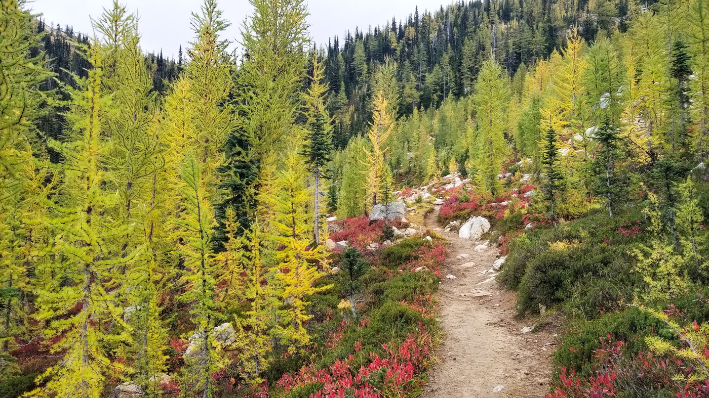
This five-mile route up to Cutthroat Pass follows the Pacific Crest Trail which means that it is well cared for and evenly graded, gaining about 400 feet per mile to the pass. The first 3.5 miles are mostly in the forest. The monotony of that section is punctuated by several picturesque creek crossings. By the time the trail breaks out to the big views and nearby subalpine larch, you are so ready for it. The last 1.5 miles to the pass are the very best part of the route and the big reason to do this hike.
As we ascended the switchbacks ever higher in a magnificent cirque of larch trees. I noted that this trail features stands of larch that seem more robust than those on the Maple Pass Trail. The larch needles, while not yet fully gold, varied from a subtle lime green to soft yellow. We found it even more interesting to be among them in this transitional stage than at their peak. The whole scene seemed to me to be pure magic.
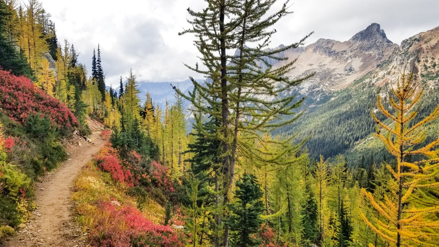
As we crested the pass, we experienced a ‘wow!’ moment as we suddenly encountered a panoramic view of jagged peaks that populated the eastern skyline. As we paused to look around, we noticed dramatic gray clouds drifting above, alternately revealing and then obscuring the nearby summits. The pass was mostly rocky and barren, with few trees, but broad and expansive enough to host many hikers. Today we saw few others but were soon surprised to encounter five horse packers slowly moving through. We had seen extensive horse poop on the trail, but had not expected a close encounter.
The drama and the dynamic of the ominously dark drifting clouds provided a photographic opportunity that clear blue skies do not. I set up my tripod and began to shoot. I took enough frames to assemble one spherical panorama at the pass and called it good. After all, it was damn cold up there and I wanted to feel warm again. We reluctantly left the pass, said goodbye as we passed the magnificent larch of the switchbacks, and finally trudged down that final tedious wooded section to the trailhead. GAIA GPS stats with additional distance to trailhead: 10.9 miles round trip, 2,064 ft, gain.
The link to the panorama from the pass is posted below. For the most immersive viewing experience, select the full-screen mode and scroll around.
Note: This trip report is a bit late, as we stayed in the area all week, doing Cutthroat Pass again from the Cutthroat Lake side and then visiting Winthrop before our return.

Comments