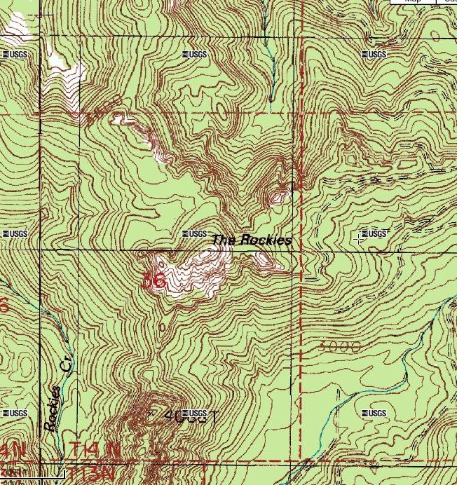
No, not the ones in Colorado. We went to Washington's very own Rockies, a high point in a mysterious little sub-range located near highway 7 between Morton and Elbe. I've never seen anything in hiking guidebooks about The Rockies, or ever heard of anyone visiting the area.
The Gifford Pinchot FS Map shows a short trail going to the the top of the 4300' mountain, which is high enough that small glaciers had carved the north slopes--there are even a few cirque lakes. Land owner ship is checkboarded, with sections of FS land alternating with private land. The area has been aggressively logged; it's no wilderness.
We were coming back from Yakima, and decided to make a quick reconnaissance of the area. We approached The Rockies from Morton. About 3 miles west of the town on SR 508, we turned onto Forest Road 73, unmarked by any sign. The road climbs the valley of the Tilton River (ever heard of that river before?), a impressively steep and rugged place. At another unmarked junction, we then turned onto FS 7307. We passed a number of other spur roads which were all gated and marked no-trespassing; the logging company landowner is pretty hard line about access to their lands.
FS 7307 was in bad shape. Trees and rocks were down on the road; someone had come along an did a quick and dirty job of cutting the trees, creating just enough room to squeeze our RAV-4 past. The road climbed the precipitous terrain above Wallanding Creek in switchbacks. One spot with a 1000 foot near-vertical drop at the side of the road reminded me of Dead Horse Point at Harts Pass. Numerous waterfalls tumbled down ravines from the steep slope above the road. The loggers must have really wanted these trees bad to build a road in terrain like this.
We met a jeep coming down the road farther along, and the driver gave us the bad but unsurprising news: the road was blocked by a landslide. We drove up to the blockage, and yep it was a no-go, even for a jeep let alone a RAV-4. The Rockies were still a few miles away, and it was too late in the day to hike there. We explored the road a bit on foot up to the 3000' level and got a view of some picturesque rocky peaks that could have been The Rockies. To the south there was a view of Mt. St Helens. Snow appeared on the road not that far above the landslide-- clearly, it was way too early in the year for visiting the area. Reluctantly we turned around.
Well The Rockies defeated us this time, but we will be back!


Comments
At the top remnants of the lookout are easy to find.
Do be careful with little ones. If yours are impetuous go somewhere else. The north side of the flat on the top drops right off. The trees you see at eye level are the tops of real trees.
Starting about twenty years ago our family got O.K. to do some rehab on the trail from the then Randle RD trails boss. We counted ~25 rings in tree we cut right out of the tread of the trail. We brushed and limbed the trail, and rebuilt tread to ~18" wide in a few steep cross slope spots. We left the first 100-200 feet a little vague to discourage buzzers.
The FS decommisioned the last 3/8' of the road by pulling up fill back onto the road, and making it bumpy.
We haven't been in about a decade. Got rid of the beater pickup, and didn't want to trash newer vehicle. After they pretty much stopped logging the Morton Block, roads continue to degrade and brushing them rare.
I think the checkerboard on the maps is mostly historical. When the s'owl became an issue the FS traded big time with Weyco. All or most of the land east of the Rockies is now our land. A little west of the Rockies all or most is Weyco.
If anyone finds a decent road to out there, please do post.
Olywa
Posted by:
Olywa on Oct 10, 2010 08:29 PM