Trip Report
Norse Peak, Pacific Crest Trail (PCT) Section J - Snoqualmie Pass to Stevens Pass & Goat Lake — Wednesday, Aug. 19, 2009
 Mount Rainier Area > Chinook Pass - Hwy 410

I'd been waiting patiently for a beautiful, clear, sunny day to enjoy the views from Norse Peak and today was the perfect gift from God! Temps were in the 90's back home, so faithful little Daphne and I headed to Crystal, where temps were in the 70's. Saw absolutely no one on the trail, except for two horsemen who rode in after me at Basin Lake and a group of guys hiking the PCT to Snoqualmie.
First of all, everyone who's written about this hike is right: it is full of unmarked trails and turns, so make sure you have a map, and even then, some of the trails aren't on the map! Even the directions to getting to the trailhead are off. To get there, from Enumclaw, drive east on SR 410 for 34 miles. Turn left onto Crystal Mountain Road (FR 7190) and drive 4.1 miles to an unsigned gravel road (Road 7190140) on your left, which is about 0.5 mile beyond the signed road on your left that reads "Half Camp. (I had mistakenly assumed there would be a large sign announcing "Sand Flat Horse Camp," as the hiking books would lead you to believe; as a result, I drove right past the turn-off.) The trailhead is located just 0.1 mile from the turn-off. For parking, there is only a slight widening in the road and room for at most 2 cars. But as very few people seem to hike this trail, parking shouldn't be a problem. The guide books say you need to display a N.W. Forest Pass.
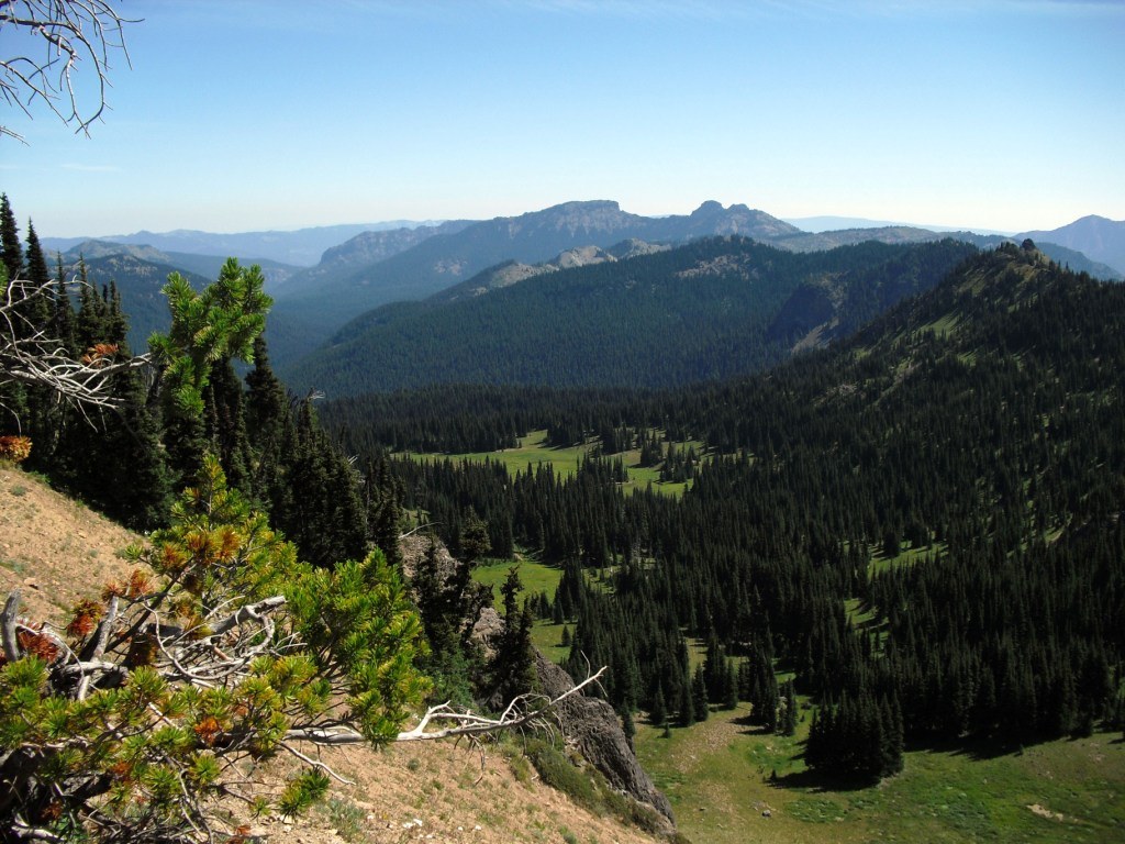
Hopefully the following trail description will give you enough landmarks to keep from erring (this lollipop-loop hike consists of climbing up to Norse Peak, going down to Basin Lake, and then traveling north on the PCT, turning off onto Goat Lake Trail, and then returning to the trailhead via Norse Peak Trail): Hiking up from Norse Peak Trail No. 1191, the trail quickly climbs 900 ft in just 30 minutes, then it levels out a bit before heading upwards again. For the most part, I'd consider the grade moderate, not terribly steep but a steady ascent through alternating shade and sun. The good news is the trail is soft dirt, which makes for easy hiking on the return. You'll pass a couple of trail closure signs and eventually pass on your left the junction to Goat Lake Trail No. 1161 (ignore this for now). I never saw any turn-offs for No. 1191A (Norse View Trail) but somehow, just by following the main trail, I ended up at the right place. As you hike, on your right-hand side, Mount Rainer rises up like a moon behind Crystal Mountain, while a left-handed gaze treats you to panoramic views of the lush, green Lake Basin valley with its namesake lake tantalizingly close. As you approach Norse Peak, the trail veers to the right and becomes more narrow and rocky, following the ridgeline.
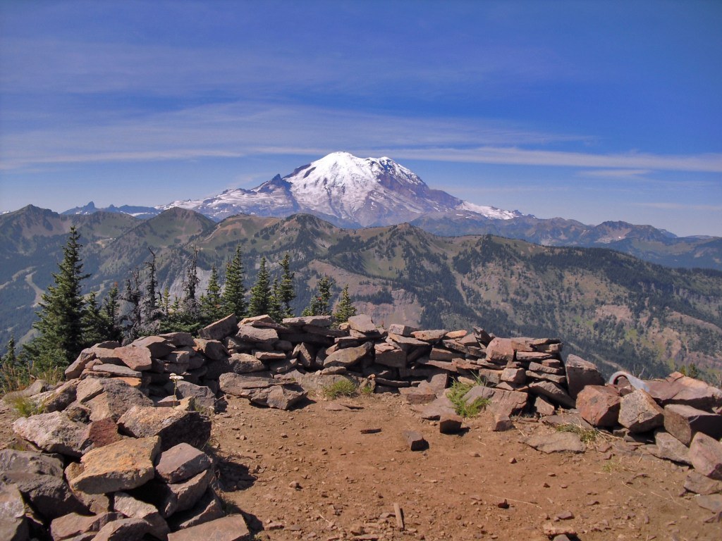
There is no signage indicating where Norse Peak is, but as you reach the apex of the climb, you'll see a trail going through the trees to your right. I assumed what I reached was Norse Peak, because my altimeter read approximately 6856 ft and someone had spent considerable time building a nice horseshoe-shaped rock shelter there. The view of Mt. Rainier from Norse Peak was breath-taking. Unfortunately, the deer flies and horse flies were being a nuisance, so Daphne and I ate just a quick lunch there.
Returning down that path, you come back to the trail you were on and turn right. The maps say there's no trail there, but there is in fact an extremely well-used trail that takes you directly down to the Pacific Crest Trail, at what I assume is Scout Pass. As you come upon the PCT, you'll see a post sticking out of the ground with a couple of other poles lying next to it; I guess that's the best marker you'll have to turn left on to the northbound PCT. (To your right, you'll see some hitching posts for horses and the southbound PCT.)
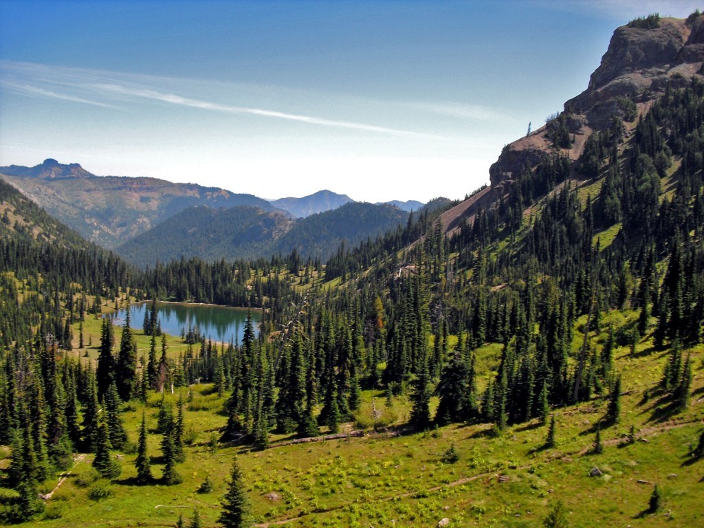
Hiking north on the PCT, you eventually come to a sign on the right that says "Basin Trail 1/4 mile." I took that trail and it descended 600 ft to Basin Lake (elev. 5800 ft). This was by far the hardest part of the entire hike. In fact, it was enough to make me question whether I really wanted to make the steep and tiresome slog back up to regain the PCT, but as there is absolutely NO WATER on the 5.6 mile ascent to Norse Peak (or on the 6.5 mile descent from the PCT back to the trailhead via Goat Lake Trail), I had to refill my water bottles and Daphne wanted to swim in this beautiful gem of a lake. Besides, had I not gone down to the lake, I would've missed the two dozen mountain goats and their kids cavorting on the big dome of rock shadowing the lake!
I never did run into the Basin Trail No. 987 but miraculously--and still following a well-worn path--I ended up at the lake, which is well worth the effort. You'll encounter several small streams en route to Basin Lake, and even a small waterfall can be glimpsed just off whatever trail I was on.
Two horsemen rode up a short while later and they decided to explore the west shore of the lake; apparently, they found the real trail, No. 987A to 987, because I encountered them further north on the PCT after I slogged my way back up via the same trail I had descended on. I'd advise hikers to ascend the way the horsemen did, as it'll save backtracking.
If you don't feel like making the trek down to Basin Lake, and prefer to just stay on the PCT, there are a couple of tiny rivulets and streams that cross the PCT, between Trail No. 987 (I passed the signpost for that trail after I passed the horsemen again) and Crow Creek Lake Trail No. 953. These probably have enough water in them to refill your bottles.
Continuing north on the PCT about 1 mile past the junction with Crow Creek Lake Trail, you'll come to a completely unsigned trail on your left. It's a major trail so I don't know why it's not signed, but that's the trail you want, Goat Lake No. 1161 (I had to backtrack a mile once I realized I'd passed it). You'll know you're at the right place when you look up to your right from the northbound PCT and see a sign for Basin Lake/Cement Basin nailed to a tree. Turn left onto this unmarked trail and if you go about 20 yards and look behind you, you'll see one of those "Entering Norse Peak Wilderness" signs.
Follow Trail No. 1161 west, going up and down, past talus fields, and you'll see murky, stagnant Goat Lake below on your right. If you look up to your left, you may see a dozen mountain goats sunning themselves on the rock face. Eventually you'll climb up to a trail junction (again, unmarked). Ahead are some hitching posts for horses. Turn right at this junction and you'll be heading south, eventually rejoining the Norse Peak Trail No. 1191 in less than 0.4 miles. Then just follow the Norse Peak Trail back to the trailhead.
Elevation gain: 4000-6856 ft (trailhead to Norse Peak)
Total elevation gain for this loop, including Basin Lake: approx. 3456 ft
Distance: approximately 13.7 miles
Total time (moderate pace, with several brief stops): 7 hrs 30 minutes
Map: Green Trails No. 271, Bumping Lake
What I'd recommend taking with you: a map, good directions, compass, altimeter, WATER and a filter/pump (esp. if hiking with your dog)
What I wish I'd had: a sign saying "Goat Lake Trail No. 1161" with a left-hand arrow, that I could've nailed to a tree near the unsigned junction!


Comments