Trip Report
Rattlesnake Slope Wildlife Area — Saturday, Mar. 9, 2013
 Central Washington > Tri-Cities

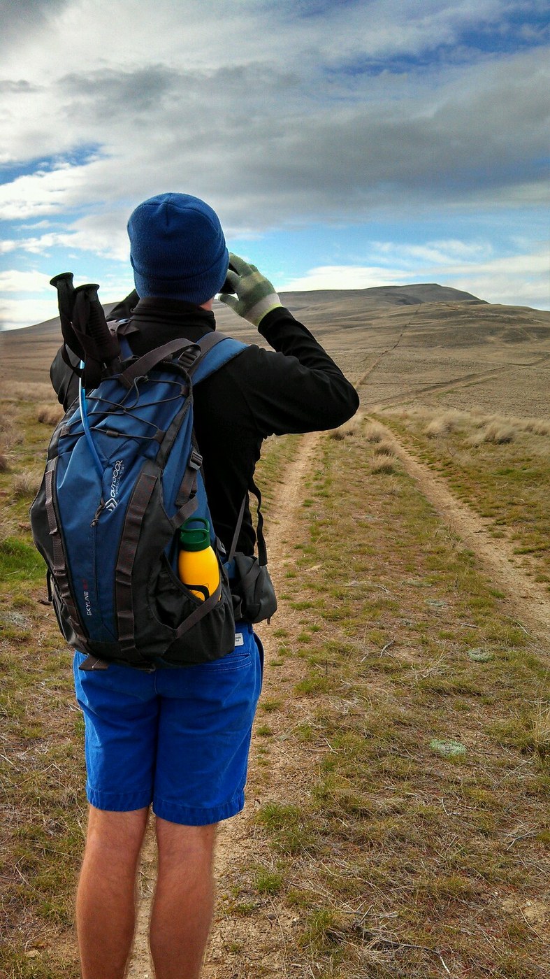
My brother and I started at 11:30am at the fenced parking lot that the hike description talks about. Headed for the top of Rattlesnake Mountain 3600 ft.The trailhead is at 420 feet above sea level. It was a Sunday. About 50 degrees, but the wind made it feel like 40. We both wore shorts and had our coats on.
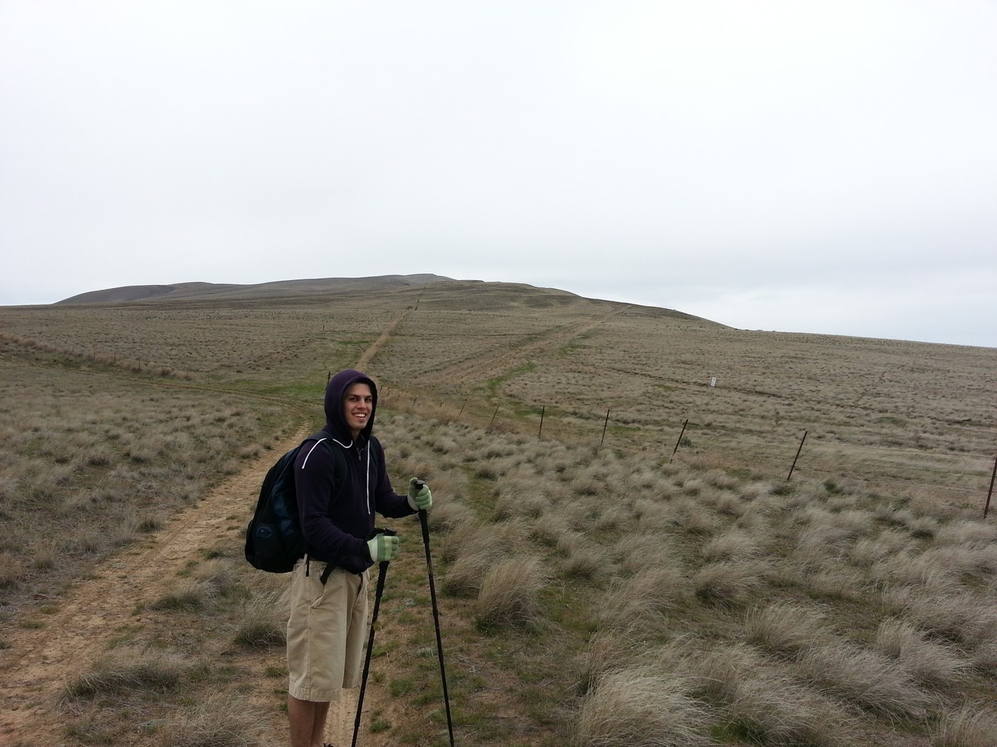
As we started on the trail west, we met probably a 100 people riding horses in the first mile. It was about at the first mile that we detoured off the main trail off to the left on a jeep trail. There is like a broken down old gate there that is permanently open. We didn't see another person the rest of the hike from here on. We walked just around the bend and noticed that the trail leaded back east. We decided to follow the small canyon south and cut through the brush and through the fence to meet up with the jeep trail again. I later realized that if we would have continued on the trail it would have looped back to where we ended up after cutting through the brush. Anyways we headed on the jeep trail going west. It soon connected to another jeep trail heading west. There is an empty water trough at around this point. After about a half mile the trail turns south and starts switchbacking at a steep incline up the "small hill." This is the first real elevation gain. This will lead you to the top of the "small hill" I bet it is close to 1200 feet of elevation in about a mile. At the top is about 2000 feet.
My brother and I took a look at Rattlesnake Mountain in the distance to the west and decided to go for it. It would be six miles to the top of Rattlesnake. For about the next three miles the terrain is basically flat along the hill top/ ridge. The old jeep trail eventually comes to a fence where it combines with another trail on the other side of a fence. The fence is very broken down and you can just step over the barbed wire. There are a couple signs saying "no public access beyond this sign." Well we didn't go 'beyond' them. That would have entailed going north and we were heading west. The trail continued for about a half mile at a pretty steep incline. Then all of a sudden we run into this paved road. Apparently out of all the research I did on this hike I didn't notice that there was a paved road that lead from State Route 225 to the top of Rattlesnake Mountain. We never saw a car or human on the trail/ road. I don't know if the road is blocked off down below or what. We were bummed at first to see the road, but glad it was there. The last 2.5 miles to the top of Rattlesnake is very steep and relentless.
We finally made it to the top. It took us about four hours to hike the 9.5 miles. My brother is in good shape and I am in decent shape. We kept a pretty good pace besides the several breaks I needed to take on the way up. At the top there was a gravestone/ memorial for two scientists. We ate some sandwiches and headed back down. It took us three hours to hike down the nine miles. Round trip was about 19 miles.
Flowers were not in bloom yet but things were starting to green up a bit.
Technically the top of Rattlesnake Mountain is restricted from public access. It's apparently owned by the government stemming from the Manhattan Project as a buffer zone for Hanford. We never encountered any problem and I wouldn't worry about climbing this mountain/hill. All the fences are run down and the jeep trails are probably never used anymore. I guess there is a bill trying to be passed that would allow public access. It's a great hike and one of the tallest hills in the area. It will not disappoint.

Comments
Mountain Justin on Rattlesnake Slope Wildlife Area
That road is very closed, with many signs at the bottom and along the road stating it is for authorized personnel only.
Posted by:
Mountain Justin on Apr 04, 2016 01:08 PM