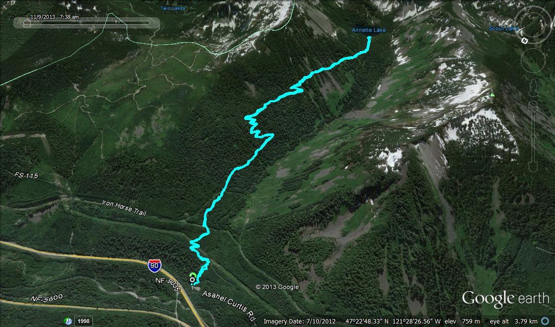
I had the opportunity to get out of the house and escape to the mountains yesterday. For my destination, I chose Annette Lake near Snoqualmie Pass. I had seen the lake before, but it had been nearly a year since my last visit; it was time to head back. I left the trailhead (elev. 1,953’) and its two cars (including my own) at 7:39 a.m., just a half an hour or so past sunrise. At 0.25 mile there is an attractive bridge (elev. 2,079’) spanning Humpback Creek, reached at 7:49 a.m. Through scrappy forest and a short distance past the creek, the trail crosses the remnants of FR 5590. I noticed some cut windfall as I peered down this road; it appears it may still be infrequently used by vehicles, probably to access nearby power lines.
At 0.51 mile (elev. 2,192’) the path initially crosses the first of two sets of these power lines. I reached this point at 8:00 a.m. The lines are paralleled for a short while before it’s back into the forest you go. The second set of power lines are passed under at 0.76 mile (elev. 2,300’), time, 8:09 a.m. Between here and the crossing of the Iron Horse Trail at 1.11 miles (elev. 2,433’) there is one downed tree that is easy to negotiate. I reached the Iron Horse Trail junction at 8:24 a.m. and stopped for a quick snack, string cheese hit the spot.
Past the junction the more serious climbing begins. With numerous switchbacks, however, the trail is never too steep. It was easy going to the 2.53-mile mark (elev. 3,284’) where I hit the first patchy snow, time, 9:13 a.m. Nothing to fear here, for all the way to the lake the snow was never deep enough for gaiters and I never bothered to put on Yaktrax. Between the snow line and the lake there were six additional downed trees, two that required some ingenuity to pass. I reached the end of the trail and the waters of Annette Lake (elev. 3,625’) at 10:02 a.m., 4.11 miles from the trailhead. I hadn’t seen another soul and seemed to have the lakeshore all to myself, excellent. The weather forecast the morning of had called for light winds between 11 and 14 mph with a high near 40. It was a little chilly at the lake but with the right layers, never uncomfortably so.
Numerous parties were met on the return trip, all were friendly. I made it back to the trailhead at 11:53 a.m. with a round-trip distance on the GPS of 7.75 miles. How it was 4.11 miles to the lake and only 3.64 miles back, I don’t know. As I walked back to my car I counted 21 vehicles in the lot. Please note that the outhouse is open but not stocked with toilet paper.


Comments