
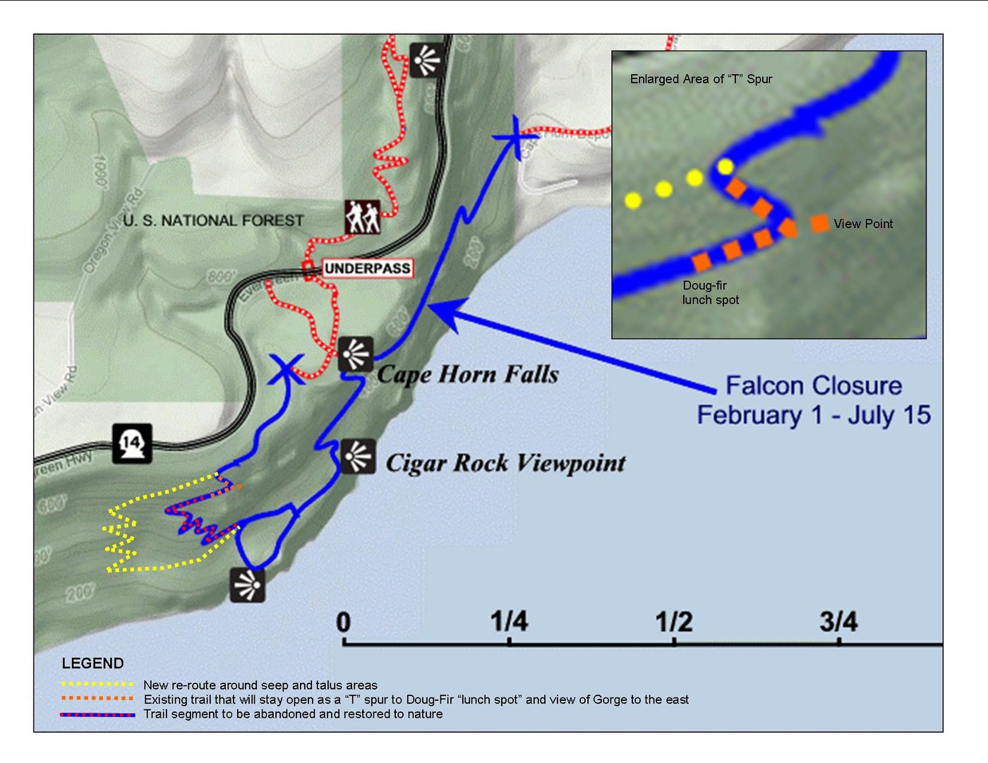
WTA and Cape Horn Conservancy Volunteers have been working on a long reroute to move the existing trail off of sensitive habitat. It was one of the projects the Forest Service put into the Recreation Plan for the Trail when they decided to adopt the user-created route. Weather permitting we will open the new route on January 18th 2014 and begin restoring parts of the old trail that will be abandoned. Below is a map showing the change.
No doubt the change will be met with a mixture of responses. Some will miss the trail the way it was, others will see the reroute as an improvement. In a nutshell, the reason for the reroute was to move the trail off of talus slopes, seep areas and away from cliff edges. They were concerned about safety and ongoing impacts to plants an animals in those unique habitat areas.
During the planning process that occurred mostly in 2009, WTA, Friends of the Gorge and the Cape Horn Conservancy advocated vigorously for keeping viewpoints available. While the original Forest Service design would have moved entirely away from the cliff south of Hwy 14 - we were able to convince them to retain two popular spots with a "T" spur. (see map)
The Forest Service designed the corridor of what we've come to call the "western reroute", but WTA was responsible for design details and construction. In accordance with the Forest Service Rec. Plan the portion above the switchbacks is built to accommodate equestrians (intended to be part of a Equestrian/Hiker route to Washougal in the future). Descending the first switchback marks a transition to a hiker-only Class 1 (primitive trail) that we've designed with steep sections, rock steps and tight switchbacks.
Please help spread the word throughout the hiking community so folks aren't too confused when they next hike the trail.
Comments