Trip Report
Truman Trail - Pumice Plains — Wednesday, Jul. 23, 2014
 South Cascades > Mount St. Helens
Type of Hike
Day hikeTrail Conditions
Minor obstacles posing few problemsRoad
Road suitable for all vehiclesBugs
No bugsSnow
Snow free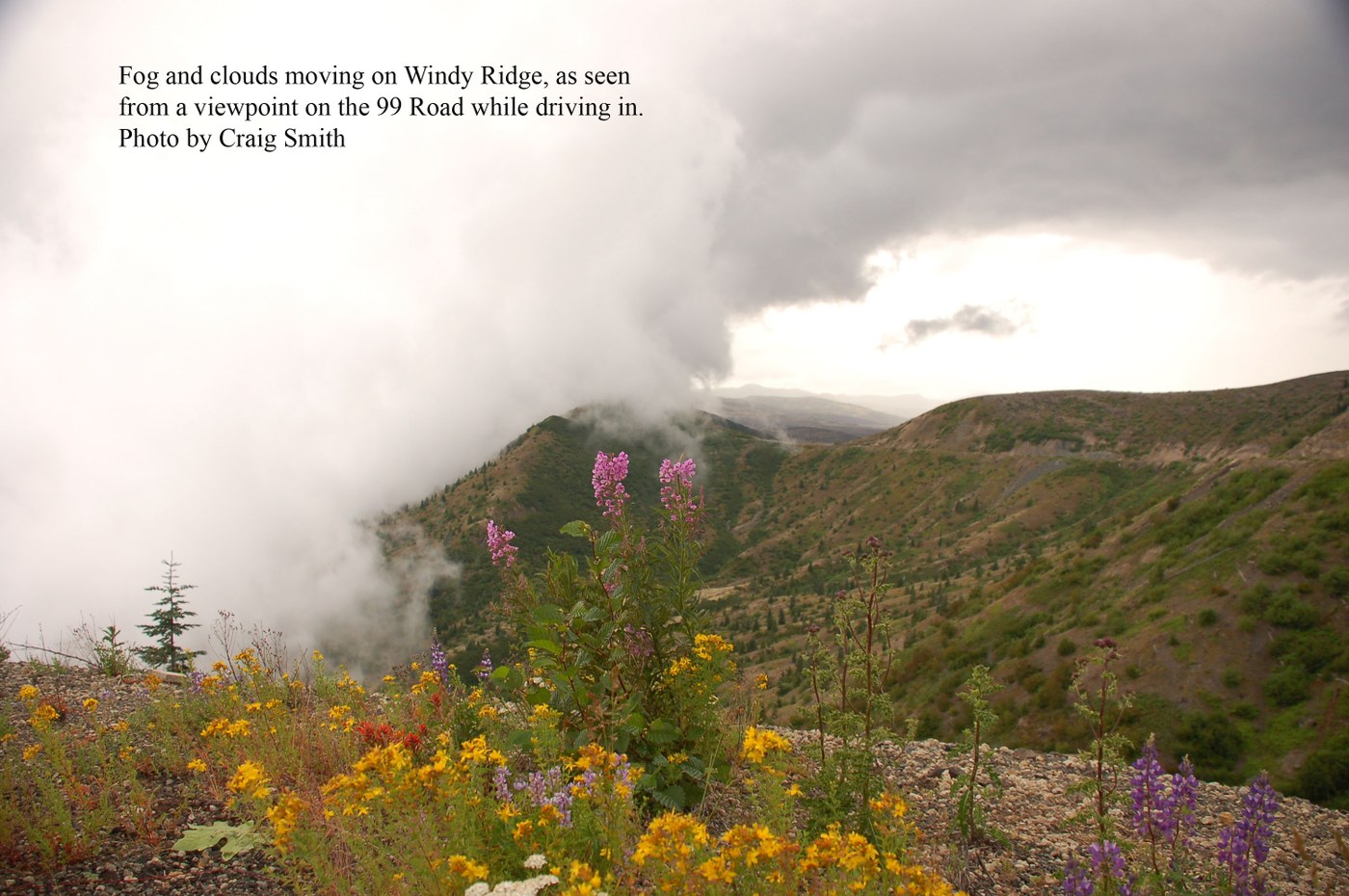
I arrived at Windy Ridge at 8:30 in the morning just as the clouds were moving in and blocking the view of Mt St Helens. It was 47 degrees. I never saw the full mountain all day -- only partial glimpses a couple of times. But that’s OK, because I rarely let bad weather stop me from following through on hiking plans, and stormy days give the mountains a whole new look and feel. So I set off into the fog, and shortly the rain, and eventually the wind.
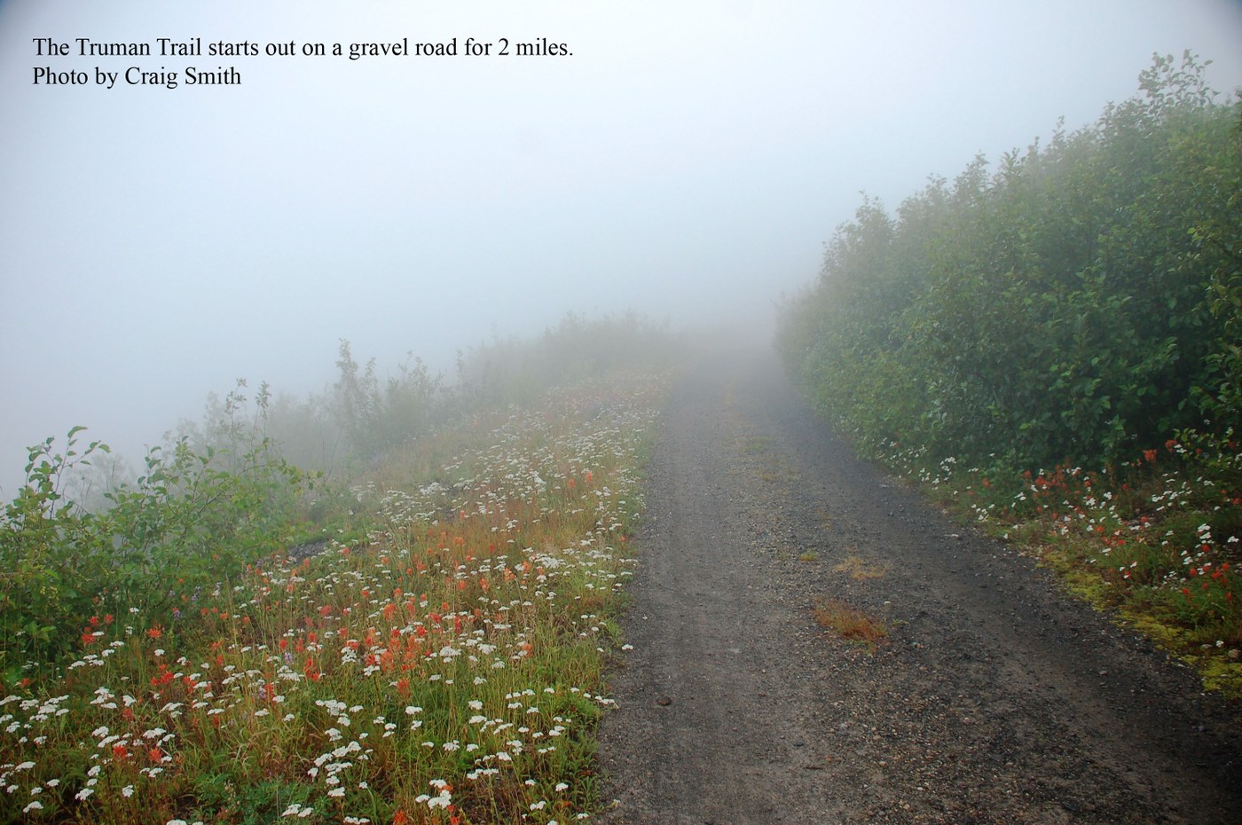
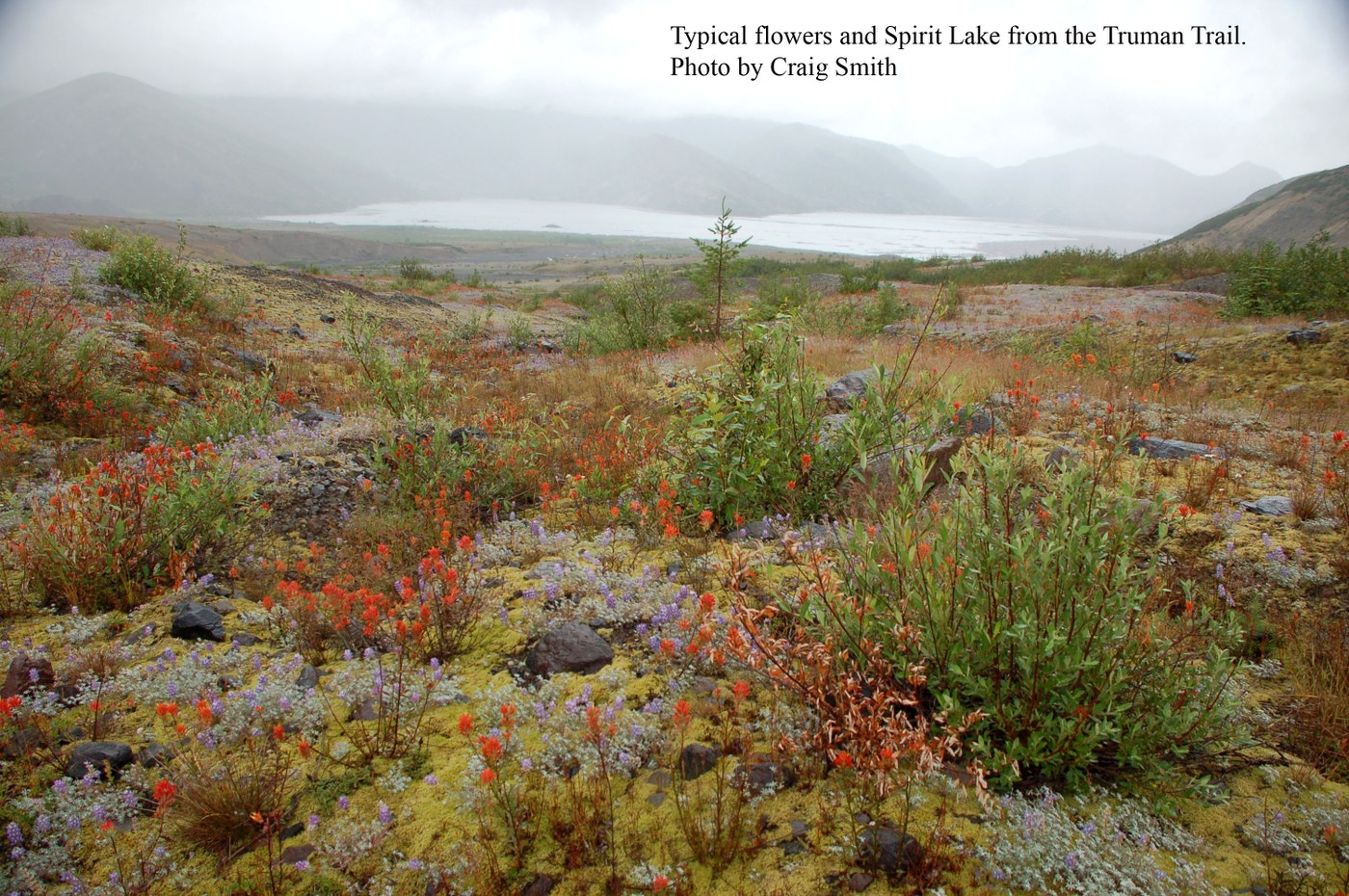
I did this trail as a loop hike. Truman Trail #207 leaves the Windy Ridge parking lot and follows a gravel road for 2 miles. This is where the loop starts. The trail follows a long-abandoned road northwest toward Spirit Lake for another mile and a half to a junction. Along this stretch of trail there are thousands of flowers blooming, hundreds of acres of them, and views of Spirit Lake. For wildflower lovers, this part of the trail is the best, and would make for about a 5 or 6 mile out and back trip.
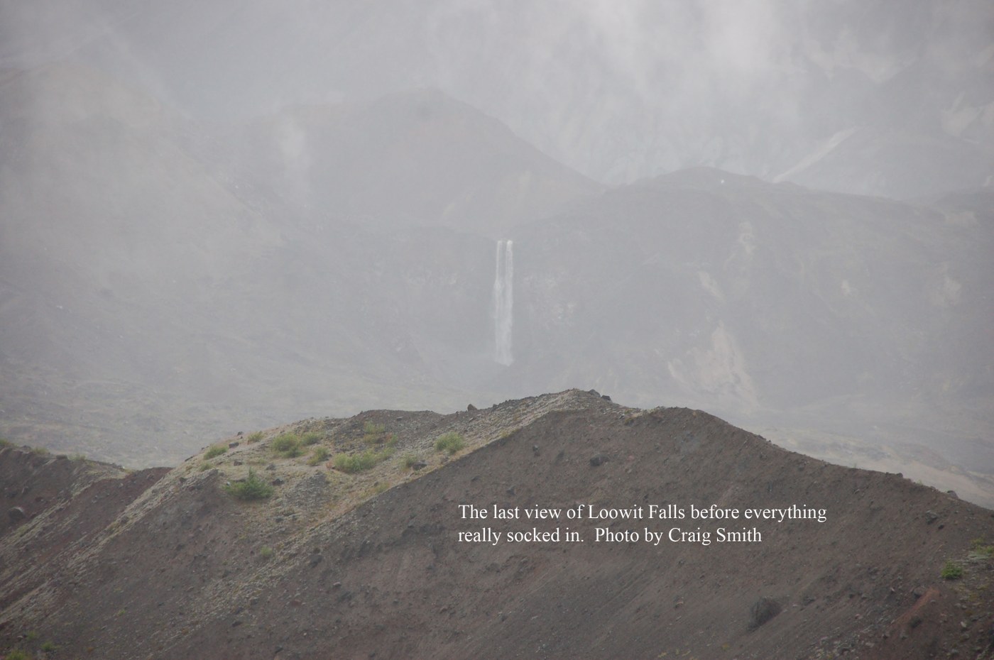
At the junction I went left on trail #207A for a little less than a mile to a junction with Loowit Trail #216. While going up this trail the clouds parted for awhile, and off on the horizon near the base of St Helens was Loowit Falls pouring out of the breach just below the lava dome. Wow. Twin falls, side by side, joining about halfway down. It was awesome. I decided I had to see that waterfall up close.
I turned left on the Loowit Trail going in the direction of the falls. But as I went uphill, conditions worsened. I shot one last picture of Loowit Falls through the fog, and then everything went gray and the rain just opened up. I have only hiked in driving rain that hard once before that I can remember – on Rock Mountain near Lake Wenatchee. Despite my best efforts to stop it, the wind-driven rain was getting into every nook and cranny of my head-to-foot Gore-Tex rain gear and boots.
When I got to the next junction, I decided to forgo the .7 mile side-trip up to the falls, as there was no visibility, my clothes were getting wet, and I was getting cold. And I didn’t want to have to start breaking out my 15 essentials. So I continued down the Loowit Trail to continue the loop. On this stretch of trail there are a couple crossings of huge erosion channels with boulders that are a bit rough to climb over, around and through, but really nothing to be too concerned about. In sunny weather it’s probably nothing.
At the last junction on the loop, the sign shows only left and right directions, while clearly there is a third trail going downhill, but no mention of it on the sign, or where it goes. So I quickly oriented with map and compass, and indeed the downhill trail was unmarked trail #216E, which takes you back to the end of the gravel road where the loop started.
Half an hour later as I headed up the 2 mile gravel road back to the parking lot the rain increased and I was literally leaning into, and being pushed around by, the wind. I had the drawstring on my parka hood pulled up to just a small circle leaving only my eyes and nose exposed, and still water was trickling down my face and neck and into my clothes. When I finally opened my truck door at Windy Ridge, the wind almost cracked it off at the hinges. Good name, Windy Ridge.
This may sound like a bad trip report, but it’s not, I loved it. I had the trail to myself except for a couple of pretty miserable looking Wazzu students collecting plant samples for a school research project. I’ve hiked plenty of miles at St Helens in stunning perfect weather, but I’d never seen it like this. I feel like Loowit Falls is a gem that somehow got past my ever-searching-for- hikes radar. I can’t wait to see it next time.
It was a great hike, but on the way home a few hours later when I was sitting on a bar stool for Wednesday Taco Night at the Blue Spruce Tavern in Packwood, my shorts were still wet.
Comments