
Type of Hike
Multi-night backpackTrail Conditions
Trail difficult/impossible to navigate:Trees down across trail,
Difficult stream crossing(s),
Bridge out,
Overgrown in places.
Road
Road suitable for all vehiclesBugs
Bugs were not too badSnow
Snow free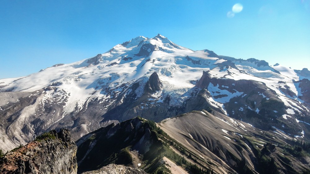
With the Suiattle River road open again access to a whole network of trails has been regained. One of those being Gamma Ridge. Now there seems to a black hole of useable information on this trail in Google land. So here's an update.
Getting there:
Hike the Suiattle River Trail to Canyon Creek cross the suspension bridge. 5.7 miles
Continue 0.3 miles to the intersection of the Pacific Crest Trail (PCT). Note that things have changed, the PCT intersection used to be 4.2 miles up trail. A bridge crossing the Suiattle washed out in 2003, the bridge crossing was relocated, and a new section of trail built. Current USGS, and older Green Trails maps do not reflect this change. The intersection is well signed. Take the right fork at the new PCT intersection (south bound) continue 3.2 miles to the next trail intersection (total mileage now 10.2 miles) Cross Vista Creek, (there is no longer a bridge) there are useable foot logs if you look around, there is also a log suitable for butt scooting near by, or just ford the creek. There are camp sites on the other side of the creek including a useable privy this is the last useable privy cat holes must be dug to do your business at any camp site beyond. The water in Vista Creek is often heavily laden with glacial silt and will quickly plug a filter.
All the trails beyond Vista Creek are no longer maintained.
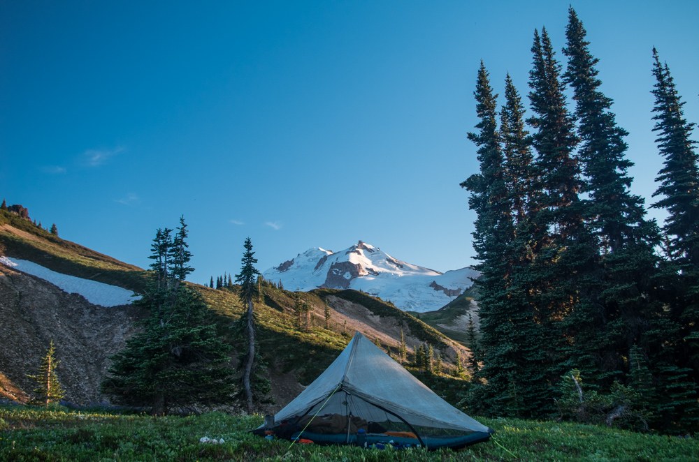
There are spots to put a tent along Gamma Creek, the water is not laden with glacial till. Gamma Creek is an additional 0.6 miles from Vista Creek on unmaintained trail
The next trail intersection is another 0.5 miles from Gamma Creek. This is where a bridge over the Suiattle used to be located. Take the fork on the right, to another trail intersection 0.3 miles. The fork on the right is Gamma Ridge.
Total mileage to the Gamma Ridge trail head form the Suiattle trail head is 11.6
Brush is encroaching, and there are numerous blowdowns to deal with on the section of trail from Vista Creek to the interaction of Gamma Ridge. But to this point is easy to follow.
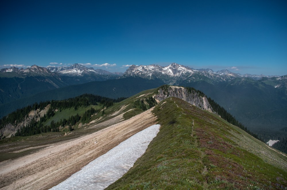
The next mile is of the Gamma Ridge Trail ascends gently but is choked full of brush. The huckleberry ranges from shoulder high to over head. There are also numerous blowdowns and is difficult to follow in places. There is more camping available a mile in (elevation 3370). Water is also available, tank up because this is the last available water for miles. After the mile of gentle grade the trail ascends a the steep hillside on tight winding switch backs. Brush is less dense on the hill side. But blow downs are numerous, only a few are difficult to get over. The hills side grade eases by 4500 feet however at this point the trail is completely lost in a tangled jack stawed mess of blow downs. The lack of forest canopy means there is more available light for the brush to take over. The mess of blowdowns thins out by elev. 5000 but the trail is too faint to follow. The hill side grade gets steeper again by 5300 feet and the trail is locatable again. Brush is dense however. The trail breaks out into open Meadows by 5450, there is a camp site here. Water near by. But with this low snow year it may not be reliable. It is spring fed and was only flowing at a dribble. From elev 5450 the ridge line is easy to follow on a faint intermittent climbers boot path clear to Gamma Peak.

Comments
whOsOwl on Gamma Ridge
Would you recommend it or are the downed trees not worth it?
Posted by:
whOsOwl on Aug 14, 2015 09:16 AM
Worth it?
Put it this way I absolutely will return. Everyones tolerance for blow downs is different. So what's worth it is up to you. The deal breaker is navigation experience. Expect to be off trail in a very, very, very remote area with the understanding that if you get lost and are reported missing it will take an entire day from the time your reported missing for Search and Rescue to even begin searching due to the commute time.
Posted by:
Hulk on Aug 14, 2015 11:04 AM
Maps with current trail routings?
Hulk, thanks for the awesome trip report. Very helpful. Can you (or anyone else) recommend what maps show the new trail routings, preferably large scale (e.g. 1:24000)? Thanks!
Posted by:
TheProfessor on Aug 29, 2015 03:46 PM
Maps
The most recent edition of green trails maps has the the new trail routings. But it's not 1:24000 scale. The only way i know of to get 1:24000 Scale map with the new trail routings is to down load half miles track for section "K" of the PCT and overlay it on http://www.caltopo.com then print it out. Half miles GPX track is available here http://www.pctmap.net/gps-url-loading/
Posted by:
Hulk on Aug 30, 2015 07:58 PM