Trip Report
Tubal Cain Mine to Buckhorn Lake, Marmot Pass & Buckhorn Mountain — Saturday, Jun. 18, 2016
 Olympic Peninsula > Hood Canal

First off I'd like to say WOW! It was great to see so many people on the trails out in the Eastern Olympics. Everybody was enjoying the weekend despite some gloomy weather on Saturday.
My trip started as an impromptu hike out to Marmot Pass, but turned into a scramble toward the end which I'll briefly cover. I met a nice woman on the way up late Saturday afternoon. We hiked to Camp Mystery and dropped packs to set up tents before ascending the pass. There was sleet, snow, and intermittent sunshine up at the pass with in and out views of the Needles and surrounding peaks (Royal Basin area).
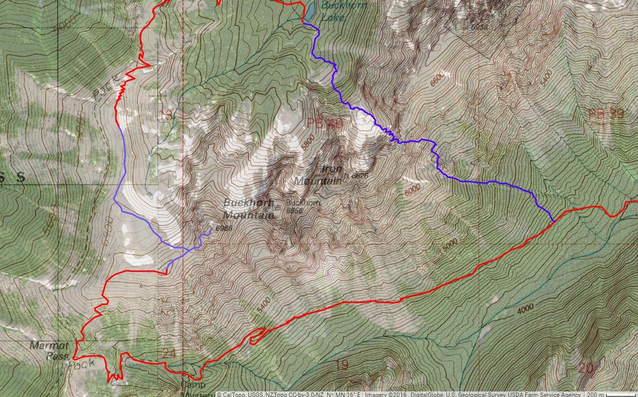
I slept in a gorgeous 10 hour night sleep, rising around 7 on Sunday. Sun was shining through the tent. Me and my new friend hiked to the pass, and with some fog rolling in and out to cause some slight visibility issues, I helped navigate up the trail to the false summit of Buckhorn. From here we parted ways, and my friend returned the way we came. I continued to Buckhorn with intent to get to Iron mountain.
From here on, my description is a scramble. Conditions were beautiful up to this point, save for some little bit of visibility problems in the highlands above 6,000 feet. With good trail under foot, it was never a problem, but I decided to go off trail after this.
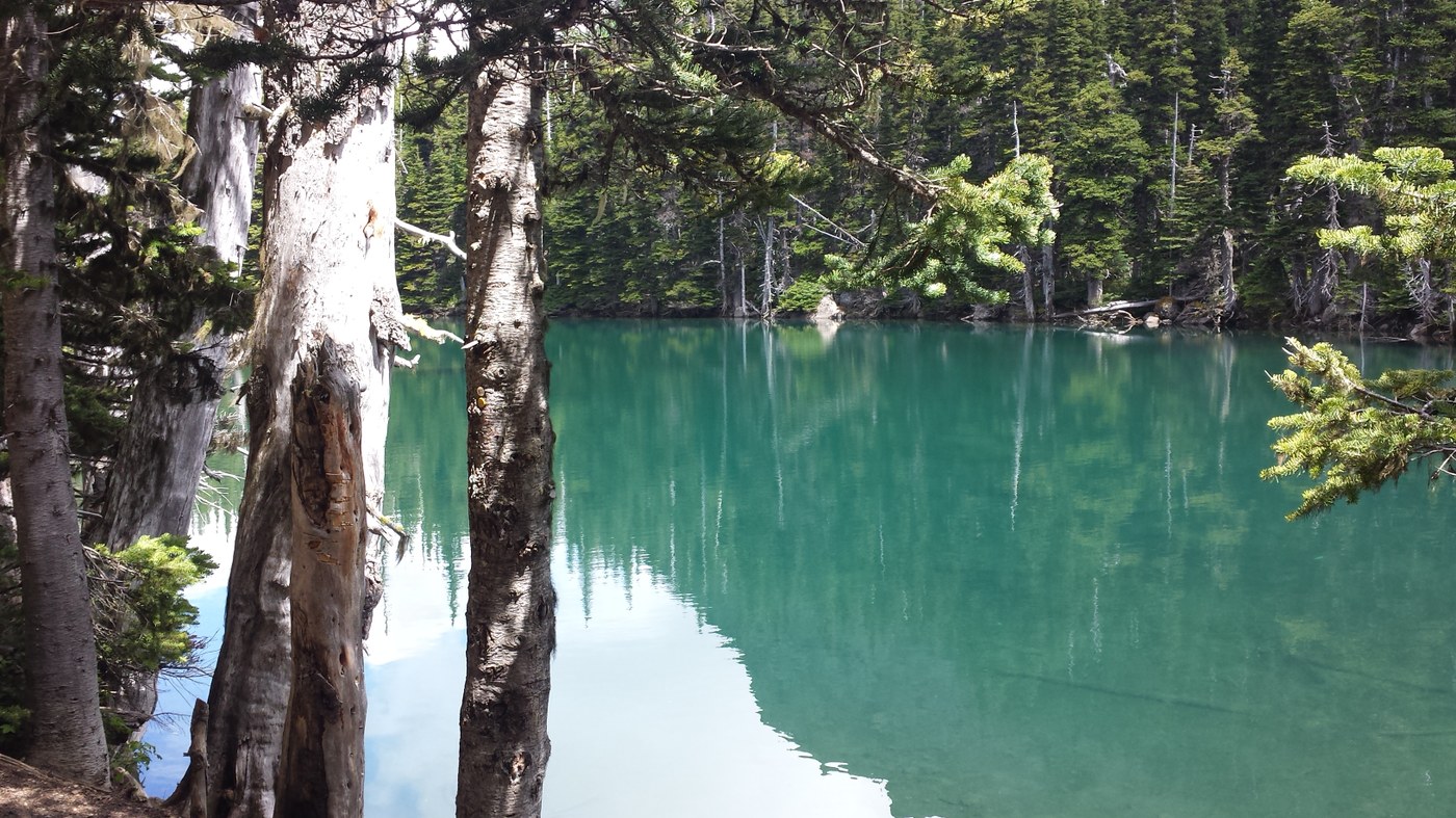
I had debated heading to Iron mountain originally, but with visibility decreasing at the top of Buckhorn, I turned back and took the saddle between the real and false summits of Buckhorn to traverse the meadow. I picked up the Tubal Cain trail in broad sunlight and descended through remainders of snow to the junction with Buckhorn Lake. After achieving the Lake, I ascended brush, forest, talus, and ultimately a final snow and scree field, to the saddle between Iron and it's opposing Eastern ridge. This is the lowest point on the ridge viewable from Tubal Cain. From here (in case it hasn't been guessed yet) my intent was to descend scree and forest on the South side of the Buckhorn ridge to connect back to the trail with Upper Big Quilcene. This was some major bushwhacking. After leaving Buckhorn Lake at 1:30, I finally reached the trail just before Shelter Rock campground @ 6:00 PM. I met yet another gentleman (either lucky or unfortunate enough) to catch me tumbling out of the forest and brush onto the trail, ice axe and helmet on.
We walked out and that finished my Sunday afternoon scramble. We headed to Quilcene for dinner at the Olympic Timber Lodge. Awesome day and met many nice people, as well as had some amazing wilderness experiences and views. Wild flowers were abound, trails were in awesome conditions, and the mountaineering in the area is solid with plenty of options for those looking to do some off trail climbing or traveling.
I feel required at the end of my report here to say a word on safety. PLEASE remember folks, if you do any mountaineering (like what I did at the end of this trip), take an ice axe - and be proficient with it's utilities and uses. On top of my axe I also had a HELMET and GLOVES. Ten essentials are always necessary if you're going to take chances route finding in the wilderness and I commenced the route I chose having also used my compass and map to figure where I wanted to go. Without proper equipment and a little bit of back country experience, this kind of travel could turn hazardous very quickly. Most of the reasons that I chose the route in the first place were because I am training for larger cross country trips to take place later in the season.
That's all I got! Feel free to e-mail me at brleinin@gmail.com if you have any questions pertaining to this loop I chose.


Comments