
Type of Hike
Day hikeTrail Conditions
Obstacles on trail:Trees down across trail,
Muddy or wet trail,
Overgrown in places.
Road
Road suitable for all vehiclesBugs
No bugsSnow
Snow free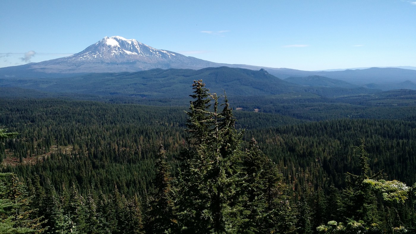
A lot of the hike descriptions I've seen give driving directions from either through Trout Lake or Carson. I took Hwy 503 from Woodland/Cougar to FR 90. Here are my driving directions:
--From Woodland, take Hwy 503 east, which eventually goes through Cougar and becomes FR 90
--Stay on FR 90 until you get to Curly Creek Rd. Turn right on Curly Creek Rd
--Turn left on Meadow Creek Rd (signed Wind River Hwy), which eventually turns slightly right and becomes FR 30
--Turn right at FR 24
For the most part, the roads are in good shape and well marked, with the exception of the unpaved portion of FR 30. This part of the road had lots of narrow ruts, almost like bulldozer tracks, making the the road bumpy and slippery.
I took the PCT down to the Sawtooth Mtn trail, climbing up Sawtooth Mtn from the north and going down the south. Once I got back to the PCT I continued south until I got to the Wood Lake trail. After that I took the PCT back up to FR 24. My total distance was around 10.5 miles with around 1000' of elevation gain.
The PCT and the Sawtooth Mtn trails are both in decent condition but the Wood Lake trail is in pretty bad shape. The section between the PCT and the first pond you encounter is fine, but once you get past there the tread is terrible with lots of drainage problems, including water across the trail and lots of mud. As I got closer to Wood Lake I started noticing a lot of fresh cougar tracks. I decided to turn around when the lake came within view.
If you don't feel like dealing with the bad trail conditions, the first pond along the Wood Lake trail is a nice spot to stop. Hopefully this trail will get some attention at some point, it seems like it hasn't had any maintenance in a while.


Comments