
Type of Hike
Day hikeTrail Conditions
Trail in good conditionRoad
Road suitable for all vehiclesBugs
No bugsSnow
Snow free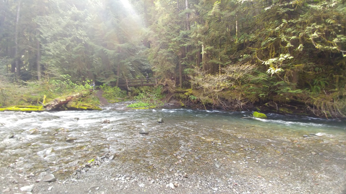
We hiked this trail over the weekend while we were camping just up the road at Fairholme.
The trailhead starts at the Storm King Ranger Station just as shown on the map. From here you walk under the road via tunnel towards the falls on the other side. The whole trek there was beautiful and everything was as green as could be. There are a few massive cedars on the left going to the falls. Ferns grow wherever you look and little chipmunks and squirrels can be seen all over. There is evidence of woodpeckers but we didn't come across any.
The first 3/4 of a mile is fairly even ground with no real elevation change, save for the muddy spots which aren't too bad. The first bridge you come to is steel and in perfect condition. About 50 feet after that is a wooden bridge, surprisingly, in just as sturdy a shape. Be cautious though as this bridge may be slippery from the mist of the waterfall.
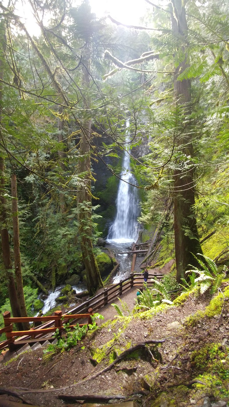
Once you're over both causeways you'll notice a huge change in elevation gain. The rest of the hike to the waterfall is steep but there are stairs most of the way, along with railings. There are also a couple places to rest if need be.
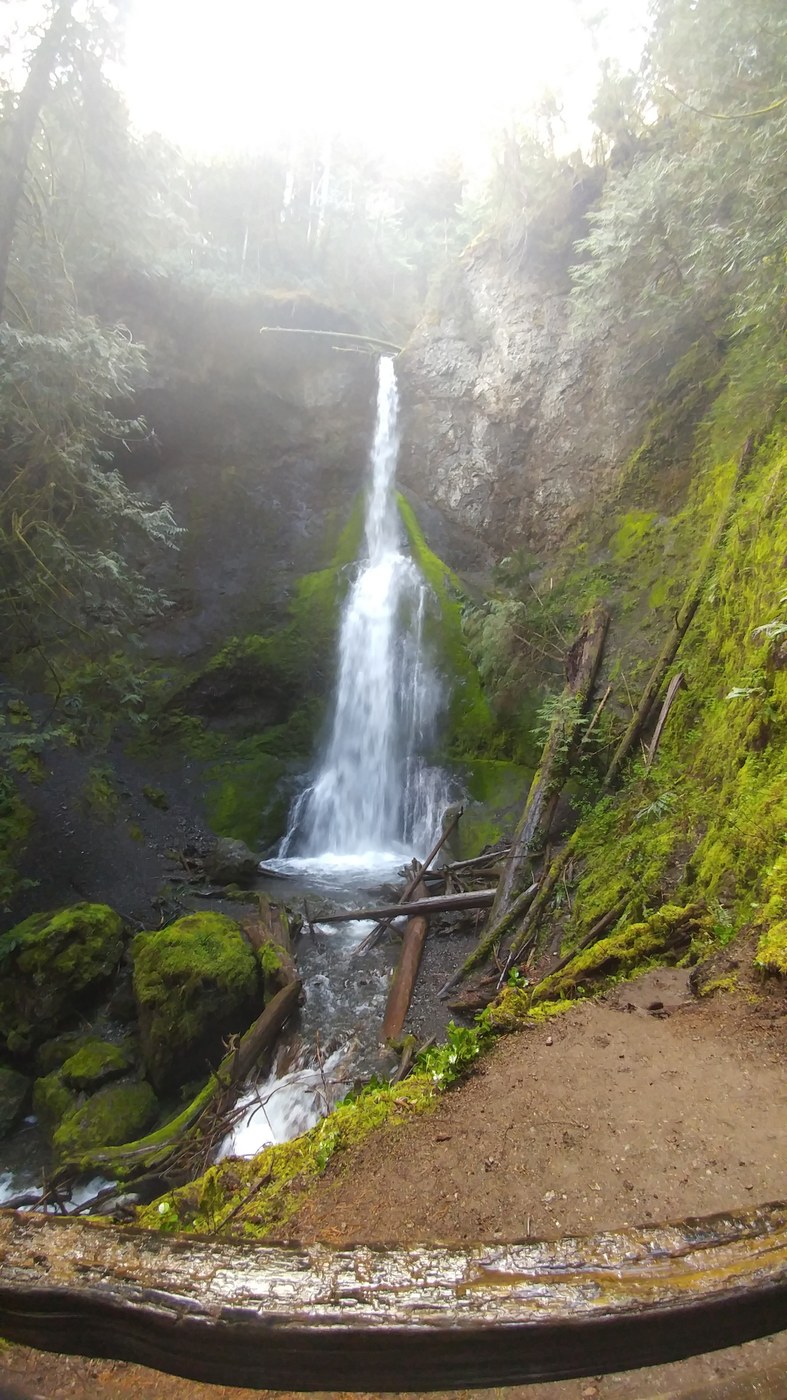
The view from the highest point is spectacular. The waterfall is stuffed back into the corner of the mountain and it makes for a great visual with a lovely smell of fresh water and conifers. There were several wildflowers in bloom throughout the trail as well.
If you are camping in the area or spending time at the Storm King Lodge I highly recommend taking 45 minutes or so to see Marymere Falls. I hope this helps!

Comments