
*NOTE* Suiattle River Road (FR 26) closed to incoming traffic 7/30/2017 due to forest fire at milepost 7. Fire crews were arriving as I was driving out, the flames were high and the smoke was thick. Check current fire status before planning a hike in this area.
Road to the trailhead in pretty good shape. Some small sink holes and a slumping section on the paved portion, these have been recently marked with orange paint for repair, so easily seen and avoided. Graveled section is alright, with some sections of potholes and washboards. Plan for around 30-40 minutes to reach the end of FR 26 from HWY 530. Nice restroom available.
Considering how many years this trail received little to no maintenance, it is in remarkably good shape. There are numerous blowdowns along the path, and because of the tight switchbacks and steep mountainside, you often cross the same tree more than once. Most can be over-undered, 2 have an alternate route being worn in around them. The trail is very narrow, and in some places overgrown with just-past-ankle-height salal and other woody shrubs. No rocks, but it is rooty in places, and there is quite a bit of soft duff covering most of the trail in the forested section. A few small slumping areas, and some places where it is off-camber. Be sure to bring plenty of water, the trail is bone dry except for a sluggish stream in the first quarter mile.
This trail is steep. Brutally steep. Thigh-burning, punishing, grueling on the ascent, no easier descending with the knee and spine jarring loss of all that elevation. Sulpher let me know I was not in as good a shape as I thought I was =) The trail heads up through forest 95% of the way, wonderful if you don't want to be exposed to the sun while toiling up the switchbacks. The trees are lovely, and plant nerds will be in heaven with the amazing variety and sheer numbers of saprophytic plants growing in the sections with less shrubby undergrowth. Pinesap, pinedrops, several types of coralroot, candystick, and gnome plant were all to be found along the way in quantity, although I missed the peak bloom by a couple of weeks. The trees thin as you get close to a small saddle, and peak-a-boo views begin here. There are a few wildflowers still in bloom, white bell heather, arnica, and lupine, but these are fading fast.
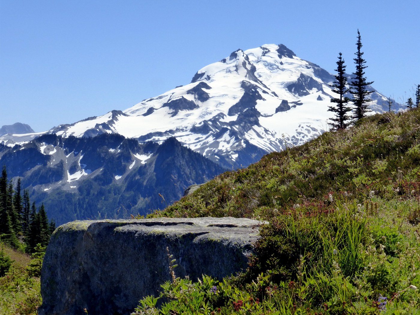
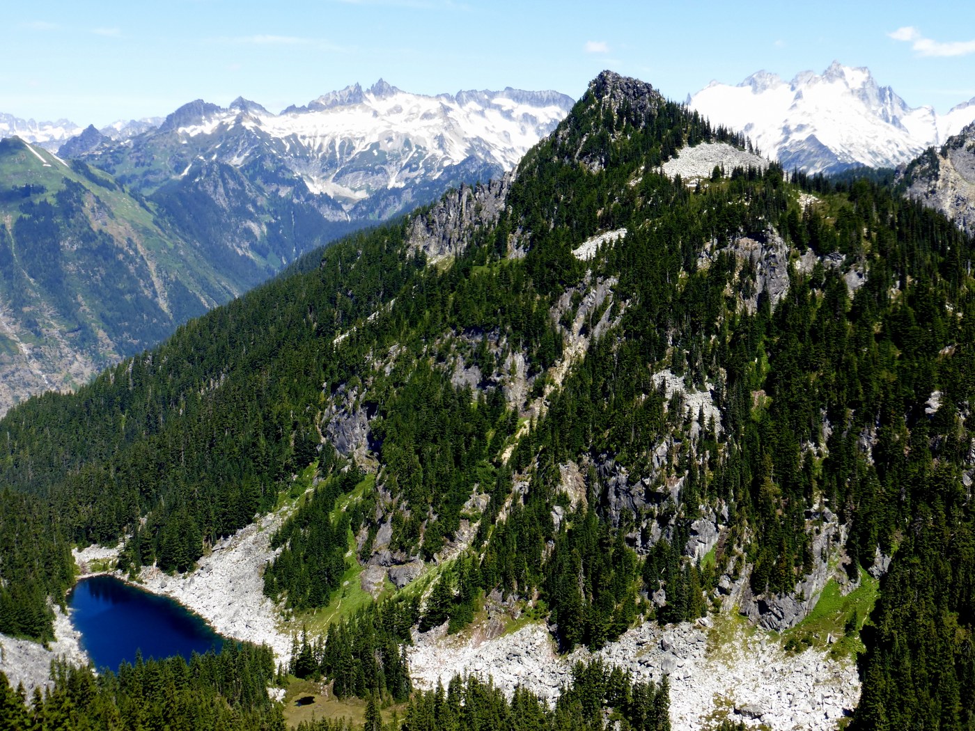
When you finally reach the saddle, this is where the real views begin. Taking a small trail to the left will lead down towards Sulpher Mountain Lake, a glittering gem in sapphire blue. Heading right leads along a ridgeline towards the old lookout site, there is still a small bit of snow to one side, well off the trail though. A few wildflowers still blooming, but definitely past prime. The views are spectacular though, and Glacier is *right there*! So close!
The bugs were absolutely terrible at the top. Despite a good breeze, I was assailed by every type of flying, biting bug you can think of, and in vast numbers. I had permethrin/picaridin treated clothes, as well as breaking out the Deet in desperation. These hungry insects were deterred by nothing, and the larger biting flies followed me a good 15 minutes downhill from the summit. Bug netting may be the way to go.
Comments