
Start:Graves Creek Trailhead
Finish: Dosewallips washout
Mileage: 34.2 miles
Elevation: 10775 ft
Highlights: Foliage, meadows, chalet, waterfalls, log bridges, thimbleberries, glacier
Day 1 - The trail is fairly flat all the way into the valley, so while the mileage is long, it's not too bad. Autumn is definitely on the way - leaves were starting to fall among the copses of trees and higher up you can see the colors starting to turn. We encountered many cool log bridges along the trail. The one right before crossing into the valley is especially thrilling, don't look down!
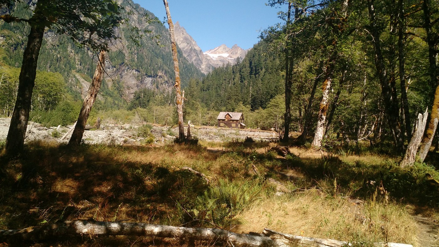
The view opens up into the valley, the chalet positioned with a mountain backdrop. As you continue further in, we saw multiple waterfalls in the distance on either side. There were a few campers set up, but there were open campsites available. We decided to press on a little further up the valley though, and we camped on the sandbar by the river.
Day 2 - Over the pass! We started gaining elevation in earnest at this point, but there are mountain views and wild berries to distract you - huckleberries, blueberries, thimbleberries (the best out of the three). Just when I was wondering if I still actually enjoyed backpacking, we crested over the pass. I took a breath (and a snack), then tackled the side trail up the the glacier tarn. Definitely do this! You'll be rewarded with a beautiful glacial blue lake with a little bit of snow still around on the left side. You can scramble down to the water or just enjoy the view from the top. Lots of fun rocks to scramble around too.
The descent from the pass is fairly steep, then we came upon a meadow right before the Honeymoon Meadows campsite. A little dried up but still nice. Warning here to not go straight over the river, there isn't a good crossing here and it leads into a campsite. Take a right before the water to ford and keep your feet dry. This campsite looked nice, but we continued on to our goal at Dose Forks. (Note: would not recommend Diamond Meadow, but Big Timber also looked like a nice campsite as well.)
At Dose Forks, we found an A+ campsite right by the river with great seating. To find it, find the bear wires - the bear wires will be to your left as you continue toward the water.
Day 3 - A fairly flat albeit boring trek back to the car parked at the washout.


Comments