It was sixty years ago that I (George) first hiked up to the Mt. Pilchuck lookout cabin with my dad Bill in 1957. A lot has gone on during those sixty years on the old mountain. The ski area has come and gone, the lower half of the 7 mile road up to the parking lot returned to gravel after being paved for the ski area, the trail has been rebuilt and relocated in several places, the lookout cabin was rebuilt twice by the Everett Mountaineers (1971 & 1989) and they still maintain it, and there are many more hikers than in 1957.
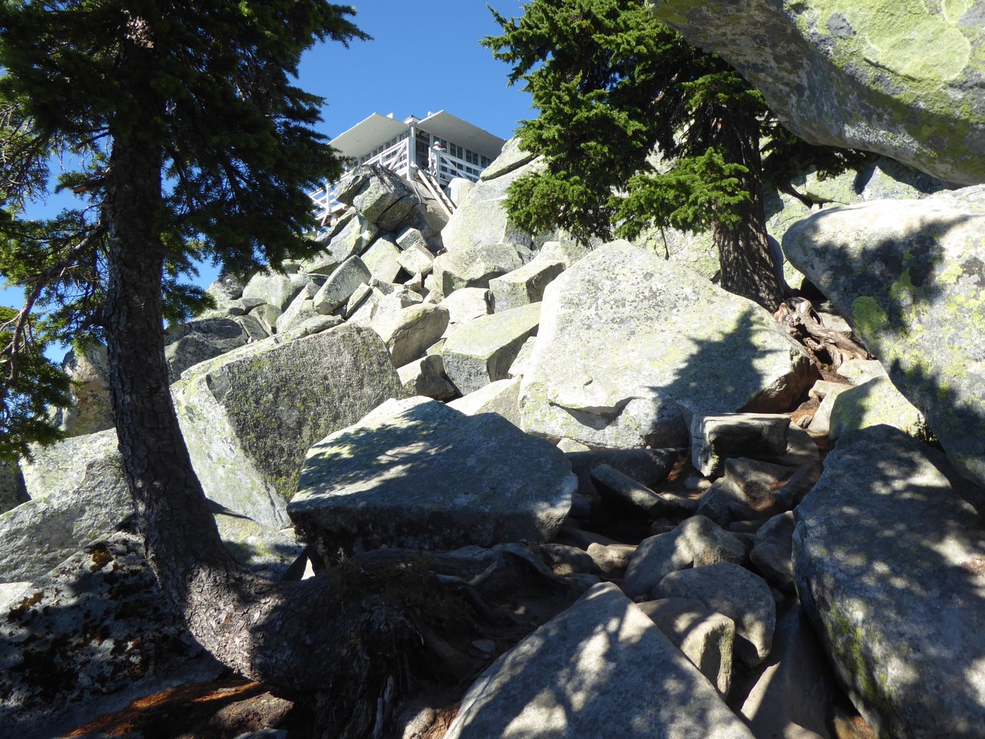
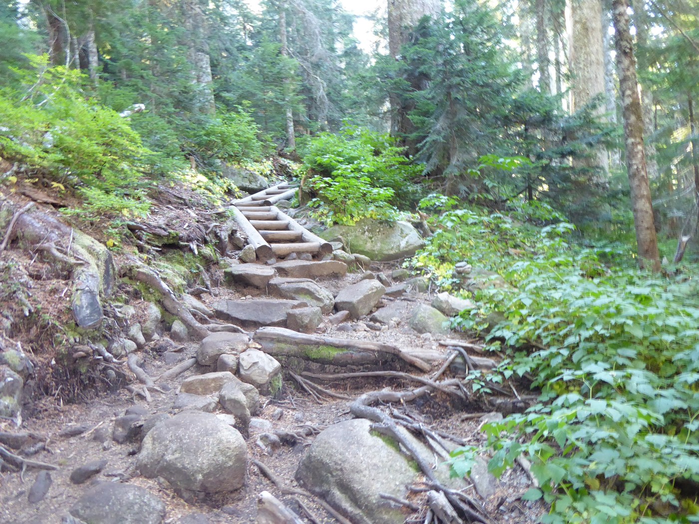
After turning off the Mtn. Loop Highway I headed up Road 42. The first half has its usual pot holes with wash board bumps, then turns to pavement after passing by the upper gate. This road was built in 1951 for Forest Service logging on the lower slopes of Mt. Pilchuck. There were already about 20 cars at the parking lot when I arrived on this sunny, blue sky day. The rest room door has several bullet holes in it. After getting my boots on I started up the trail which is on an old road bed from the ski area days for a short distance. The original trail up Pilckuck was built in 1918 and was 12 miles round trip from down by the Mt. Loop Highway. After switchbacking up through the woods, the trail turns to being rocky, really rocky as it works its way up the north side of the mountain through the old ski area. Skiing on Mt. Pilchuck was from 1956 to 1978. There were four rope tows and two chairlifts with 1,800' vertical drop. At the parking lot were two A-frame buildings for the day lodge (ski rentals, restroom and snackbar). I stopped at the location of the former upper ski lift terminal below Diamond Point for a snack break. The trail then goes over a ridge and continues on the south side of the mountain (still very rocky) before getting up to the summit. From the end of the trail it is a boulder scramble to get to the ladder and up to the lookout cabin. There were only a few other hikers in the lookout cabin when I arrived. One young guy was sleeping in a hammock hanging from the rafters. Great 360 degree view with Baker to the north, Three Fingers just across the valley, around east to Glacier Peak and down south to Rainier with hundreds of other peaks to see. The Olympic Mtns. from north to south across Puget Sound could be seen as well as many cities and towns.
After taking some photos and having lunch, I headed back down. I met a lot of first time hikers on this trail going up and down Pilchuck. Only a few with no packs, food or water. One couple only had the purse the woman was carrying. A young couple was hiking up wearing flipflops on this very rocky trail. You would not want to stub a toe! As I was getting down to the parking lot, there were still hikers heading up in the late afternoon. Made for a nice hike up Mt. Pilchuck on a great sunny day. The view is just as grand 60 years later.
A good book to read about the mountain is: "Pilchuck, The life of a mountain", by Harry W. Higman and Earl J. Larrison, published by Superior Publishing Co., 1949.


Comments
stever on 60th Anniversary Hike, Mount Pilchuck
George, congrats on 60 years of hiking. I enjoyed the historical parts of your TR very much. Thanks, Steve R.
Posted by:
stever on Sep 29, 2017 12:29 PM
seabeav on 60th Anniversary Hike, Mount Pilchuck
Very nice trip report...thanks for the comments on its history.
Posted by:
seabeav on Sep 29, 2017 03:12 PM
Muledeer on 60th Anniversary Hike, Mount Pilchuck
I enjoyed the history on this report! I can remember the ski area and the old paving. I didn't ski, but I remember hearing the ski reports on the radio with Mt Pilchuck in the middle. Didn't there used to be big yellow dots on the rocks to mark the trail at one time?
Posted by:
Muledeer on Sep 29, 2017 05:46 PM
George & Sally on 60th Anniversary Hike, Mount Pilchuck
Yes, there were yellow dots painted on the rocks on the north side of Pilchuck above the old chairlift base. They were there for many years to help hikers find their way. I saw only one of them on my hike last Thursday. Now the State Parks put in the orange flexible guide posts to keep people from getting lost. I saw on the north side they had installed "Wrong Way" signs as some hikers had gotten lost and got off the trail, and went down through the woods on the south side of the mountain.
Posted by:
George & Sally on Sep 30, 2017 10:10 AM
Muledeer on 60th Anniversary Hike, Mount Pilchuck
yeah I saw those wrong way flags last year. If you've been hiking around the MLH for awhile, I'll bet you remember the Heather Lake trail coming off the old logging road and parking on the road for Lake 22!
Posted by:
Muledeer on Sep 30, 2017 11:52 AM
mato on 60th Anniversary Hike, Mount Pilchuck
Hey George! Congrats on your sixty year visit! You're looking great!
We talked briefly on your way down. I was thinking about your sixty years as I was taking a buddy up on his first time. We were skipping work, and I told him we might as well get the most bang for our buck, so I chose Pilchuck. He loved it!
Should of talked longer with you. Take care.
Posted by:
mato on Sep 29, 2017 09:06 PM
mato on 60th Anniversary Hike, Mount Pilchuck
Hey George! Congrats on your sixty year visit! You're looking great!
We talked briefly on your way down. I was thinking about your sixty years as I was taking a buddy up on his first time. We were skipping work, and I told him we might as well get the most bang for our buck, so I chose Pilchuck. He loved it!
Should have talked longer with you. Take care.
Posted by:
mato on Sep 29, 2017 09:13 PM
mato on 60th Anniversary Hike, Mount Pilchuck
Dammit! Foiled again! I was just trying to correct my grammar, and got posted again.
Sorry everyone...
Posted by:
mato on Sep 29, 2017 09:44 PM