
Me and 6 other idiots decided to go to Summit Lake over the weekend. Sure, there's a 2.5 mile, moderately graded trail that goes straight there, but why do that when you could do a 20-25 mile loop through a bunch of unmaintained backcountry? Like I said, we're idiots. However, we were at least well prepared. Each of us had a compass and at least 2 different maps, as they indicated different mileage and difficulty of terrain depending on which map you consulted. We also had GPS with us, and definitely needed it. (Foreshadowing...)
The road up to the Summit Lake trailhead is BRUTAL. Steep on the way up and filled with innumerable deep potholes. I really would not try this road without a vehicle you're very confident in. We arrived at the trailhead at sundown and hiked by headlamp to the junction 0.8 miles in to a sign pointing to Summit Lake or Bearhead Mountain. From there we proceeded another mile and a half to the base of Bearhead Mountain before making camp.
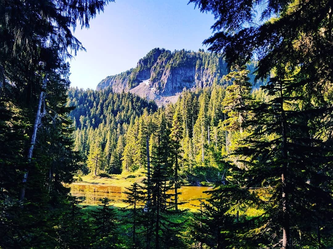
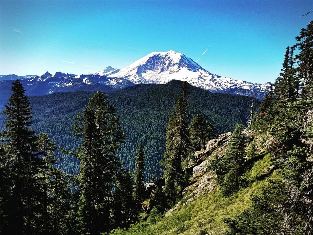
The next morning was our big push, and we were aiming to get to the confluence of the Clearwater River and Lily Creek. As the summit of Bearhead is only a mile up, several of us made the trek before setting out for the day. There are precious few areas of flat trail between Bearhead and Frog Mtn...you're either going up or down at a pretty steep grade. Everything is deep woods, so don't expect any views aside from towering trees. Once at Hurricane Gap we dropped 2,000 feet then went right back up 1,000 to get to the base of Frog Mountain. That was the last of the "pleasant" trail for a long time.
From Frog down to the river was a steep, brutal descent of 1,600 feet or so with a seemingly endless parade of huge trees to overcome. Very often there would be several close together, and you'd have to climb over one only to scurry beneath the next, all while wearing a full pack. The switchbacks did little to mitigate the sore knees, and by the time we hit the river at sundown we all had exactly enough energy to unroll our sleeping bags before crashing on the rocks. Maybe half of us threw up a tent, but the rest didn't even go to that effort.
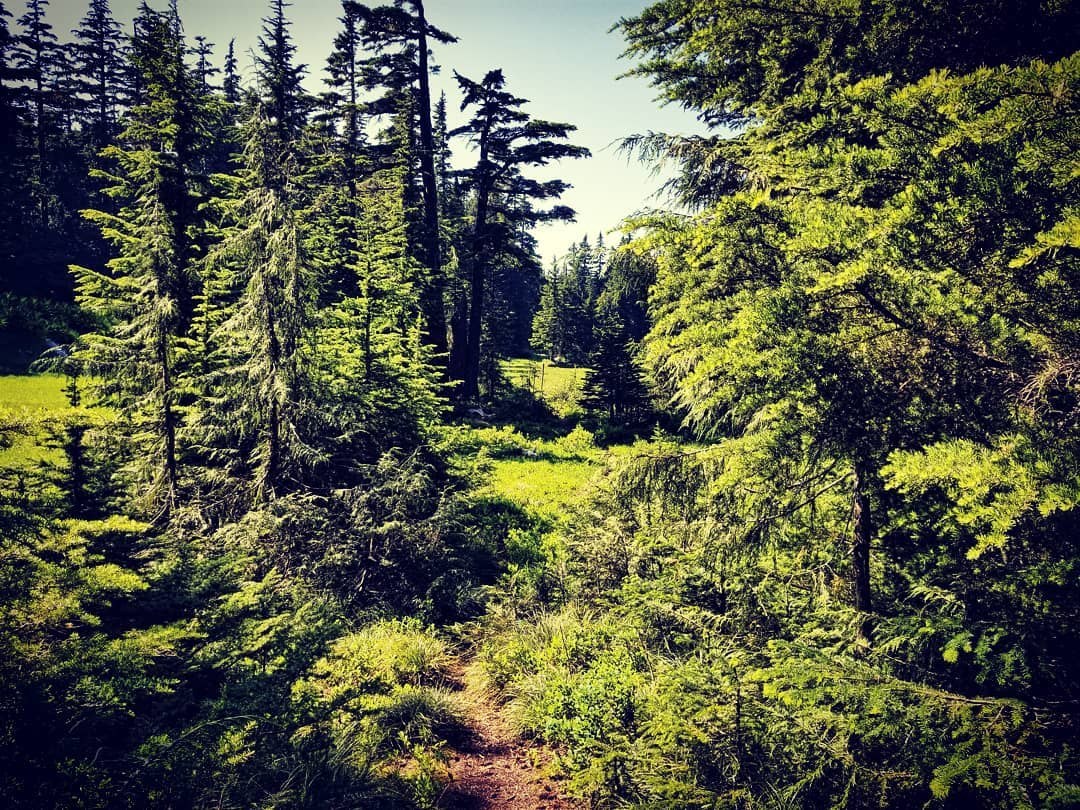
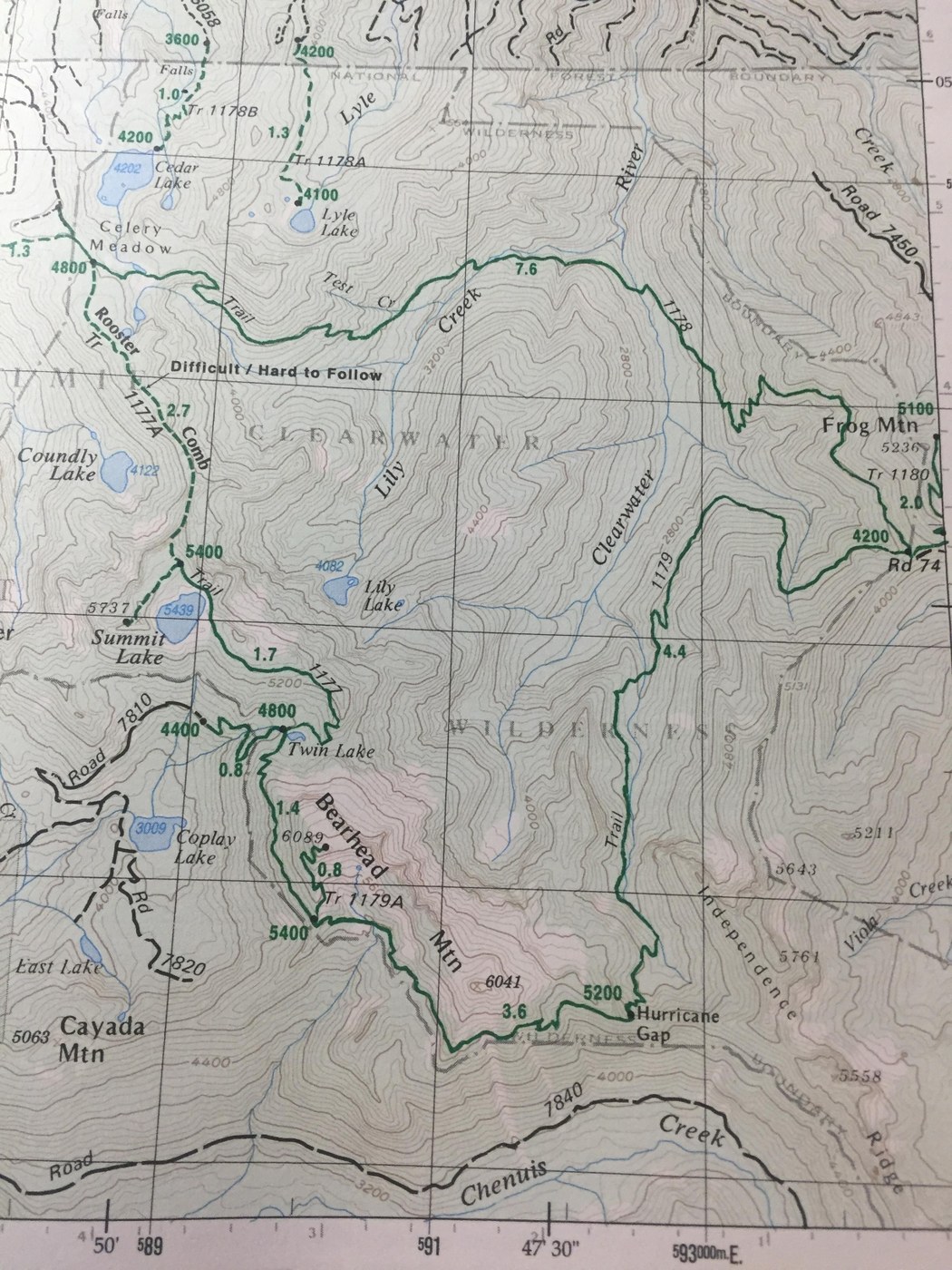
Saturday morning we broke camp and got right into the fun. The map included in the report is a bit out of date much of the northern section of the map is now dotted-line material. Luckily, one of us had the foresight to bring a machete which we put to good use clearing away underbrush and lots of devil's club to find some semblance of a trail. Even with the GPS and maps, we lost our way many times on the way and charitably made maybe a mile per hour. Once we emerged from that ordeal to an actual trail again we encountered a work party that had been clearing the trail from the opposite direction and gave us some hope. An actual path to walk on! Yes, it was clear, but man was it steep. We all made it to Celery Meadows by about 3:30 and collapsed in the shade to recuperate for an hour and take on some much needed calories.
Save the hardest part for last, right? We faced a decision of whether to press on to Summit Lake across the Rooster Comb while racing the setting sun or camp in the meadows and tackle it in the morning. We made the call to go for it. The Comb is a narrow footpath that ended up being less terrible than previous trip reports had led us to believe, but was still by no means something to be underestimated. It goes up a sheer ridge and stays along the top with a lot of ups and downs, much of which is only indicated by ribbons tied to branches along the "route". Near the western end of the Comb is a nearly vertical ascent with very little room for error and should not be attempted unless you have confidence and experience. We had rope with us but opted to skip it (probably stupidly).
We all made it up and the last leg to the lake was a welcome relief. Once we arrived at Summit Lake we collapsed along the shore, pitched tents, and rested. Glorious, glorious rest. Sunday morning was an easy 2.5 miles down to the car.
What I'll call the Clearwater Wilderness Loop was incredibly challenging, an endless series of elevation gain and loss and gain again, and a test for all of us. Thankfully we left with the same number of people that we started with. We were alone the entire way aside from the work party we encountered, so if you're looking for some solitude this will certainly fit the bill. Be safe out there, folks.
Comments
Gulchguy on Summit Lake, Bearhead Mountain, Frog Mountain
Twenty years ago I looked at that Green Trails map, showing the Clearwater "Wildness" Loop...and wondered if it was still doable, (since I heard the northern trail was unmaintained). Bravo to you and your hearty team for taking on this adventure. Sounds like you were well prepared.
Nice to hear there was a trail crew working their way east. Perhaps the Clearwater Wilderness will one day be known for more than just Summit Lake.
Posted by:
Gulchguy on Jul 31, 2018 03:06 PM