
I did the loop in 5 days going counterclockwise. I planned to do the trip in 6 days, but a combination of being hard-headed and lots of smoke led to me skipping my last night and trekking all the way out to my car. I think most people go clockwise, so keep that in mind when reading my descriptions! As is well known, this is an ever undulating trail with each day having at least one 2-3k climb in a single shot. Switching between deep valleys thick with forests and subalpine sprawling meadows with larger than life views of Tahoma. What an awe inspiring collection of trails. Signage was very well done along the trail. I brought a bug net after hearing some horror stories, but I barely saw a mosquito. And it was super fun hearing the stories from people I ran into along the way. Shout out to the couple people who were trying to push through in a single day, yall are brave.
Day 1 white river to mystic. 12 miles. 920am-230pm, 5 hrs. Trail is great shape. Somewhat unclear on which direction to go when reached the fork to skyscraper mountain. Stay left to remain on the wonderland. Right will bring you to the top of skyscraper Mt. A little down from here there was a wasp nest in the middle of the trail. Go off to the side and it is fine to pass. You probably won’t see it until they swarm up and you run away, like I did haha. Mystic camp is .2 miles away from the lake. This lake is warm! Would have been perfect to swim in but it was a little overcast and chilly so I just waded in a bit.
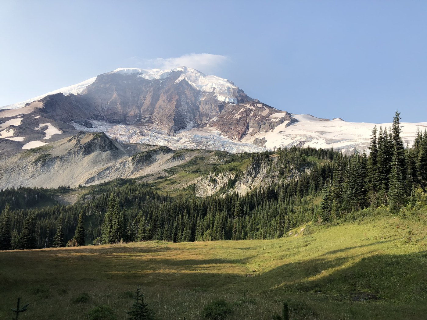
Day 2 mystic to south mowich. 17 miles. 730am-430pm, 9hrs. I deviated from the wonderland to take cataract valley up to suittle and spray park. Definitely recommend doing this. Trail is in great shape. 2 snow crossings on the upper park of the boulder going to spray park. Easy to cross, trail runners did just fine. Spray park was absolutely gorgeous. After spray park take the spur down to the foot of spray falls. It’s an easy jaunt off the trail. A little further you’ll see a sign for eagle cliff view point. Definitely go down here. There was another wasp nest further down the trail. Someone left a note on a piece of paper before you reach it. You eventually meet back up with the wonderland trail, and south mowich is about 4 miles further. South mowich camp is great. Right next to the river and had nice afternoon sun. There is also a covered shelter and an out-house.
Day 3 south mowich to south puyallup. 18 miles. 720am-250pm, 7.5 hrs. The day started off immediately with a pretty long uphill section but the grade wasn’t too bad and the trail was nice and wide. I found a Spot device in the trail; if it’s yours I gave to to the rangers at longmire! The trail eventually flattens out after gaining over 2kft and is lined on both sides by huckleberries. Bring a ziplock! A slight downhill to golden lakes, which were looking very fine. Further along the trail above golden lakes are a bunch of wild blueberries. Add them to the bag with huckleberries! After you reach the north puyallup camp it is a steep hike up to klapatche park. This was the steepest section I had been on so far, and it was also pretty overgrown and narrow. Klapatche park and St. Andrews park were both gorgeous. Lots of blueberries in St. Andrews park. From here it was mostly switchbacks down to south puyallup. A group coming the other direction warned of a bear in the trail, but I never saw it.
Day 4 south puyallup to cougar rock. 13 miles, 730am-230pm, 7hrs. Today I had the experience of shitting on my headphones. It was one of those kind of days. However, emerald ridge just 1.5 miles up from south puyallup was gorgeous and the meadow up there was bountiful and had plenty of marmots running around (but too bad the smoke came back). Next was a downhill section (and over the huge suspension bridge over what I think was Tahoma creek) then back up hill to the gorgeous Indian Henry hunting ground. Wonderful meadow with wandering creeks and flowers and wildlife. I proceeded down to longmire to enter civilization for a bit and collect my food cache. As mentioned before, I found a spot device and gave it to the rangers here, so give em a call if it’s yours. Made myself a nice lunch with fresh avocado and warm IPA then walked on another 1.5 hrs to cougar rock campground. This front-country camp ground was crowded and not nearly as nice as the other camps (but bathrooms and running water).
Day 5 cougar rock to white river. 30 miles, 640am-630 am, 12 hrs. I left cougar rock just as the first people were waking for their morning trip to the bathroom. Stopped to collect some water and a last bathroom visit then hit the trail. About an hour in I noticed that I was making very good time. It was at this point that I got the idea in my head that if I got to Indian Bar at a reasonable time I could challenge myself and head all the way to white river instead of camping for a final night. Reflection lake was beautiful with two early morning folks taking pictures, but with the smoke Tahoma was pretty hidden. The climb up to Indian Bar is real, but it was absolutely gorgeous ounce you get out of the forest. However, the smoke was SO thick today. I could make out the base of Rainier, but thats about it. I pushed on and got to the Indian Bar campground at 1:20. I was absolutely worked, but made the decision to eat lunch, change clothes, and hit the trail to go to white river. Coming out of Indian Bar the climb was almost the end of me. I was put through the ringer as I slowly made my way towards Summerland. To be honest, if the smoke wasn’t around I would probably have stayed. Slightly disappointed, as this would probably have been my favorite and most scenic part of the trail, but I could only make out the outline of Tahoma. There were a couple snow crossings between Indian Bar and Summerland. Both were pretty short and manageable with trail runners, but poles definitely helped. Ounce at Summerland (also a gorgeous campground) the trail changed from rocky scramble to dirt again. From here it was a little over 6 miles, mostly downhill. I stumbled up to my car at 630pm.


Comments