

Solitude:
Our party of four arrived at the Rachel Lake trailhead mid-morning on July 4th and were surprised to find the parking lot wasn’t full. However, I am fairly certain, from the number of people we encountered on the mountain over the next couple of days, that it filled quickly and quickly overflowed. In fact, on our way out (Saturday July 6th) we ran into a Ranger at Rachel Lake that told us that she had already talked to 50 people and fully expected to break 200 on her trip. When we arrived back at the trailhead at around 1:30 the lot was full and cars were parked on the side of the road for what must have been a mile. Although most people stop at Rachel Lake, even the higher lakes were busy. At a quick guess, I would say that there were at least 20 people up at Lila Lake. So, if you are seeking solitude, this is probably not the right place.
The Hike:
The first few miles of the Hike are relatively easy with beautiful views of the creek and forest. However, the last section (a little over a mile?) before Rachel is a steep obstacle course that has you high stepping over roots, rocks, mud, and water. It is beautiful, but if you aren’t ready for it, it can wear you down. Especially when you are carrying a heavy backpack. We stopped at Rachel Lake for snacks and a quick break before we continued up the trail. Surprisingly, the bugs weren’t bad. They were there, and we definitely recommend bug spray, but they weren’t thick relentless swarms like we had experienced in the past. If your destination is Rachel Lake, we recommend getting there early to find a good camp spot.
After leaving Rachel the trail is steep and switchbacking as you work your way up to Rampart Ridge. However, it offers a lot of amazing views overlooking Rachel. There was only one patch of snow that I can think of and that was off to the side of the trail. You don’t have to cross it.
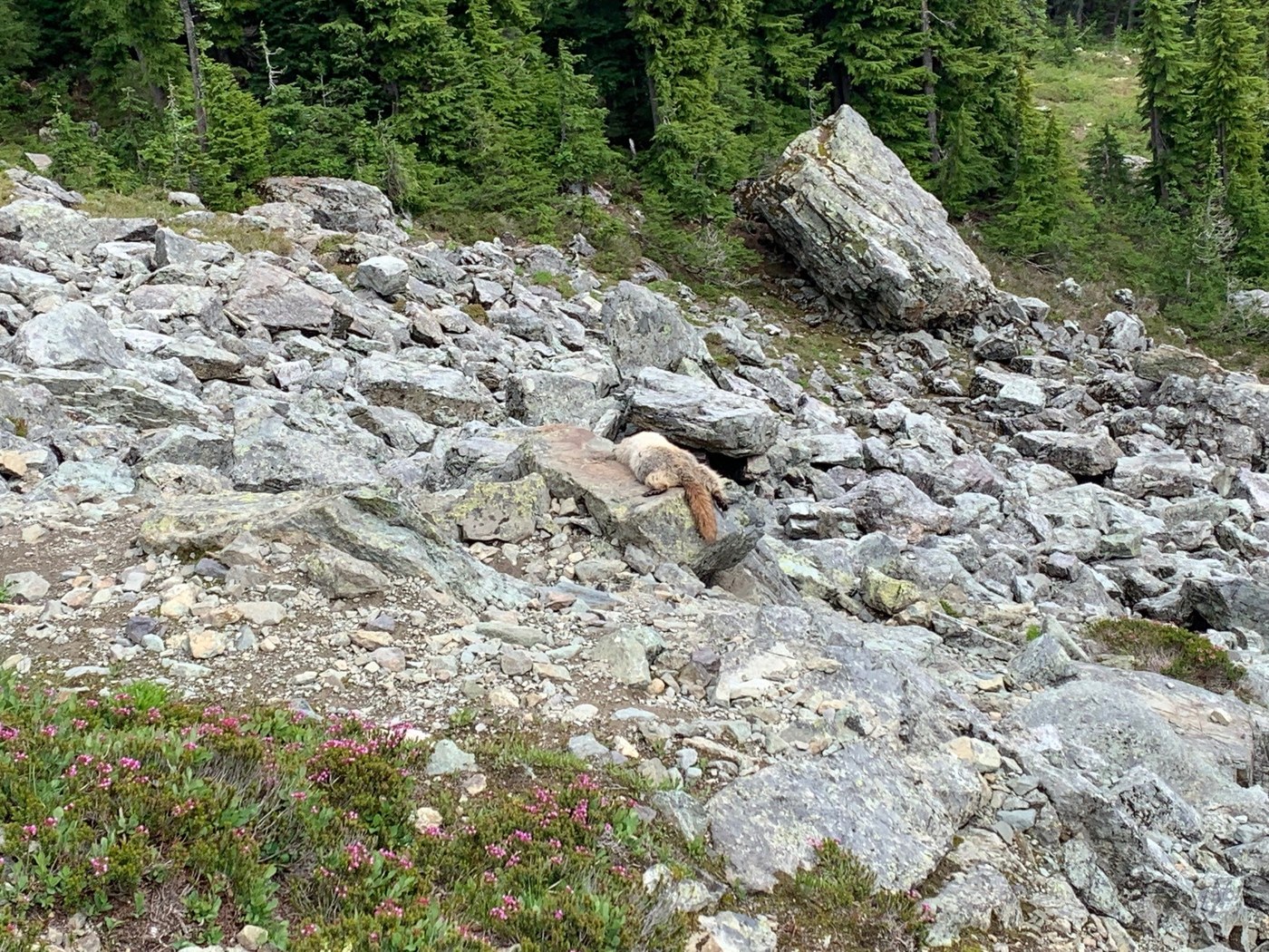
At the ridge you turn right and follow the trail to Lila Lake. We passed by snow in a few locations, but again, you never have to actually cross it. The trail was clear. Keep your eyes open when you hit the Scree field just before the lakes. We spotted a number of Marmots playing and one beached itself on a rock to soak up the sun. We also spotted what looked like a Pika down in the rocks, but it was a bit far away to confirm.
Once you roll up over the ridge above the scree field we found quite a few larger snow patches (again, not on the trail). As the day warms up they start to run across and down the trails making some areas work like little creeks. If this is your first time up here, the first couple of ponds you spot are not Lila. Keep going down and around the bend in the trail and you will spot Lila and a couple of companion lakes down below you. The trail that drops down to the lakes is steep but short.
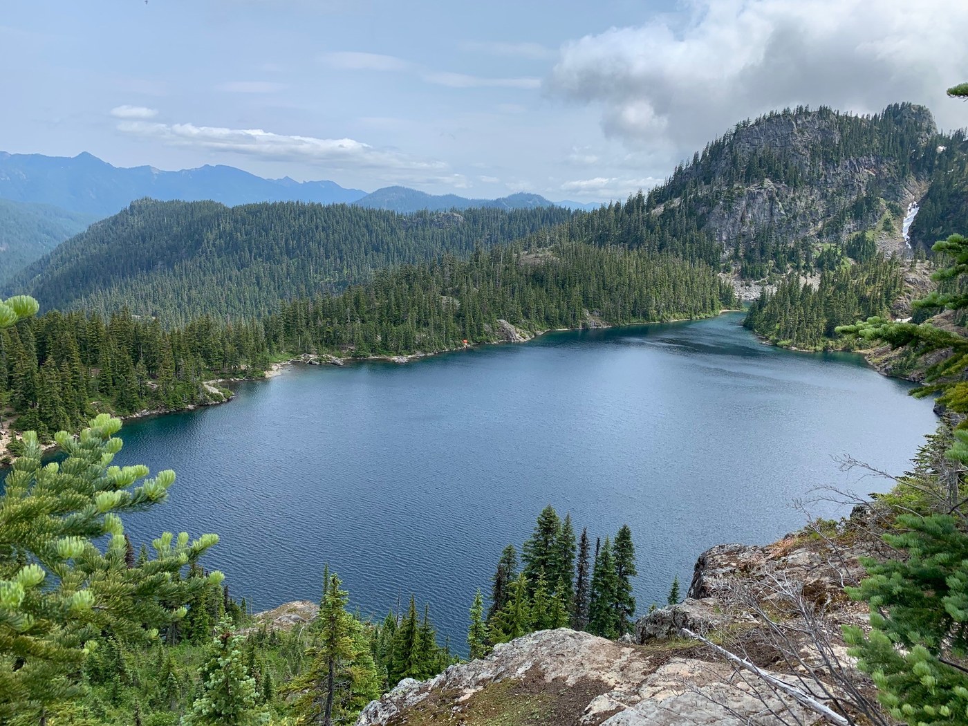
Lila Lake:
There are actually three little lakes beside each other as well as a few small ponds around the area. I assume that the first one is Lila Lake proper, but we camped beside the second lake in a flat spot on the South end that was a little more protected from the wind and we spent most of our time sitting down beside the lake on some big rocks that rest between the first and second lake. Sunrises from that location are stunning.
Alta Peak:
On Friday morning we hiked up to Alta Peak to take in the view. Although there is a split in the trail back before the scree field that takes you up the ridge, there is also a side trail next to the small upper ponds near Lila that Tee’s into the ridge trail. The lower end of the trail is pretty brushed in by the trees on either side of it, but if you push through them, the trail opens up and is a really nice climb up to the ridgeline. There is a cairn at the Tee to help you spot it on the way back down. Once up on the ridgeline, the hike isn’t bad, but there are some steep and scrambly parts that require people to pay attention to what they are doing. One woman that we visited with didn’t reach the peak because she was alone and didn’t want to lower herself down a rock edge to where the trail sat around 5 feet below. We found that the rock had enough toe holds to make it fairly easy, but I understand her playing it safe considering she was by herself and not very tall. There are times on this trail where you have to stop and take in your surroundings to make sure that you are not missing the actual trail, but we were able to find it without getting off route. One of the things that we loved were seeing all of the other lakes and ponds that sit out beyond Lila. There was even a heart shaped pond that we snapped a photo of. When you reach the Peak there is a giant Cairn marker and the views from up there are a fantastic sweeping 360 degrees. We almost didn’t make this hike, but I am so glad that we did.
Weather:
The temperature was very comfortable for the hike up, but once we were up at Lila, we did find ourselves wearing sweatshirts most of the time. The first night it cooled down, but not terribly. However, the second day we had fog roll in late afternoon/early evening. I ended up pulling out my warmer jacket to layer over my sweatshirt. In late evening, just after we climbed into our tents, it started to rain and rained off and on all night. It let up around 4am and turned into a beautiful morning.
Wildflowers:
There were a lot of different wildflowers in bloom and I took way too many photos of them.
Wildlife:
Marmots (playing and constantly singing their high pitched songs), a Pika, and we pushed a couple of deer up out of the upper ponds as we were headed to Alta.

Comments