A stunning summer hike over the Queets and under the spruce. This was a first day hike for new trio of experienced hikers and a first Queets hike for all of us. We tracked this USGS site to make sure the water volume would be low enough to cross, packed plenty of guidebooks and maps as well as supplies (tent, food, headlamps) to stay the night if the river rose from increased meltwater during this sunny day and prevented our return. And we stopped in the Quinault Ranger Station to get current conditions and, possibly, a better map to lead us to the best crossing site and to our destination--an enormous Douglas-fir (15' diameter).
I advise you do all of these things...and still prepare for lots of guesswork when it comes to the river crossing and way finding. I'm considering the lack of trail marking to be the "minor obstacles" on this trail.
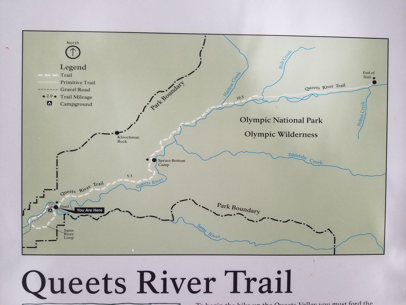
We took Hwy 101 to FS 21 then FS 2180 where we followed signs to the Upper Queets Rd. and the Queets Ranger Station (unstaffed). This is where one end of the Sam's River Loop Trail begins, but not the best place to cross both Sam's and Queets Rivers. We drove further up Upper Queets Rd. to the Queets Campground and then a bit upstream parked along the side of the road with other cars at the trailhead for Sam's River Loop. The park has posted information signs about how to cross the river (but not where). Maps are really not helpful for finding the river crossing given that the river conditions vary greatly by season, day, and hour and so and "best" crossing points vary as well. We had hoped to follow in the wake of other hikers, but there were none that day.
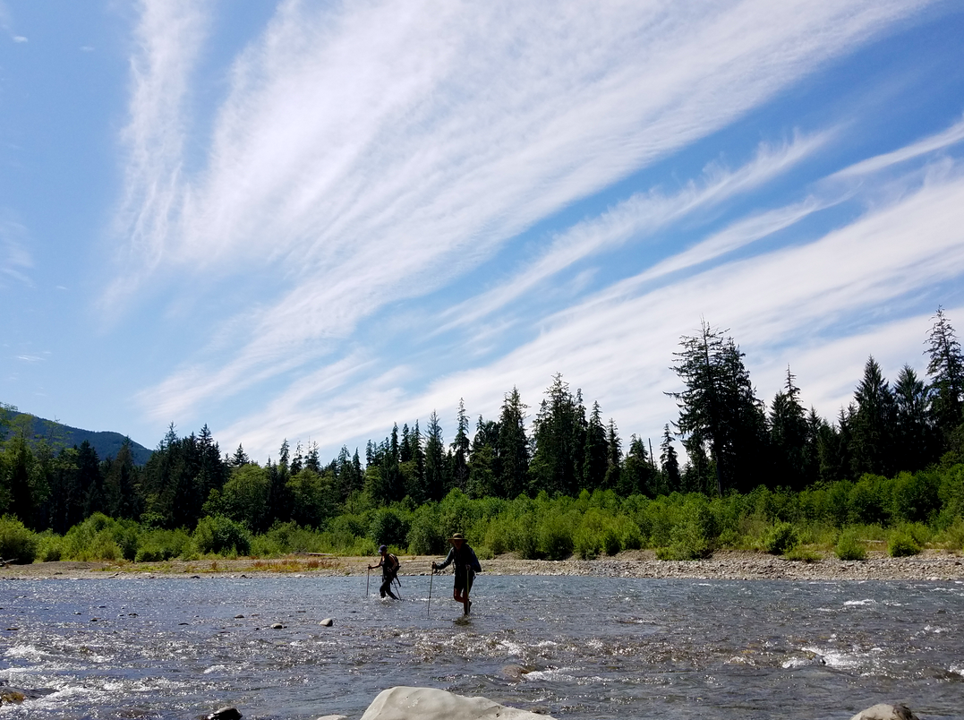
So, we headed down Sam's River Loop Trail and soon found ourselves wandering around on a gravel bar at the edge of Sam's River. It was an easy (ankle deep) crossing to another gravel bar and the Queets. Where to cross? There were no NPS signs or clues...but someone (THANK YOU!!!) left a rock cairn we rightly assumed was a safe place to cross. With hiking poles in hands, we started across. We were shin deep in water and we moved slowly on the slippery rocks, careful to have at least one foot and two poles planted at all times. Only in the very middle of the Queets did the river tug strongly--enough to make the crossing exciting but not petrifying.
Once on another gravel bar on the far shore, we set off upstream on what we thought was a trail...as did quite a few others before us. Several petered-out paths later, we returned to the Queets and walked a few hundred feet downstream where we spotted another cairn at river's edge and a piece of green flagging tape tied to a shrub. This is the entrance to the Queets River Trail. Yay! We set off happily, letting the sun and time dry our wet shoes and pants.
The Queets River Trail is a gorgeous single-track trail through open grassy areas, swaths of trail-obscuring salmonberry, and a breathtaking forest of old-growth Sitka spruce all along the way. We had hoped to reach the 212-foot-high Douglas-fir (one of the largest in Olympic NP) but there were no signs to lead us there, only vague directions on a Park handout from 2009: "Just before Coal Creek, a small way trail on the left leads 0.2 mile through rain forest to the humbling giant." Uhhh...there were a few creeks (some dry) on this trail and many small way trails in this forest and we were not tracking our mileage so the "0.2 mile" marker wasn't useful. However...
...the Sitka spruces stole the show and we were not disappointed that the mighty Doug-fir eluded us. We could have spent all day hunting for it (fun!) but with the sun beating down on us and glaciers as well, the specter of the rising Queets cut our rambling time short.
And rise it did! In just two hours (between 12 noon at 2 p.m.) the shin-high river had become thigh high. We all made it safely across though the current felt strong enough to throw any of us off balance had we been less careful.
The Queets River Trail is a fantastic place to feel humbled by the power of water and the magnificence of the forest. Though the NPS could do a much better job with trail signage, we enjoyed the opportunity to practice our our instincts, wit, way-finding skills in the wilderness.


Comments
SpruceMoose on Queets River
The official crossing has always been at the mouth of the Sams River. There used to be a marker (same as they have on the coast trails) on a tree directly across from there. It may have faded or fallen by now. As for the trail - it is always a route finding affair. To reach the big Doug fir, you have to look for a faint trail leading left on a hump just a little ways after Andrews Field, and just before Coal Creek (which is the stream that the trail crosses over on a down tree). A massive spruce fell across the "Big Fir" trail in recent years and almost nobody goes up there anymore, as is evident by the underbrush that has literally obscured the entire route. These challenges, and the fact that the trail rarely receives maintenance, make it appealing only to a few hikers.
Posted by:
SpruceMoose on Jul 24, 2019 02:38 PM
Maria Ruth on Queets River
Thanks for this info...but there are definitely no trail markers at all along Sam's or Queets. Which map/app were you using to see "Andrews Field?" I'd love to know as none of mine showed this feature. We did follow for a short way a faint trail off to the left just before a creek (presumably Coal Creek) but this creek has a sturdy bridge over it now. I will persevere!
Posted by:
Maria Ruth on Jul 24, 2019 03:23 PM
SpruceMoose on Queets River
Apologies for my much delayed response! The only trail sign I can remember is at the trail's beginning, opposite side of the river from the campground. I use the Custom Correct paper maps (REI and Metsker by Pike Place sell laminated versions that are handy for wet rain forest trails). Andrews Field is the really large clearing you enter at 1.8 mile. Best of luck!
Posted by:
SpruceMoose on Jul 11, 2020 07:45 PM