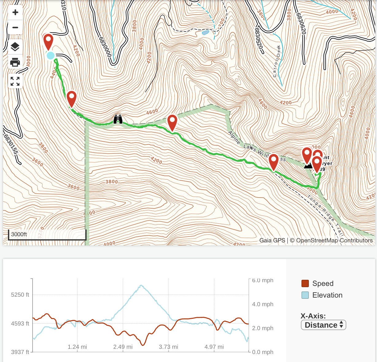
A couple friends and I did Tonga Ridge to Mount Sawyer and back today.
The road was completely snow-free all the way to the trailhead. The road is in excellent condition; there are a few minor spots of washboarding, and an occasional pothole that requires a bit of care, but any passenger car should be able to get up there with no problems whatsoever. At least, until it snows up there again...
We got there around 10:30 (we had a bit of a late-ish start and drove up from the Seattle area), and were the only vehicle in the parking area. We were the only vehicle when we got back, too, 4 hours later. In fact, we didn't see anyone on the trail at all ! I love days like that.
FYI, just a few feet down the trail (after the trailhead sign), there's a signed trail to the right that leads to a toilet.
Anyway, the trail itself is in great condition. The stretch from the trailhead to the well-signed branch to Mount Sawyer is in fine shape; no mud spots, not big rockhops, no blowdows, and only a couple of short snowy sections.
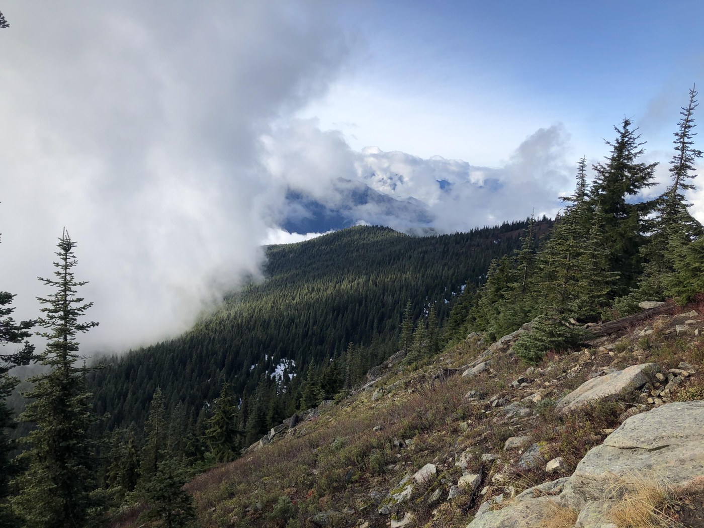
After turning left on to the trail up Mount Sawyer, things start quite steep, but after a short distance, the slope becomes quite a bit more moderate, with late-fall colors and some fine views to the south-west. The trail here also is in great shape; a little brushy in spots, but still mighty fine.
The trail becomes consistently snow-covered where it turns west and wraps around the north side of the peak. We followed the tracks some people made through the snow in the recent past, so it was easy to follow their path. If this was recently-fallen snow, however, it'd be quite easy to lose the trail. The snow was pretty soft so I wasn't worried about footing, but if it were more icy or crustier, I would have put on spikes; the slope down is pretty steep and I'd hate to lose it and start sliding .
The trail wraps around the summit to the south side again, where the ground is currently snow free and offered some pretty good views across the valley, when the clouds cooperated. It then climbs a few feet to the actual summit, which is snow-covered, but the USGS survey marker is visible, and the geocache that's right at the top is also still discoverable.
We had our lunch on the snow-free south-facing rocks near the summit, then had an uneventful trip back to the car. We had considered pushing on and checking out Fisher Lake, but time constraints meant we had to leave that for some other day.
Post-hike beer was had at Timber Monster in Sultan. I had the Stone Chucker Vanilla Bourbon Porter. Holy smokes, that was an amazing beer. I'm going to find excuses for more hiking in the area just so I can stop by and fill up a growler or two. It went quite well with the pulled-pork nachos, too.


Comments
LindaWal on Tonga Ridge / Mount Sawyer
Great trip report, thank you.
We kust did the trail 11/21 with the same experience (snow, road conditions, trail conditions, etc). Wonderful hike. And, like stated, if you didn't have footprints to follow it would be hard to find your way to the peak. We did miss the trail that lead up to Sawyer and hiked about 30 min more by the time we realized and turned back.
Posted by:
LindaWal on Nov 22, 2019 01:10 PM