
Gorgeous day to explore a new hike so took one of the side roads we'd noticed many times off the west side of Blewett Pass (FR 9714 about 2 miles past Mineral Springs Resort) and drove the roughly 3 miles (some potholes, not bad) to the Iron Bear trailhead. We arrived around mid-day.
I was using both my Mountaineers Alpine Lakes guide and the WTA trail directions, and both are a little confusing. Here's what we found: You can park before or after the creek ford. There were about a dozen cars parked well before the ford, and we thought we may have to squeeze in amongst them, but after crossing the creek (no problem in my Subaru) we came to a small parking lot with enough room for about 6 or 7 cars. It was full except someone had just pulled out so we snuck in. We initially headed up a small trail to the left of the parking lot, but it didn't seem right, so we instead walked up the road to the right of the lot and after about 100 yards or so and came to the trailhead. We could have driven to it as there is another lot with enough room for another 6 cars. There was only 1 car parked here.
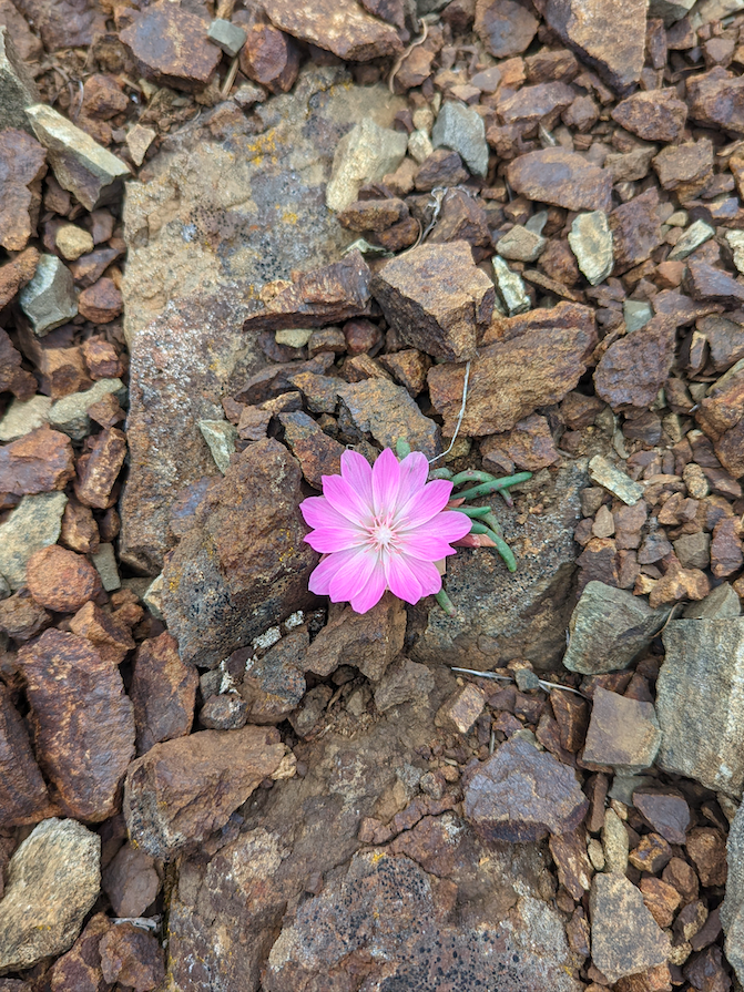
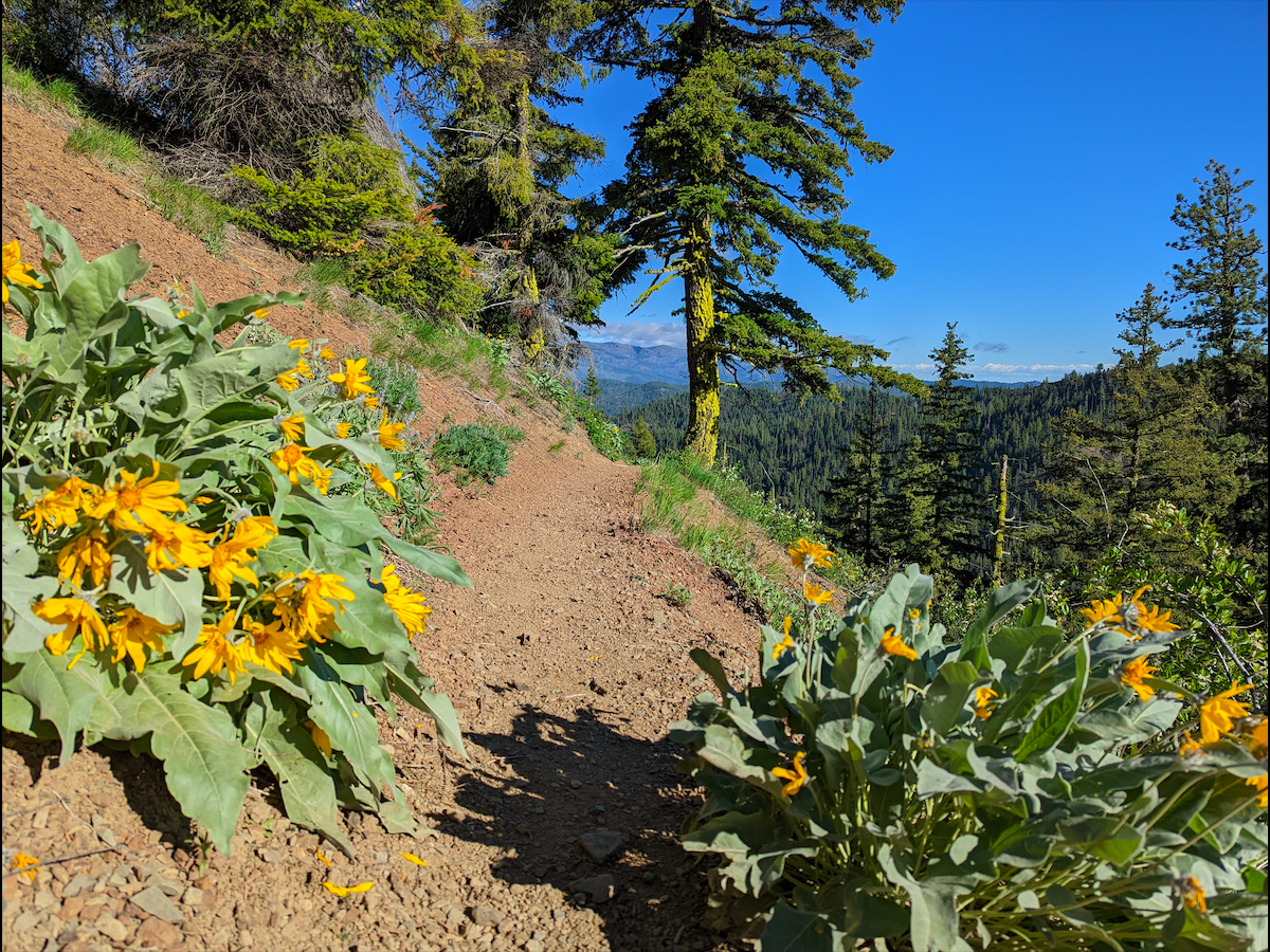
The hike is easy with only a couple moderately strenuous sections. It winds up through various habitats, providing interest the whole way. The wildflowers were in full bloom! Balsam root, bitterroot, avalanche and glacier lilies, forget-me-nots, camas, serviceberry, Indian paintbrush, nineleaf biscuitroot, ballhead waterleaf, Cascade penstemon, trillium, including some pretty speckled magenta ones, lupine, larkspur, and so many more. There were many hikers (we probably passed 15 groups of at least 2 people) and dogs. Everyone was really friendly. There are a couple of creek crossings (luckily for the dogs), but both within the first mile or so, then there's no water. Very luckily we neither saw nor heard the whine of motorcycles, though I understand it can get noisy up here (why in the world are they allowed here??).
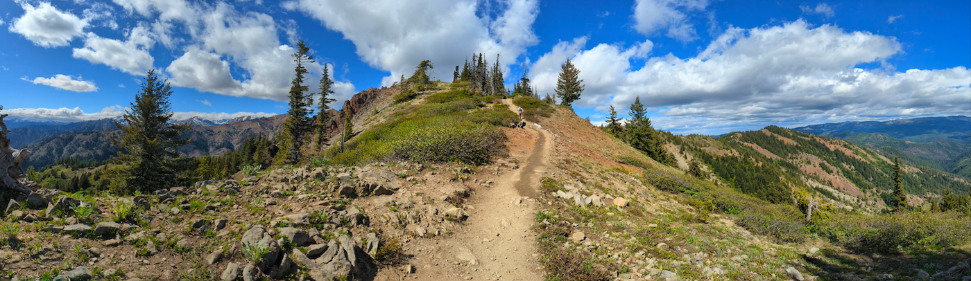
The 4 way intersection would be confusing if you weren't already aware that to reach the peak of Iron Bear within 1.5 miles (the knoll) you must take the hard right path, signed "Teanaway Ridge" NOT the other path signed "Iron Bear". I'm guessing this path also takes in Miller Peak and is therefore quite a bit longer/more strenuous.
There's a cool, sandy, dry ridge about half a mile from the peak that affords a great panorama, then the path disappears into forest again. I love the way this hike peeks in and out of forest. There's a lovely larkspur-strewn mountainside, and neat rock formations, and balsam root and bitterroot exploding everywhere!
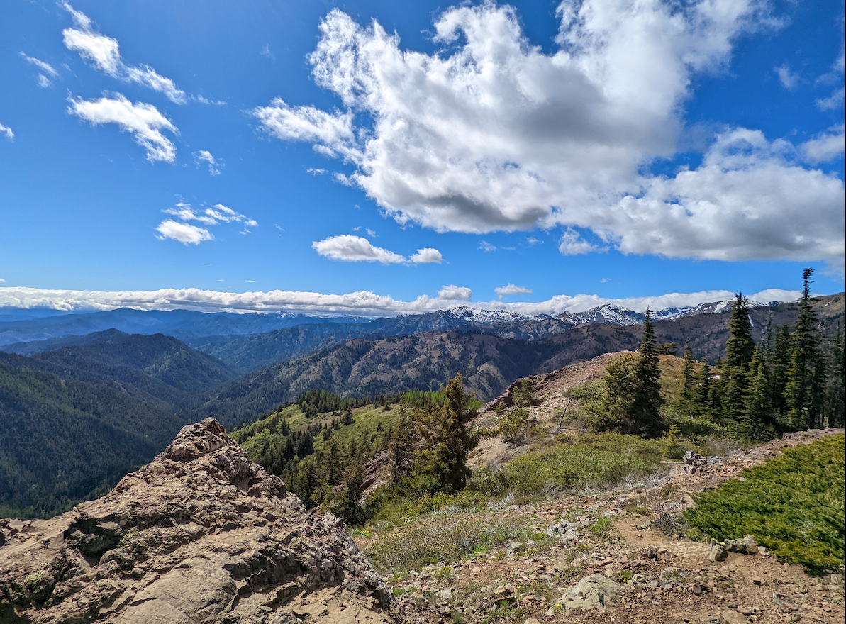
We reached the peak by about 3 (3.28 miles) and soaked in the stunning view of Mt. Stuart and Miller Peak, and their many snow-capped neighbors, ate a leisurely lunch, strolled to another knoll via a snow patch, then headed down, checking out long and lean Tronsen Ridge to the east.
Made it down quicker (I ran most of it). We only met one other group going up as we headed down. Everyone had skedaddled. Glad we left it later in the day.
Very colorful and pretty and easy-going hike.
Comments