
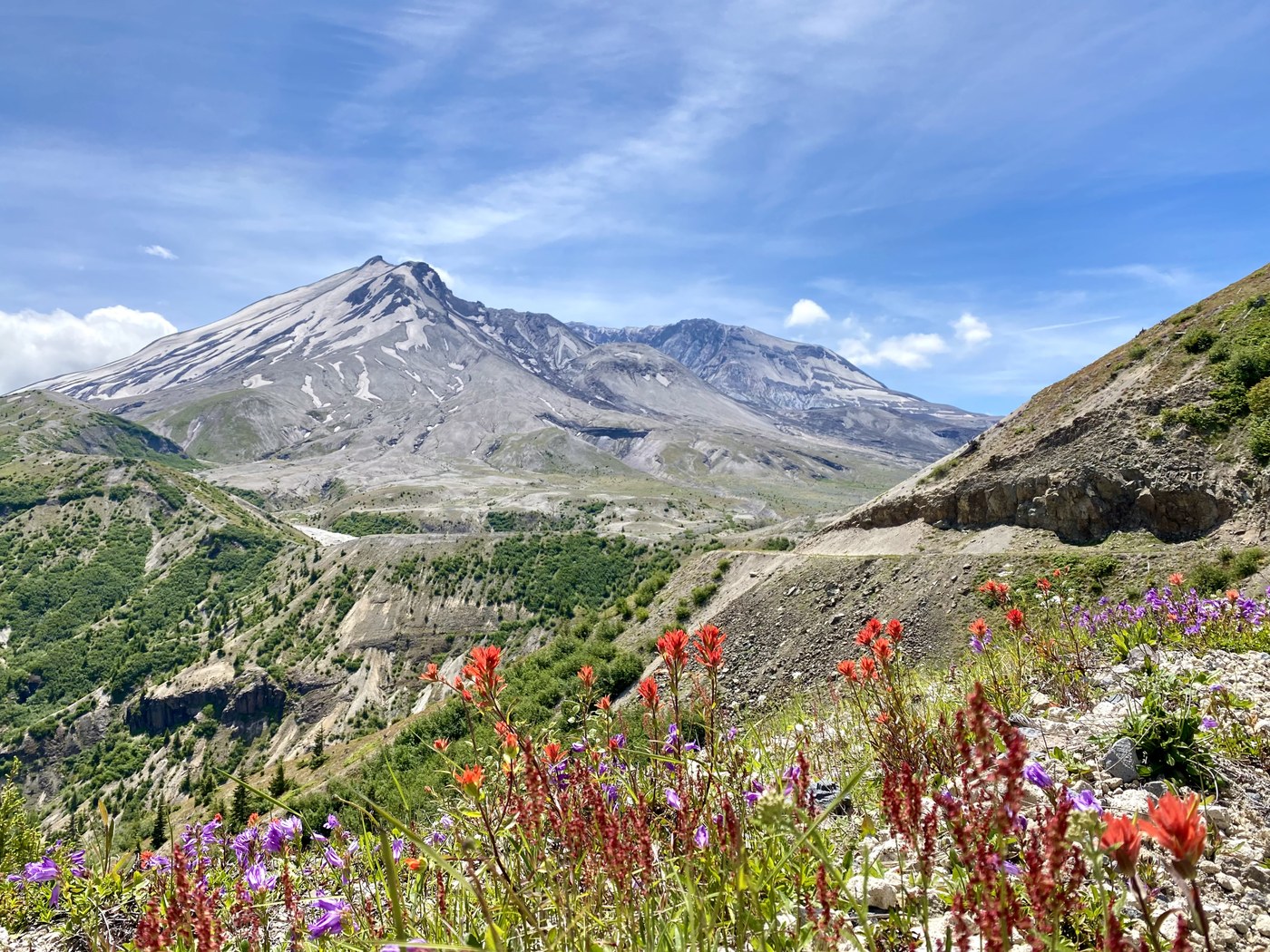
Trapped in a magical triangle of volcanoes, this trail is your private audience with Her Majesty, wise in her patience yet malicious in her rage. She stands proud and beautiful on the finest tapestry of all, sewn with yellow, red, blue, and violet, and watches people and years pass by. Admire her face-to-face while hiking in. Retrace your steps quietly as she remains behind your back. She will kindly wait for you to come back, but will she be the same next time? - you never know.
Getting there & trailhead
Ok, drive to the Windy Ridge is less poetic. Most important: Google Maps timing is a bit of overkill.
Up there: For some reasons, Google kindly diverted me to Forest Road 25 on my way to the trailhead. #25 is a single lane paved road with plenty of turnouts. Pavement will often turn to gravel unexpectedly. Not many potholes, but plenty of rough dips. Area around Norway Pass is the worst. Think a typical gravel washboard, except paved and on a larger scale. A series of dips that you will not want to hit unprepared in your sedan. Still pretty doable with a standard clearance. No snow. Google estimate from US-12 jct: 33 mi / 2 hrs. Reality: 1 hr 15 min.
Down: I said no thanks to #25 and drove a usual #99 to #26 route. Both these roads have two lanes and are paved. Again, some nasty dips and unexpected gravel sections, but waaaay better than #25. Driving down was a bit unnerving since the lane was often following a backdrop with no guard rail. Also the downhill lane - since it's an outside lane most times - is prone to more damage from landslides, so it's in quite a poor condition. I ended up driving almost on the left some times. Some roadside snow, nothing on the road. Google estimate from US-12 jct: 36 mi, 2 hrs. Reality: 55 min.
Trailhead: Large paved parking. Restroom available, stocked, in ok condition. Bonus: there're a couple nests up above restroom doors, easy bird watching. There's also a pay station in case you missed that NW Forest Pass.
Trail
Trail starts at the seemingly locked gate and follows FS99 for the initial 1.5 miles. The road rises gently and then drops. This stretch is only suitable for high clearance cars and brave drivers; fortunately, legs will be your most convenient and highest clearance. Views of Mt. St Helens and Mt. Adams will be your delight, as well as multiple flowers. When coming to a junction with Abraham trail, keep right to go down the hill. Look to your left and up: this hill has some exceptional amount of flowers.
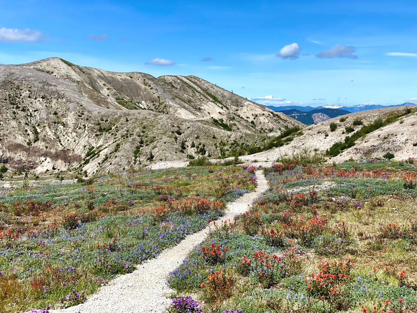
#99 terminates there with a parking lot that was surprisingly full of cars - no idea how they passed the gate. From there, follow mostly flat Windy Trail. I had hard time stopping myself from taking pic of each and every paintbrush field. It's a pity WTA will only allow four picture per report. Flowers are just all over. It's definitely the best time of year to be there.
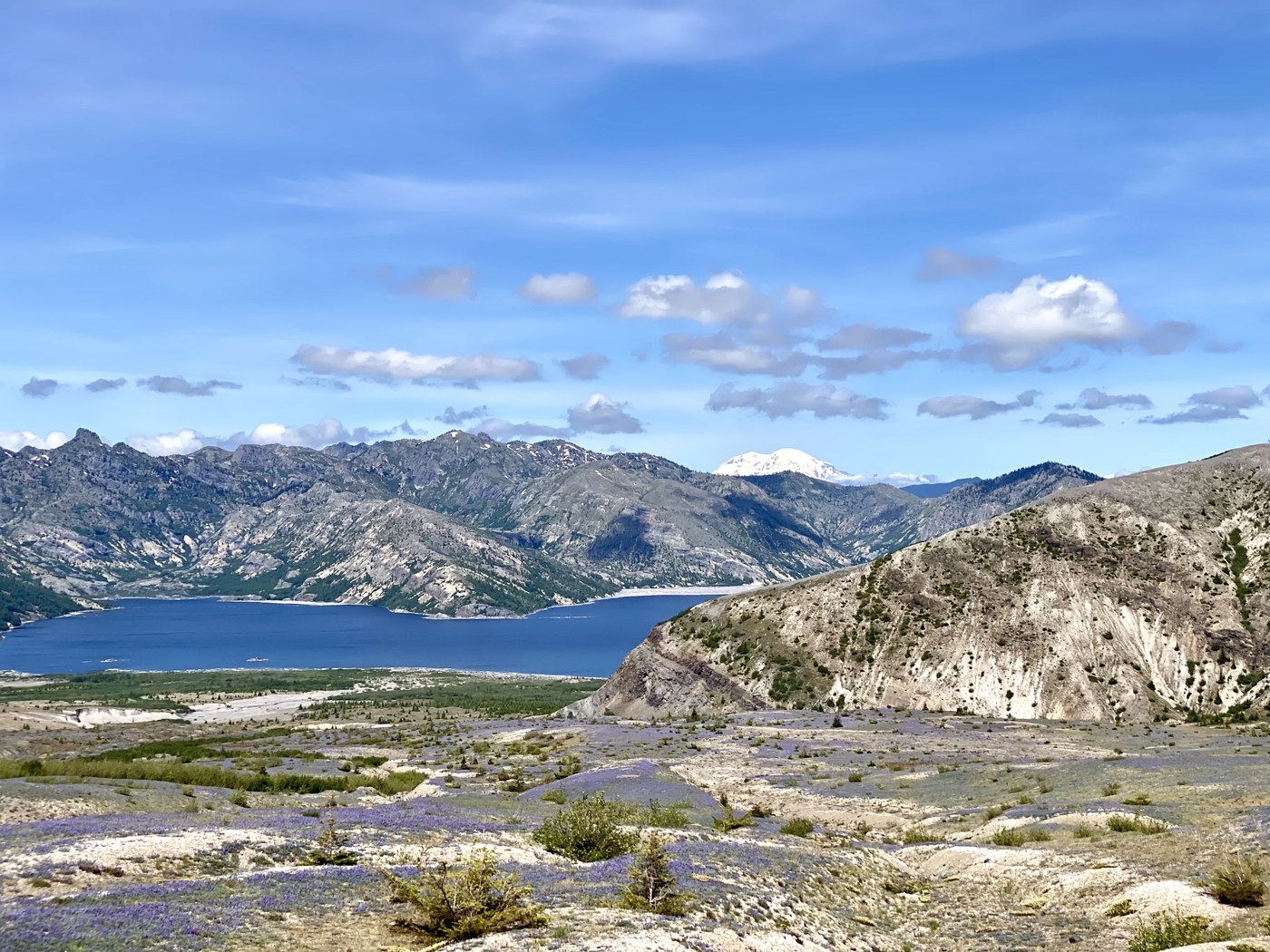
Coming to a junction with Loowit Trail, turn right. Nature starts changing drastically. Paintbrush gives way to lupine. Not for long, soon even lupine gives up. Step by step, you enter an almost lifeless desolation. Trail is no longer flat as it dives and rises to cross creek and former lava beds. Creek crossings are pretty easy, only one creek is wider than one step - it can still be crossed without issues. While Mt. St Helens is barely seen from there, views of Spirit Lake and Mt. Rainier on your right will be exceptional.
Finally, keep straight at the next junction to stay on a spur to Loowit Falls viewpoint. Trail climbs from there through a rockfield. There is no well defined trail end, but you will realize you can't go safely any further. Waterfall is raging and seems completely out of place, but it's real. I guess Washington is just a collection of waterfalls in weird places [re: Ancient Lake trail].
Timing & Tips
3 hrs sharp from start to finish.
Tip #1: if you're a photo guy, consider coming earlier for the most favorable light. In pm hours, sun is more in your face when you try to capture a photo of mountain.
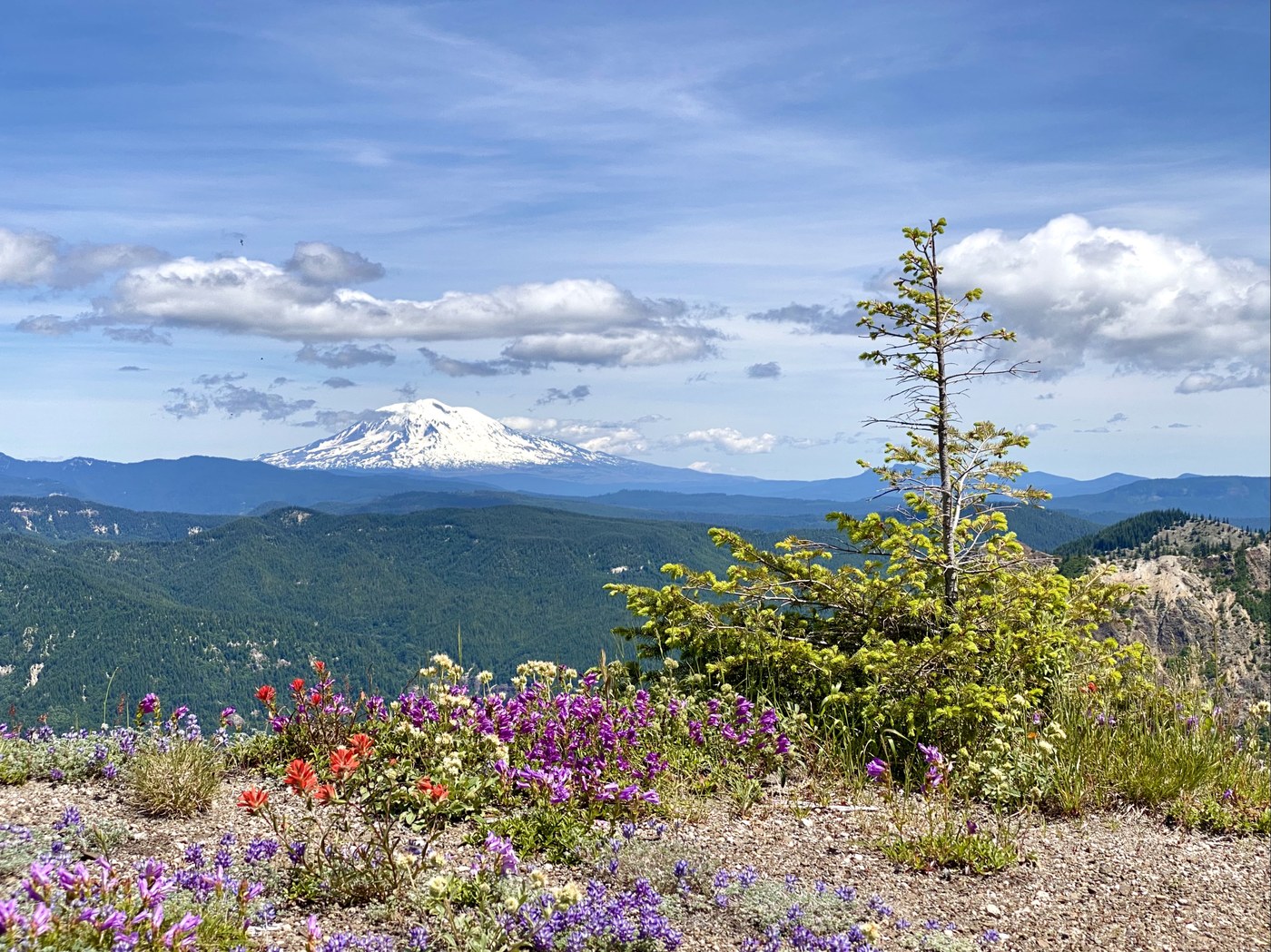
Tip #2: Make sure to stop at Smith Creek Viewpoint, which is next right once you depart from Windy Ridge. In clear weather like today, you can see Mt. Hood from there - and pretty much only from there - so a bonus volcano for your day. It's just beyond beautiful.
Comments
Hey there! Quick note re: locked gate. The stretch of road between the Windy Ridge parking lot and the small researcher's lot at the bottom (where you noted the various parked vehicles) is CLOSED to public vehicles, and can only be accessed by special permit and personnel. All vehicles present at the lower lot had permission to be there. :)
Also also! Per a recent announcement from the FS, this rough gravelly stretch of 99 extension will also be closed to the public altogether M-F for the remainder of the year. This means no feet, bikes, etc until cometh the weekend.
It's an amazing hike, especially now with the flowers going bonkers. Thanks for your report! :)
Posted by:
lonerwolf on Jul 11, 2022 09:26 PM