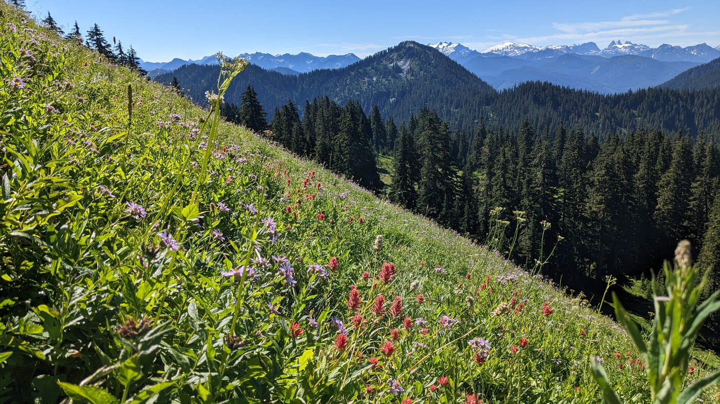
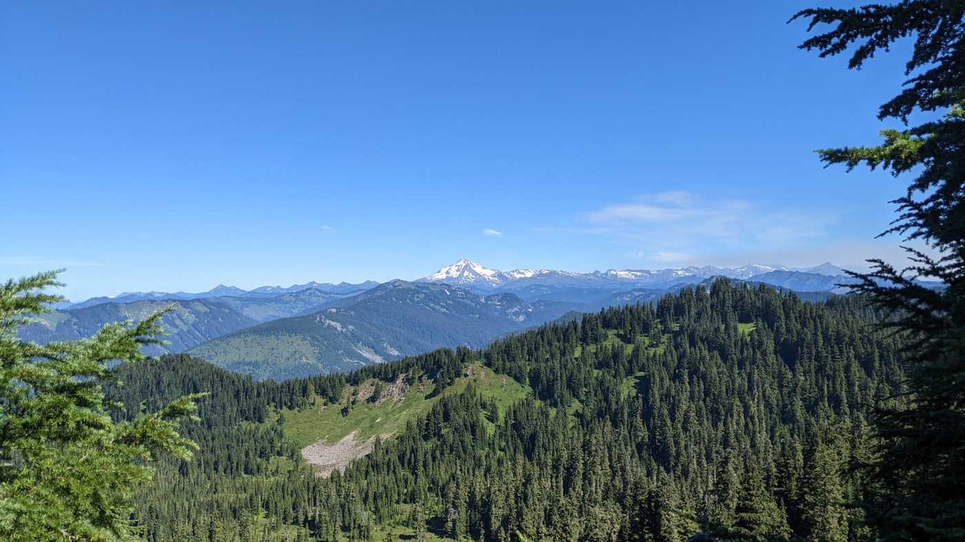
Fairly quiet, moderately difficult hike with nice views at the end.
The forest road has some potholes but isn't too bad. The road is narrow (barely one car-width) with blind corners and few pullouts for passing, and I'm very glad we didn't encounter anyone going the opposite direction on our way up or down. We were the fourth car in the lot at 8:30am on Sunday. The lot can hold about ten cars and was full when we returned around 2:00pm. There are no facilities at the trailhead, but there is a pit toilet just off the road at the Beckler River Campground that was clean and well-stocked when we stopped there.
The trail starts off with a solid climb on loose cobbles. It gets a little gentler for a stretch, but continues with ups and downs for most of the trail (Strava recorded 2629 feet of gain round-trip). Sunrise Mountain in particular is a steep climb and descent midway through the trail. We were taking baby steps on the descent to avoid sliding on the loose, dry dirt. There were several trees down on the trail, generally easy to step/climb over. The trail is mostly in forest, occasionally breaking into small meadows and with open patches to view Glacier Peak and others. In the last mile (or less) of the trail, you get a couple of peekaboo views of, and then traverse through, a huge meadow on the south-facing slope of the ridge. Finally, there is a split in the trail: left takes you up quickly to the summit of Scorpion Mountain, and right takes you down to Joan Lake. We skipped the lake as we didn't feel like climbing back out of the basin. There are some trees at the summit, so mountain views are actually better from other parts of the trail, although there are some social trails around the broad summit area that can take you past the trees to some views.
Bugs were mild on most of the trail, but the mosquitoes were awful at the summit. I hate using bug spray but I pulled it out within minutes because I couldn't stop slapping mosquitoes long enough to eat. We would've retreated to eat elsewhere, but the summit was the only flat area nearby and we were hungry.
Wildflowers appeared to be on the tail end but were still beautiful in the ridgeside meadow below the summit. There was lots of Cascade aster, some paintbrush, lupine, and heather, one tiger lily, and some others that I've forgotten or didn't know the name of. Surprisingly, we found a few huckleberry and blueberry bushes with ripe berries. There are lots of berry bushes lining the trail in the forest and I imagine the pickings will be good in a month.
We encountered ten parties on the trail, including a pair of backpackers and a pair with hunting rifles.


Comments
mato on Scorpion Mountain via Johnson Ridge
You are really tempting me into doing a Hwy. 2 hike, but not on a Sunday!
Posted by:
mato on Aug 15, 2022 03:58 PM
blackice on Scorpion Mountain via Johnson Ridge
Oh yeah, I forgot to mention, the traffic back was backed up past Zeke's (which had a huge line)! I assume hwy 2 traffic is better on Saturdays? We don't go that way often.
Posted by:
blackice on Aug 15, 2022 04:04 PM
mato on Scorpion Mountain via Johnson Ridge
Yeah, all the folks that fled east of the mountains head back on Sunday afternoon. Saturday is slightly better as it is mostly dayhikers. Used to be you had to hit Gold Bar by 4pm to avoid it, then it was 2pm, and now it's noon.
The small mountain in the first and second photo is Captain Point. There is an abandoned trail that connects it to Scorpion Mtn, but only traces remain. It's been on my to-do list for awhile.
Posted by:
mato on Aug 15, 2022 07:51 PM
blackice on Scorpion Mountain via Johnson Ridge
Good to know, thank you!
Posted by:
blackice on Aug 15, 2022 08:32 PM