
IMPORTANT NOTES:
- Norovirus is hitting a lot of people on this section of the trail. Thru hikers have noted that they think Mirror Lake water and runoff is a culprit, but I also saw another hiker that was sick heading north over 30 miles south of Mirror Lake- so be cautious with water treatment and try to maintain good trail hygiene!
- lots of NOBO thru hikers on the trail, a lot had to skip large sections of OR so there is a big bubble moving through right now
I had originally planned a more conservative trip over 6 days, but ended up finishing by noon on the 5th day. This section can be done pretty quickly as long as you pay attention to water and camping locations. I felt like on J, there were more opportunities to get off trail and set up and this section seemed to have longer sections between camping opportunities. There are TONS of NOBO thru hikers on the trail right now which further limits camping options as people would often arrive to the camping site for it to be full, making them press on further. I relied on the Nat Geo PCT WA south map and my inReach, but they all use FarOut which has updated comments on water sources, water caches, and camping. You may want to consider buying the maps in the app. Here are the details of my trip:
Day 1: White Pass to Two Lakes Junction: apx.19.5 miles
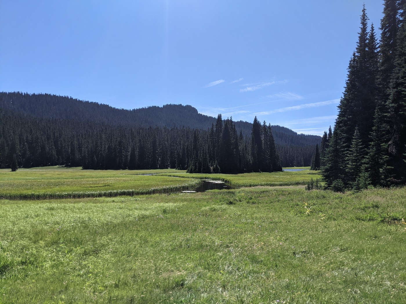
The first half of the day went really fast, easy mileage and elevation- all in the forest. Bumping River Ford has a down tree to the left of the trail that a lot of people missed. Great place to stop and relax before the push up. I was planning on staying at the Crag Lake camp area, and it didn't call to me. It is below Crag Lake, so no lake views, kind of dark, and just next to the trail. I ended up pushing on, which provided some beautiful views of Crag lake as you move up the ridge. There were a couple small trails off that would take you down to camp in a meadow by the lake, but I was worried about bugs and pushed on. At the top of the ridge, you reach the edge of Rainier NP and have BEAUTIFUL views. Two Lakes junction had spots for 4 tents just off trail, and a couple others found more slopped locations just a little down the trail to Two Lakes.
Day 2: Two Lakes Jct to Martinson Gap: apx. 22.4 miles
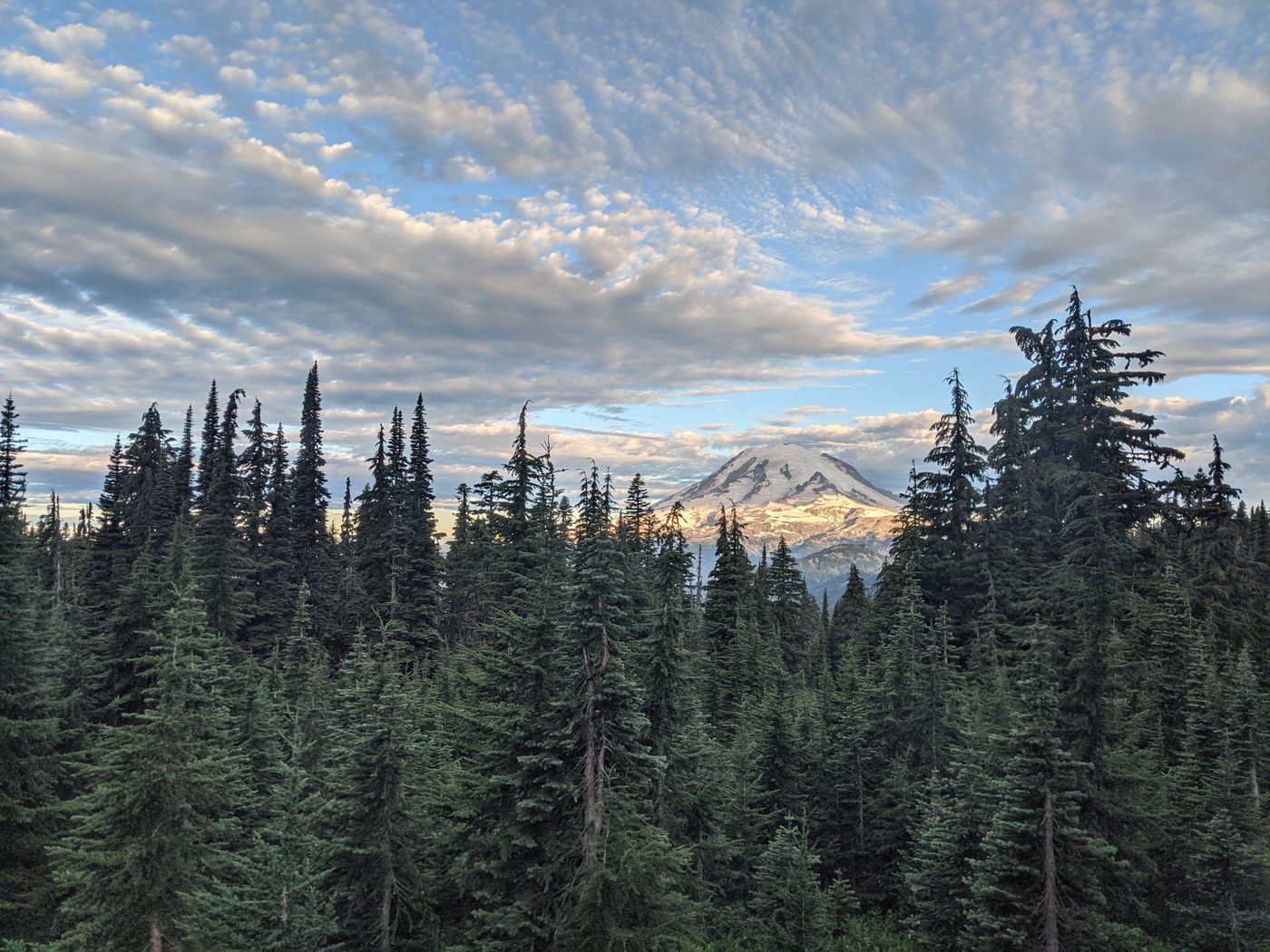
The morning provided some amazing views of Rainier. Since I was passing by Dewey Lake on a Monday, it was super quiet, but on the hike up to the pass there were tons of day hikers out on the trail. They were extremely courteous, but it was definitely the busiest section of trail of all the days. There was some awesome trail magic happening in the parking lot of Chinook Pass once you cross the footbridge that I skipped, but I mention it because I saw lots of trail magic on this section, and this one in particular was talked about for days on the trail. The approach to Sheep Lake was easy and not too crowded on my way up (although hikers who went thru later in the afternoon said it was like a dog park). Beautiful place, and my original spot to camp but since I was so ahead of schedule, I pressed on. I didn't fill up at Sheep Lake, and it was a mistake. You don't encounter water again until Big Crow Basin, apx.7.5 miles. There is a lot of uphill and almost all is exposed between Sheep Lake and the piped water. There is a shady junction (that has cell service) at Bear Gap. The last miles of the day were in the burn area. The camping area at Big Crow Basin, right by the water was nice, but I pressed on. The water source can be easy to miss from the trail, it is a little downhill and seems like a fairly small stream. Martinson Gap isn't an ideal camping area with dead trees nearby, but there were at least 8 tents that we fit up there.
Day 3: Martinson Gap to Blowout Mountain Trail Jct: apx. 21.3
The morning out was lots of burn, but there was fireweed, which provided a beautiful colour contrast. Getting to Camp Ulrich, I definitely noticed a few more bugs. Nothing too annoying. A lot of thru hikers were resting or spending time on the porch of the cabin, tons of places to set up a tent in the trees. I got to the spring and hung out there for my afternoon rest. This is where I encountered the first thru hiker with noro. He was sick and trying to get off trail to a doctor. I wanted to camp on the downhill, so once I pushed over Blowout Mountain, I started looking for a spot to camp. There is room for a few tents at the Blowout Mountain Trail Junction, but I pushed on a little more to a more flat site a little further down the trail. We were able to squeeze in 4 tents, but no more.
Day 4: Blowout Mountain to Stirrup Creek: apx. 21.5
I had a difficult morning mentally because the Nat Geo printed map shows downhill or flat for the 6.3 miles to Tacoma Pass but definitely found some uphill slumps in there. I missed the creek access, but I didn't need it, so if you are hoping for a water refill in that area, really pay attention. There were lots of road crossings which disoriented me a bit so I had trouble accurately tracking where I was until I used my inReach. To my happy surprise, I was a couple miles ahead of where I thought I was. Bearpaw Butte provided a nice lookout but otherwise it was another day with lots of trees. The spring after Bearpaw was a nice spot to stop, but I don't think the camp site was as nice as others. It seemed smaller and more slanted. Lots of huckleberry, there were even some people there for the day picking a bunch. The seasonal spring seemed dry as I was keeping an eye out for it and missed it anyways. Stirrup Creek was a nice camping spot, but again, not many sites. I managed to get a single spot, but on the other side of the creek there was space for 2 shelters and another person cowboy camped because there wasn't any more room. This was the last water source I used before heading north as I was hearing lots of speculation about water sources around Mirror Lake and didn't want to risk getting noro. Lots of people showed up to camp at this site and unfortunately had to find other places.
Day 5: Stirrup Creek to Snoqualmie: apx. 13.3
Lots of the thru hikers were speeding out with pancakes on their mind, but I was really starting to feel the miles and went slower. I had really built up all the elevation on this final push in my head, but it really wasn't bad in the morning shade. There was a nice water flow the trail crosses over that goes into Lodge Lake, but I had conserved water so I was ok to not refill. There were a couple of day hikers around Lodge Lake, but nothing like Chinook Pass. I arrived in the TH parking lot at noon and there was a retired Forest Service Ranger handing out trail magic. I went into "town" and got pizza and went to Dru Bru while I waited for my ride, and over the couple of hours I was there, it was filled with thru hikers. Several of whom I had been interacting with on the trail. I think the bubble will be over in the next few days.

Comments