

Amazing to have a Bulger like this with no forest service road required to access. We arrived at 6 o’clock to the Rainy Lake Trail head with an almost vacant lot.
First portion of the hike to the turn off breezes by, with nice views of Lake Ann along the way. After heading off to the right, the objective is almost immediately in view. As is the robust boulder field. While you are supposed to stay left of Lewis Lake, it’s very easy to get too high up on the left side as you make your way over. We got up into the boulders and probably made the section twice as hard as it needed to be. During the descent it was much more easy to see the actual path which hugs very close to the lake and or any running water sources that feed the lake. When you first descend towards the boulder field look for a little path running on the right side which slips down quite low on the boulder field, but still ultimately keeps you left at the lake.
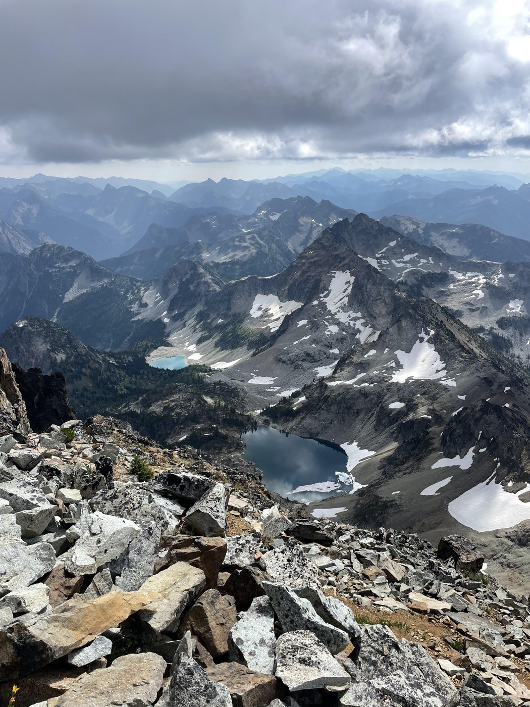
The section from Lewis Lake to Wing Lake is the first portion of the hike that is a little steeper, but it seems to end relatively quickly. Wing lake is beautiful and it was a great place for a dip after the summit, although the water is exceptionally cold still. So exercise caution.
After making your way around the lake, the ascent up the scree field begins. There is a lingering snow field that is pretty easy to come up and keeps you off of some of the rock for a time. Eventually you have to get off the snow field and that stretch to the ridge is the worst part of the whole climb. Very steep, with bad footing, and slip and slide rocks.
After crossing the ridge, the views immediately become amazing all around. Heading up to the Summit from the Ridge is relatively straightforward, there are a few gullies to choose from, all of which ultimately seem to head up to the same spot, we did find one on the way down that felt like the real trail and was very clear and quick. Once you do get up to the base of the false summit, you do have to sneak around the right side (south face) to get the base of the true summit. It’s a small little block that took about a minute or two to scramble up. The views at the top are absolutely incredible.
Down climbing from the summit takes a little bit of extra care, but from there back down to the ridge is pretty straightforward. We took the snow field down as a glissade, which probably wasn’t the safest given the state of the snow field, but it did cut off time and that terrible rock field again.
For someone from Issaquah, it just feels like a shame that the North Cascades are so far away, because the area and the peaks are incredible.

Comments