
Did a wonderful overnight backpack of the "Triple Rainbow High Route" as posted on the blog "Climber Kyle". We mostly followed Climber Kyle's route with some slight variations.
We left for the Marblemount ranger station early Saturday morning hoping to grab a permit for Rainbow Ridge Cross-country zone. However, the area had been fully reserved already so we took the Hidden Meadows camp as a consolation. It took nearly 45 minutes to get a permit. After reaching the Bridge Creek Trailhead, we started hiking towards the Stiletto lookout.
Stiletto Trail: The Stiletto trail was in generally good condition with minimal blowdowns compared to when I did it last year, and the lookout viewpoint at the top is as good as I remember when I day hiked there last year. From the lookout, we headed down the east side of it to travel across the basin south of Stiletto peak.
Stiletto Lake: We meandered through the beautiful basin below Stiletto peak, generally easy cross-country travel between larches beginning to turn. We made a slight detour to Stiletto lake for lunch, and it is a gorgeous spot. Two parties were camping there and seemed to be catching fish pretty quickly.
Twisp Pass: We found a decently well defined trail to follow from Stiletto lake to Twisp pass, losing a bit of elevation as we traversed the ridge. At the Twisp Pass junction we started off trail towards Twisp mountain through somewhat brushy sub-alpine terrain. At the base of Twisp mountain there was a small tarn for water.
Twisp Mountain: The north facing gully described by Climber Kyle was easily seen above a short boulder field. We ascended a strip of heather running climbers right of the gully until we were forced into the gully proper. While Class 2 scrambling, it was fairly steep and loose, and finding solid foot placements was challenging towards the top. We crested the top of the gully by climbing rock on climbers left to avoid steep, loose dirt. We were moving slower than expected and did not continue to the summit of Twisp mountain. We descended trending right towards the pass between Hock and Twisp mountain, but realized that it got quite cliffy and traversed back east to a ridge. Descending down the obvious ridge south of Twisp mountain was a much better choice. We crossed a small marshy basin at about 5900 ft elevation and began side-hilling towards Twisp Lake. Small amounts of running water could be found in this Basin.
Twisp Lake: After a brief stop at Twisp Lake for water, we debated which pass to cross to descend to our camp at Hidden Meadows. Climber Kyles route ascended south from Twisp lake to a basin, then headed for a pass south-west of that. We saw what looked like a much easier pass directly southwest of the lake, just south of Pt 7385 on the map. This pass turned out to be pretty easy boulder and talus travel that topped us out on a pass full of fully yellow larches just as the sun was beginning to set. We then had a fairly gentle grassy slope to head down for camp.
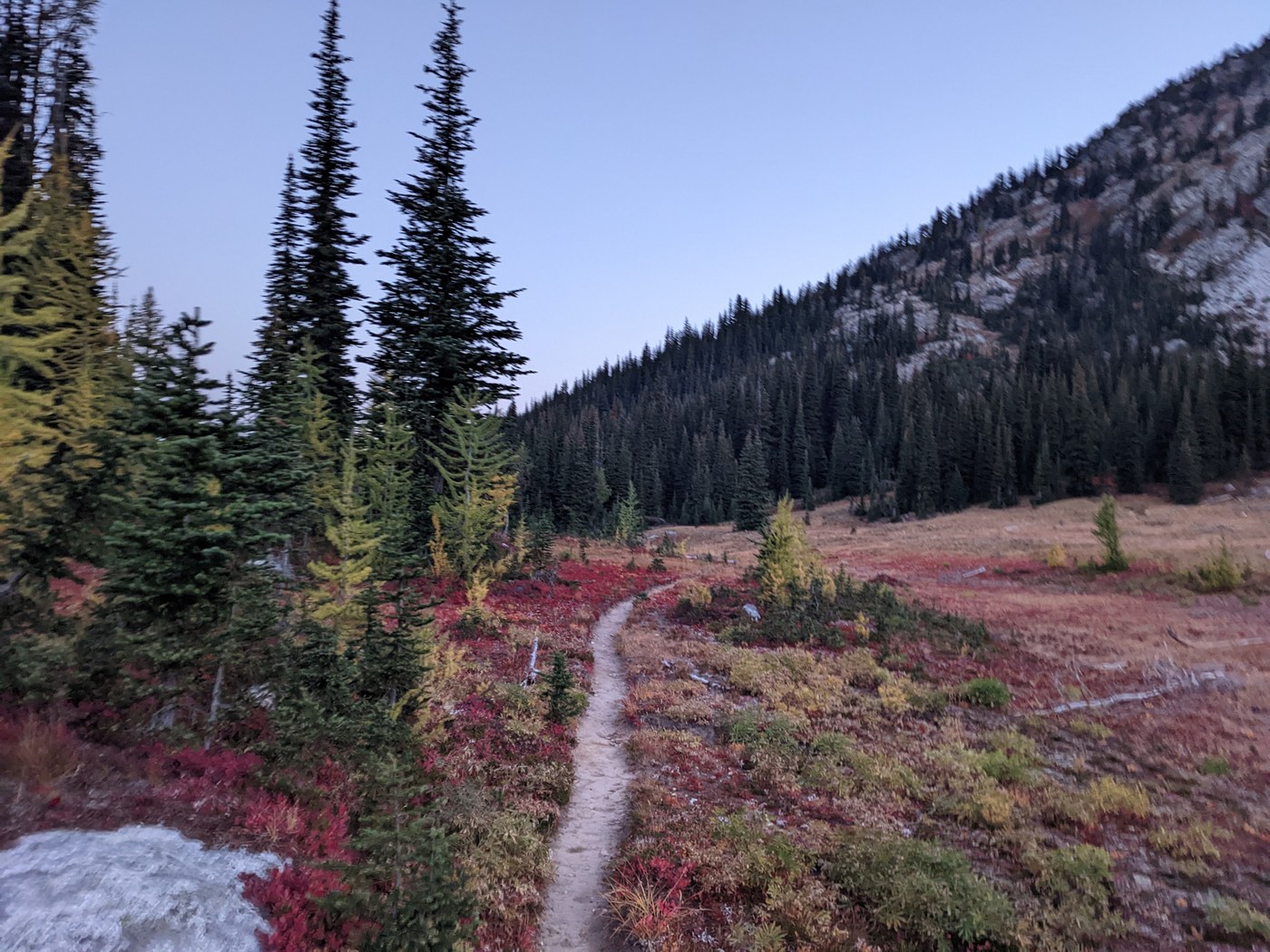
Hidden Meadow: We set up camp for the night at a site in the trees right at the edge of the meadow. Really an amazing camp spot! An owl swooped over us as we ate dinner on a rock in the meadow. The next morning we packed up and were on the trail by 6:30. At McAlester pass we saw fields of red and yellow larches.
Rainbow Ridge: Gaia GPS had shown a trail running along a bench south of rainbow Ridge which we thought we would give a shot. We found what we thought would be the trail, but ended up sidehilling along rainbow ridge. We just decided to climb up to the crest of the ridge and follow that as we thought it would be scenic and more in the spirit of a "high route". The top of the ridge was more alpine and had incredible views, though it probably slowed us down and added 1000-1500 ft of elevation from all the ups and downs. It was generally easy travel, but not fast. If you opted to take the lower bench you would be in the sub-alpine forest for most of rainbow ridge, but would likely make better time. We met up with the "trail" at a nice little tarn at 6500 ft with a couple of backpackers camping there. We continued to the top of Rainbow Ridge summit at 7200 ft then followed the ridge down to the unnamed lake below. We stopped for water at the lake and observed bear tracks in the mud. Another couple backpackers were camped here as well.
Rainbow Pass: Leaving the lake heading west across boulder fields, we aimed for a pass southeast of Bowan mountain. It was generally easy except for the last 100 ft to the pass was fairly steep and loose. After cresting this pass we descended on a bench to skiers right, generally following the path of least resistance. Unfortunately, we kept coming up above cliffs and had to zig zag across the slope to find paths down. At this point the slope was very brushy and it was taking nearly an hour just drop to the pass. We then decided to try and intersect with the gully described in Climber Kyles trip report. We found a loose dirty entrance to this gully which was a bit sketchy, but managed to enter the gully and follow it to the final talus field back to the trail. We reach the trail around noon, overjoyed that the off-trail travel was over. But we still had nearly 12 miles on trail until we reached the cars.
Rainbow Creek Trail/PCT: We cruised on the Rainbow creek trail and PCT, which were both in great shape. A really nice log bridge was in place over Bridge Creek before Rainbow creek trail meets the PCT. The PCT past South Fork camp had long sections with no shade, which was brutal. At about 4:15 we finally reached the Bridge Creek trailhead and ate some delicious salt and vinegar chips.
Overall this was a great route, but more challenging than expected. The gully on Twisp mountain was not my favorite, and the descent down to Rainbow Pass was pretty terrible, though it may have been better if we had entered the gully earlier. We also debated if this was in fact a "high route" as it didn't really feel like much of the route was in the alpine. It was an excellent cross-country route however, and traveling the crest of rainbow ridge really adds some high route feel. Water sources are fairly frequent even late season, and the larch density is amazing, along with the red fields of blueberry plants. I would definitely recommend, but don't underestimate the off-trail portions.


Comments
tsuga on Stiletto Spur Trail, Stiletto Vista, Stiletto Lake, Twisp Pass, Twisp Mountain, Rainbow Ridge
I don't think you meant to tag the Rainbow Ridge trail adjacent to Mt Baker.
Posted by:
tsuga on Aug 05, 2023 07:55 AM