In the first week of October I usually am looking for bright fall color. This year it has been more about avoiding the smoke. Of course it is very hard to predict what part of the state will have the best air quality. Purpleair.com is very useful but there is a sad paucity of sensors up in the mountains. I really wish there was a sensor at Snoqualmie Pass and another one at Sunrise. Maybe some day. Fortunately there are sensors at Crystal Mountain and they looked like the best air quality that I could find in the Cascades. It turned out to be a great choice with really great air quality for most of the day. It did start to get a bit hazy after 2pm.
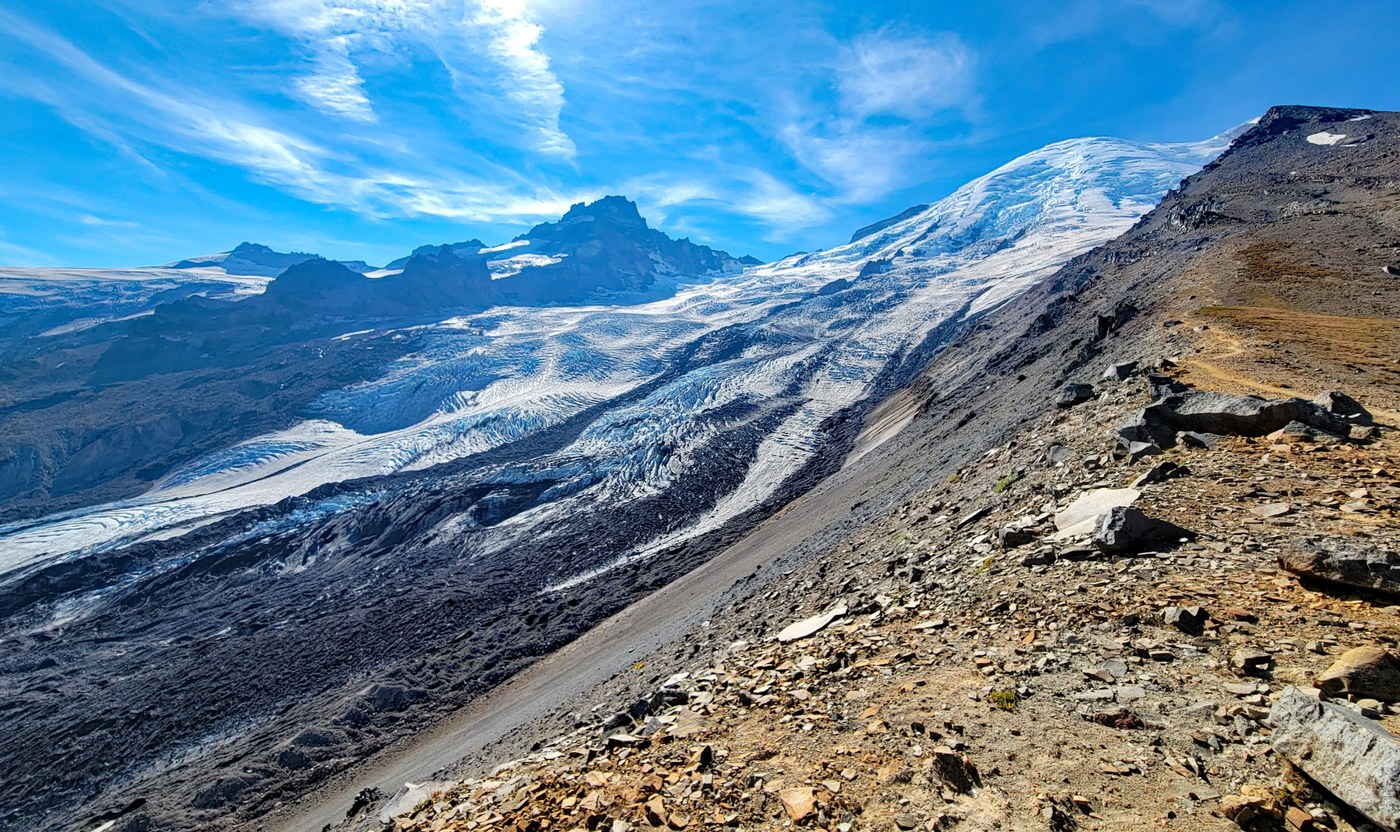
We did a very steep side trip up to the ridge that leads up to Ruth Mountain. To reach the trail you have to cross the creek. It has a fair water flow but we were able to find a dry boot crossing. Poles were helpful for this. The trail passes by some really cool mining relics from the old Storbo copper mine that was very active in the early 1900's. At one time there were multiple building and even a hotel. The NPS report below gives a very detailed review of the mining history including some cool photos. The photo on page 97 shows the Inter Fork Glacier extending into the upper basin in 1912. Now it has receded way up the valley.
https://www.nps.gov/mora/learn/historyculture/upload/2017-mining-glacier-basin-burtchard_web.pdf
The last 1/2 mile of trail to the ridge is very steep (~1400ft/mi) and has soft soil. Poles were very helpful for this part. The view of Emmon's glacier from here is amazing.
We only crossed paths with 6 people all day.
RT 9 mi, 2600 ft


Comments
bentley-edelman on Glacier Basin
Great photos. We've never gone further than about .5 miles past the campsites--I hope to check things out a bit further on! Thanks for the report.
Posted by:
bentley-edelman on Oct 08, 2022 06:40 PM
Maddy on Glacier Basin
Cross the Creek just beyond the campsites at the meadow
Posted by:
Maddy on Oct 08, 2022 08:45 PM
bentley-edelman on Glacier Basin
Thanks! Is the trail visible from there, i.e., easy enough to pick out?
Posted by:
bentley-edelman on Oct 09, 2022 07:35 AM
Maddy on Glacier Basin
It is a well worn trail. Easy to find with AllTrails. Creek crossing is a bit tricky but not too bad. A well worn path can be found on the opposite side of the creek also. If you are bush wacking then you are in the wrong place. It gets very steep after crossing through the mining relics. Pumice soil is very loose so poles were necessary for me not to fall on my backside on the way down.
Posted by:
Maddy on Oct 09, 2022 08:03 AM
bentley-edelman on Glacier Basin
Thank you very much for the detes!
Posted by:
bentley-edelman on Oct 09, 2022 08:30 AM