Overview: Overnight up at Flapjack Lakes with a side trip up to Gladys Divide and then a hike out via Black and White Lakes and down the B&W trail to Big Log and back out the North Fork of the Skokomish. Overall the trails were in good condition - low brush, good tread, and minimal blowdowns.
I won't go much into the North Fork, Flapjack Lakes or Gladys as those are pretty well covered. I will cover the Black and White Lakes and down to Big Log as that seems to be less covered.
Brush scale used:
- 0 = clear, may as well be walking down a sidewalk
- 1 = some brush and sometimes it touches my legs but the path is clear
- 2 = yes the brush is reaching over the trail but I can still see there is a trail, I can see my steps just fine even if I need to push some brush out of the way.
- 3 = i can't see my feet. I need to actively bush the brush out of the way to see what I am about step on (rock, root, a downstep, etc.).
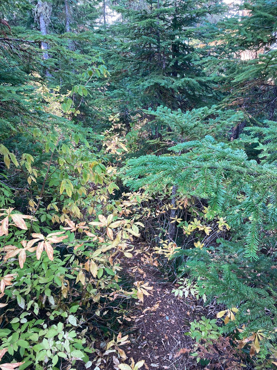
North Fork --> Flapjack Lakes: A very nice (and quick) stroll to the junction just before Spike camp. The climb up to Flapjack is where the blowdowns were encountered but still a nice hike up. The tread overall was good.
- Trail: good condition, no complaints
- Water: good availability
- Mud: none
- Brush: 0
- Blowdowns: <10: 1 walk around, 1 duck under Doug, and the rest an easy climb over or step over.
- Bugs: effectively none
The lakes were wonderful and going in on a Sunday late in the season I had both almost to myself. There was one other group up there but we barely saw each other. Thank you to those folks who gave me the recommendation of which campsite to score (as I had my pick) - I was able to get the site right by the water and my only visitors were some deer at night.
Gladys Divide: After setting up camp and having lunch I day hiked up to Gladys Divide. The hike is ~1.5 miles on a good trail. Beautiful views and if I had more time I would add in Mt Gladys as the approach from the NFS side is quite easy. The views of the Sawtooth ridge is great. Well worth the side trip.
- Trail: good condition, no complaints
- Water: none (unless you want to climb down to a small tarn - just pack from Flapjack)
- Mud: none
- Brush: 0-1
- Blowdowns: 2 maybe
- Bugs: none
To Black and White Lakes: This is labeled as a primitive trail but the quality the whole way is pretty much on par with what you would experience going up to Flapjack from the North Fork junction.
- Trail: good condition - some "creek bed" walking and some loose tread in spots
- Water: None after the junction and until you get the to lakes
- Mud: none
- Brush: 1 in spots, maybe a spot of 2
- Blowdowns: 1 (I think - maybe zero)
- Bugs: none
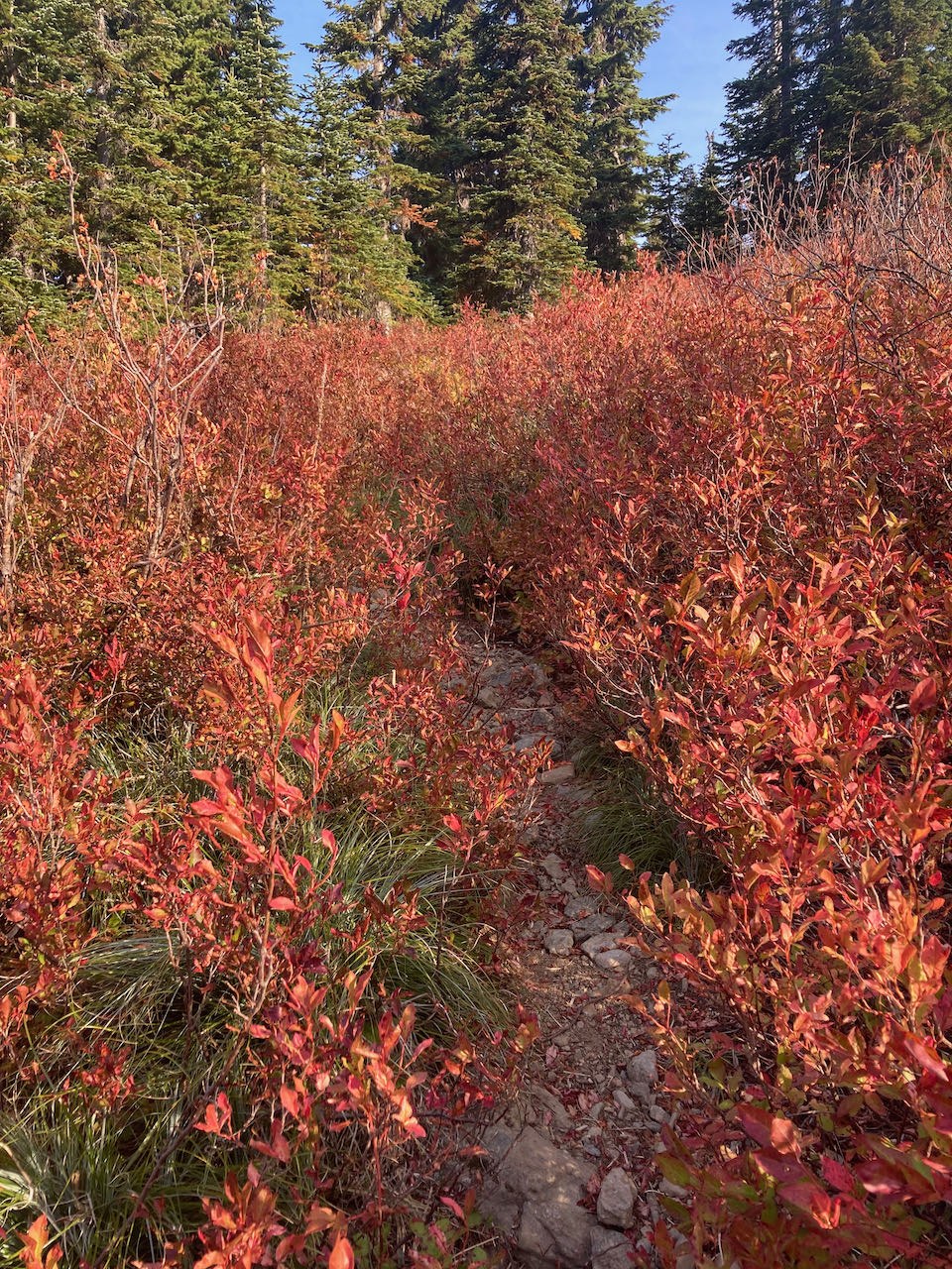
After doing Graves Creek earlier this summer, it is hard for me to see this trail as "primitive". The trail is easy to follow, minimal blowdowns and the brush was not an issue. The climb up from the Flapjack junction is a steady climb. The tread loosens in some spots and narrows in others, it is all minimal. The main other footprints I saw were deer along the way. As you get toward the top, you break out into a meadow and the trail is more like a small creek bed you walk up through the brush. The pictures will make it look brushier than it really is - meaning the trail is still very easy to follow. As you continue to climb the brush shortens and the tread returns. I was greeted with a gift in the middle of the trail of who actually lives there - I guess a reminder that I was just a visitor. I didn't see any bears but I knew they were around - and rightfully with all the berry bushes (which were all picked clean this late in the season).
The junction with the trail down to Big Log is well marked (unlike what is described in the trail description posted). The 0.2 to the lakes themselves is easy to follow and the lakes, the view, all was wonderful. There was some smoke dulling the distant views but little smoke up at the lakes themselves. Definitely can find even more solitude up there.
Black and White trail down to North Fork at Big Log: Hiking back down to the North Fork junction at Big Log was an uneventful. The trail was easy to follow, with brush in my 1-2 scale range. It is ~2.3 miles and descend ~3k of elevation. It was on this section where I encountered some more loose tread. I also passed the time down contemplating why this trail was a "primitive trail" as its condition is just as good as some of the non-primitive trails in the park. I will admit that my quads were burning by the time I got down to the North Fork junction.
- Trail: good condition - loose tread in spots
- Water: None
- Mud: none
- Brush: 1-2, a spot or two of 3
- Blowdowns: 2-3 on the way down to Big Log. All step overs
- Bugs: none
The hike from Big Log to the TH along the North Fork was smooth sailing the whole way. Any blowdowns were cleared (except maybe one between Big Log and Spike camp which was an easy step over) and brush is "0" the whole way.
Overall a very nice autumn trip when the crowds were minimal.
Ponder this - Gladys Divide elevation.
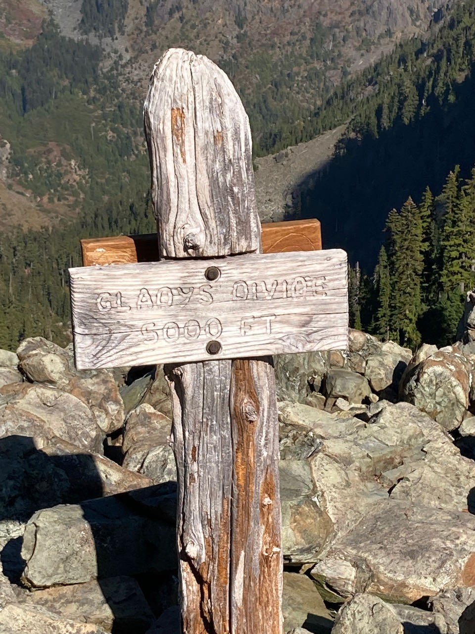
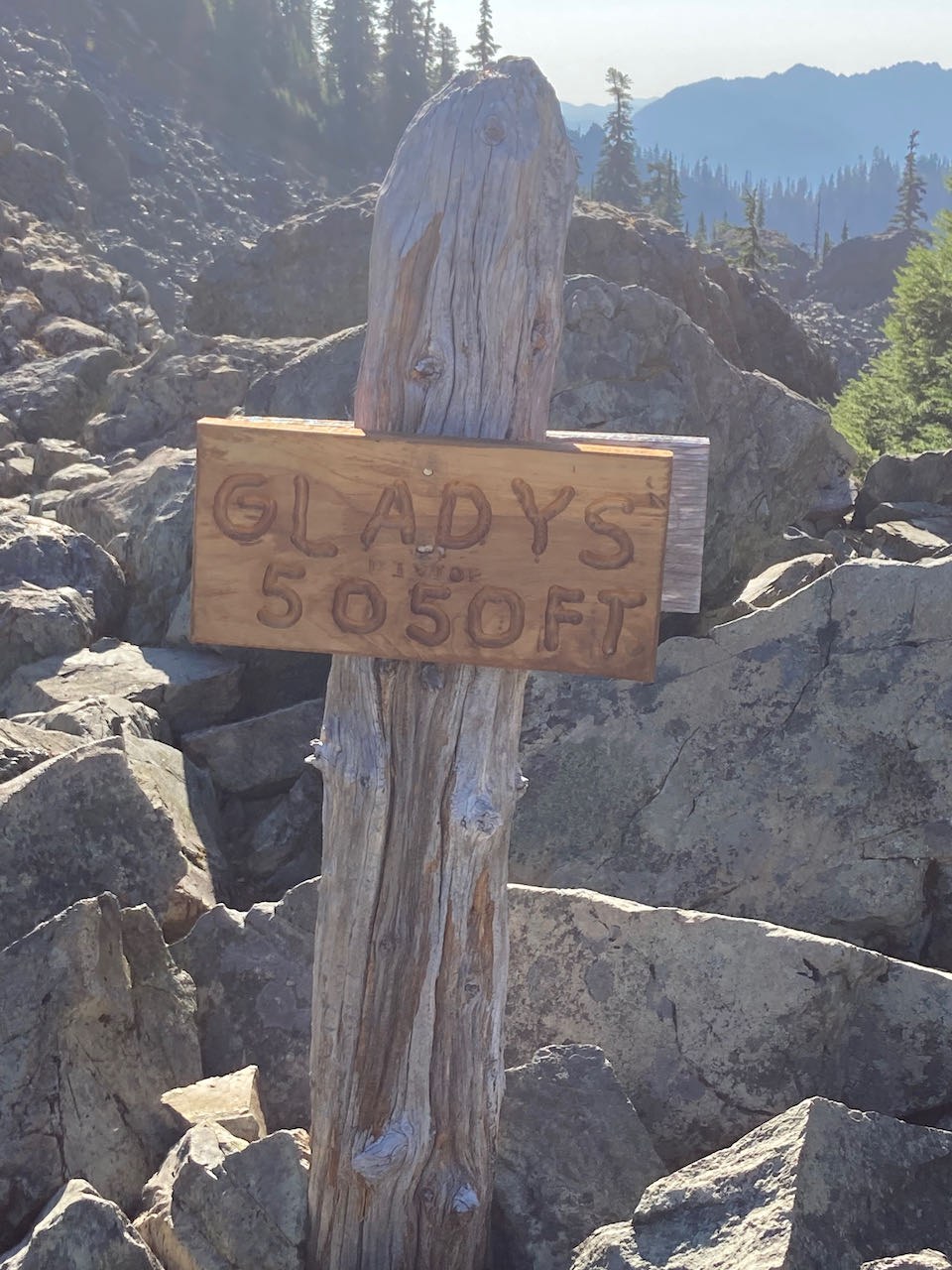
The National Park Service puts the elevation at 5000', but just on the other side of their sign the National Forest Service puts the elevation at 5050' - so which is it?
I wonder if there is a little competition going on between the services. I think NPS should go update their sign to 5051' and then if the NFS wants to update theirs to 5052' make them climb up from their side (bushwhack) vs. being able to use the nice trails on the NPS side. ;)
(ok....they should just put the real elevation up there but somebody needs to fix their sign because, 50' difference when they are on sign post? c'mon man)


Comments