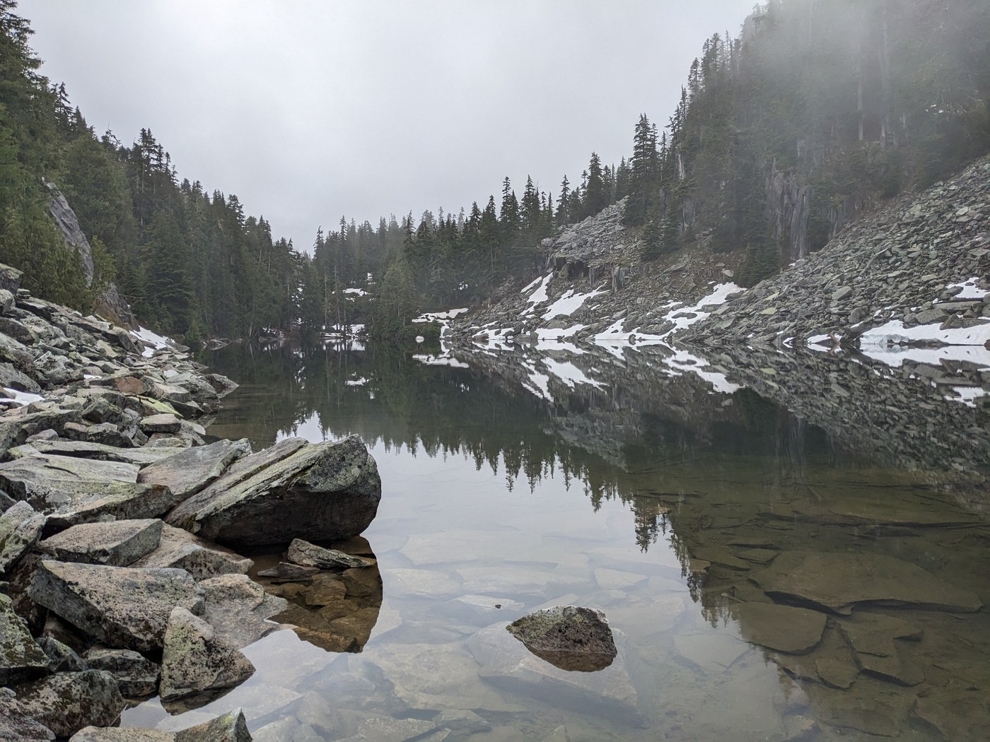
I made it up to Jade Lake and back on this damp and cloudy day - my first time hiking Necklace Valley! I plan to visit again in late summer on a backpacking thru-hike, so this is just a small taste.
ROAD / PEOPLE: The road is in great shape, just a few potholes here and there. Only one car at the TH when I arrived - two backpackers who I met on my way up. Two day hikers pulled in behind me, and two backpackers later in the day. I only came across four people on the entire hike - not bad for an uber-popular area on a Saturday.
TRAIL: This trail is all over the place in terms of conditions. At the beginning it follows an old road bed before entering the Alpine Lakes Wilderness, so it's generally wide and level. After entering the wilderness it gets a lot more "rustic", but the main problem is the brush. The vine maple and occasional other small trees are slowly taking over the trail (or not so slowly, perhaps!) along with all the perennial vegetation. On this wet day, my bottom half was soaked by the time I got to the river crossing, from all the water on the plants. Sometimes the plants are waist-high, sometimes ankle-high, often right in your face. It was pretty much impossible to stay dry, and the water made everything hang that much lower over the trail.
Along with the brush, there are lots of old puncheon bridges that are very slippery, and occasionally those are almost buried by brush as well, or are quite slanted. In general I would say this is not a great trail for a wet day due to all the brush and the slippery bridges. There is also a sketchy double log bridge over a pond, but one of the logs has broken in two and can't be walked on, so you're left with a single log with no handrail.
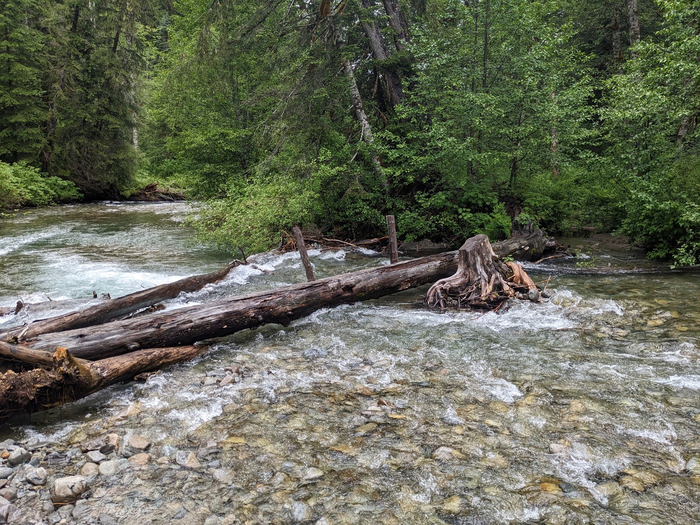
Which leads me to the next "interesting" part about the trail - the crossing of the East Fork Foss River. It's doable right now - the bridge is a flattened log over the rushing river, and the handrail that (I am guessing) used to be there is gone. The log is fairly wide, so I crossed it OK without using poles, but there is a deep pool on one end of it with some rocks in it, and I inadvertenly dunked both my boots into that. I had to stop on the other side of the river to wring out my socks and dump the water out of my boots! On the way back, I found you can go around the pool with a sketchy side trail if you are intent on keeping your boots dry.
The real climbing begins once you cross the river, after crossing the Necklace Valley creek on yet another makeshift bridge. Pick up the cairns through the boulder field on the other side and the rest of the trail is pretty easy to follow. I never found that it got all that steep, though it does climb about 2400' over 2.5-3 miles to Jade Lake. The big problem on the climb is one really nasty brushy section, again mostly vine maple. Although rocky at times, the tread of the trail is decent, but there are so many trees getting in the way that it's pretty unpleasant, especially when all the trees are dumping water on you as you try to avoid them!
I believe WTA is working on this upper section this year - it really needs it! I hope they have a chance to brush out some of the lower sections too. If I had one word to describe this trail, "overgrown" would definitely be it.
Continuing on to the lake, the rest of the trail is rather primitive, rooty, and rocky in a number of places, but overall it's not as bad as I was expecting. It's generally not muddy or wet. However, getting to Jade Lake took a lot longer than I thought it would - every time I thought I was almost there, I had to climb again! It took me about as much time to get from the river to Jade Lake as it did from the car to the river - about 4:25 to the lake from the car.
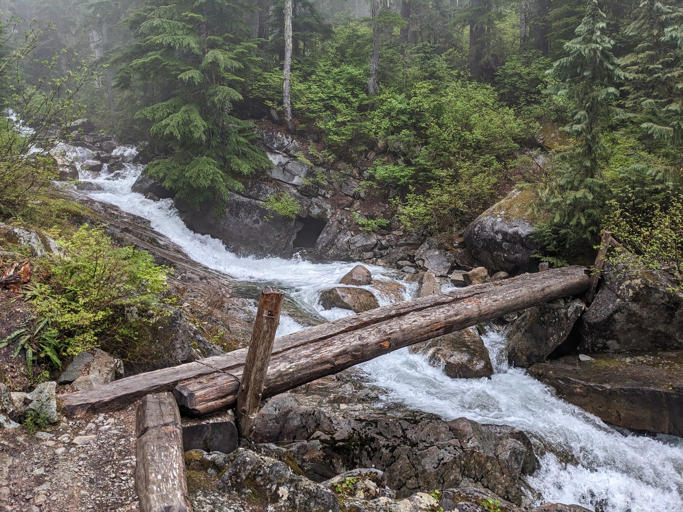
WATERFALLS: There are quite a few waterfalls to enjoy along the way, though I would say the West Fork Foss River Trail is better with more waterfalls and less effort. About a mile in, there is a nice wide bridge (no railings) over a roaring waterfall. Then at about 3 miles in, there is a riverside camp on the right with some excellent rapids and huge boulders in the river. The water is a cool bluish green color. The best waterfall of the hike is next to the trail on your left, about halfway between the river and Jade Lake, where the creek from Necklace Valley drops about 150' through some slabby rock. See video below. Then, you can see the raging waters right below you as you cross that creek on the Michael Nesby bridge, about 1/4 mile farther up the trail. This bridge also has no handrail - a recurring theme for this trail!
BLOWDOWNS: There are quite a few. I counted 18 before crossing the river, and 9 after. Many of the ones before the river crossing are small and could be handled with a trail saw, but several are much larger and will require a crosscut saw. Most are step-overs but there are at least a couple that require a detour off trail. Almost all of the blowdowns past the river on the climb to Jade Lake are quite large and will require crosscut work.
About halfway up the climb to the lake, one massive blowdown covers the trail almost entirely where it dips down to cross a small rocky creek bed. The trail starts out on the right side of the huge log, then crosses under the log to the left, then curves back to the right past the root end of the blowdown. I found it worked well to just walk straight up the log and pick up the trail on the other end. You can also climb up a creek to the left and pick up the trail that way, but the creek has quite a bit of water in it so it's hard to stay dry.
Farther up, a bit past the Michael Nesby Bridge (look for the plaque on your right), there is a massive double-tree blowdown that has fallen right on top of the trail, covering it for about 100'. Again, you can walk the log(s) and find the trail at the root end. Or you can detour around the whole mess in the brush, just know the trail continues at the uphill end of the logs.
SNOW: There is only one very small snow patch over the trail just as you are climbing a rock field right below the lake. It's a bit tricky and might require kicking a few steps in, but it's not bad. Certainly not worth putting spikes on. Jade Lake is entirely melted and the shore is mostly snow-free.
STATS: This is a bit of a guessing game. The trail sign at the start says Jade Lake is only 7 miles. Green Trails has it at closer to 8 miles, and my Garmin said over 9! I think the 8 mile distance feels about right. Total hiking time for me was about 8:45, with about 25 minutes for lunch and lots of time taking pictures and videos on the way up. The elevation difference between the TH and Jade Lake is only 3000', however with all the ups and downs in the trail it may amount to about 3400'.


Comments
Maddy on East Fork Foss - Necklace Valley
Great detailed trip report. This is one of the few local hikes that I haven't done. It always seemed to me that it is a lot of effort to get to a small non-alpine lake. I'm prob too lazy to do that so I really appreciated your detailed description so I could experience it vicariously. Thanks.
Posted by:
Maddy on Jun 11, 2023 08:01 AM
ALW Hiker on East Fork Foss - Necklace Valley
Yes, it is definitely a lot of effort. I think it's best enjoyed as a backpacking destination, when you can spend some quality time exploring around all the lakes and scenery in Necklace Valley itself. The lower parts have some appeal (I added some stuff about the waterfalls above), but there are many other hikes that have far more interest and/or a nicer trail, especially if you are going to hike 15+ miles.
The lower section to the river crossing is a nice forest hike with lots of ferns and wildflowers, plus some really cool cliffs to the east and a couple waterfalls. So maybe a decent option for a hot day when you want to stay in the trees. I definitely wouldn't go there on a wet day again, LOL!
Posted by:
ALW Hiker on Jun 11, 2023 08:46 AM
Liz K on East Fork Foss - Necklace Valley
Thank you for your detailed report. Jade Lake is on my to do list. So very useful info for me!
Posted by:
Liz K on Jun 11, 2023 11:28 AM