
WEDNES JULY 12 — SUN JULY 16
What a grueling but rewarding five days in the N Cascades. I had always had my eye on both the Devil's Dome Loop and Desolation Peak. Then with the initial forecast for a super agitated aurora borealis, I cobbled the trip together.
ROUTE
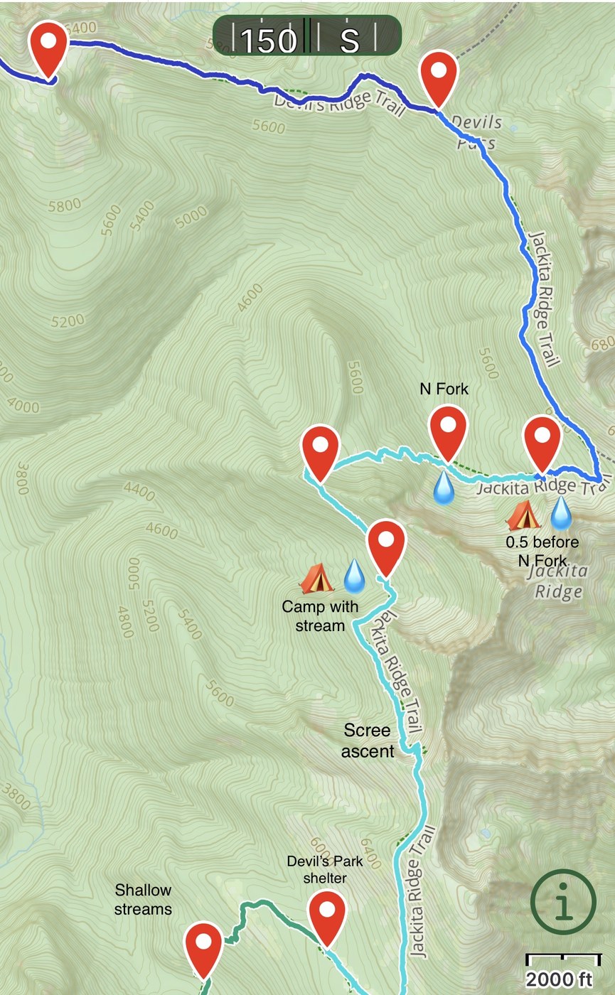
See PIC 2 // Park at Ross Dam TH then boat to the drop off for Desolation camp; Desolation camp back to the shoreline then south to Devil's Junction; start the Devil's Dome loop heading east/clockwise, camping three nights before exiting at Canyon Creek TH.
DAY 1
1 mile from Ross Dam TH to the boat dock, then a twenty minute ride to the shoreline drop off, then 3.5 miles up to Desolation camp
** don't wait until the last minute to plan the boat! I delayed, then was left with options only for early morning or late afternoon
** don't wait for the camping permit either, though apparently Desolation camp is often available since most people don't want to lug water all the way up for an overnight
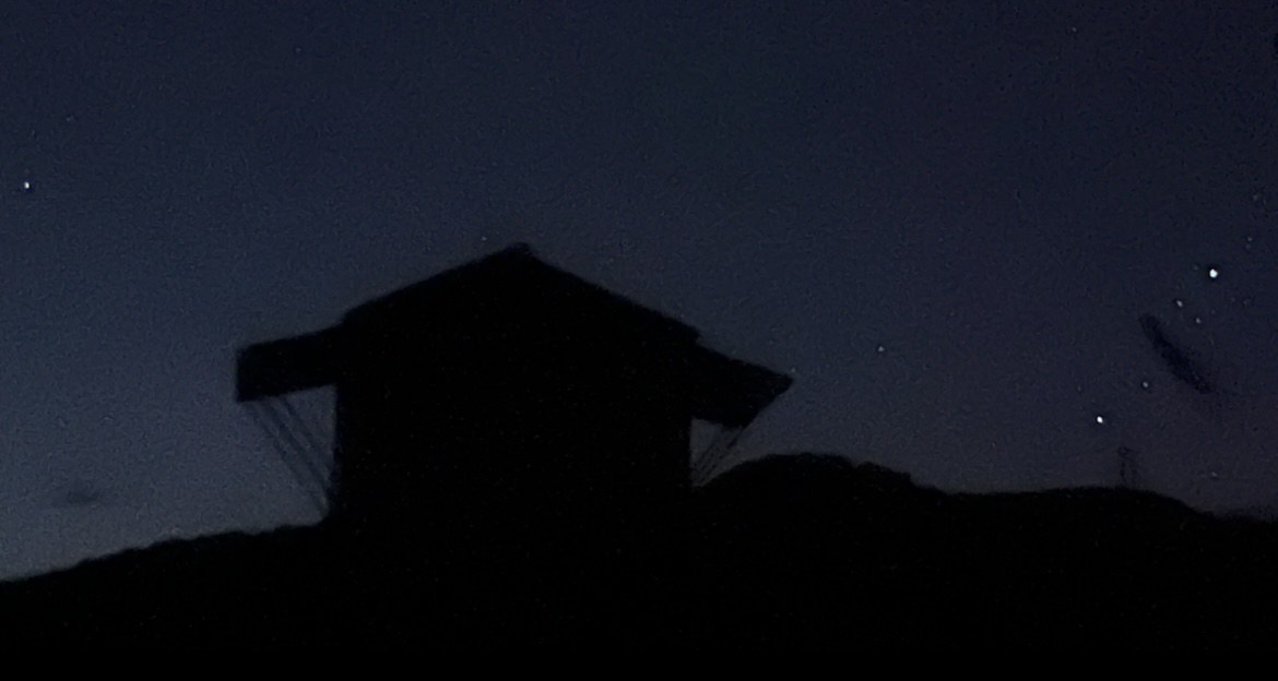
** despite the ratcheted-down forecast for the aurora, I set my alarm for 1030p and walked up to the peak just in case there was a faint glow to be seen; nope!, no aurora for this kid; however, the moonless night meant a spectacular night sky
** PIC 1, the lookout tower in the pitch black of night
DAY 2
3.5 mile descent from Desolation camp to the East Bank Trail, then 5 miles to Devil's Junction, then 7 miles ascent to Devil's Dome — ie, doing the loop clockwise
** on the descent, at about one mile from the shoreline, I saw a bear approx 30 feet away and approx 20 feet from the trail; I waited 10-15 minutes as he ambled around from bush to bush, even climbing a sturdier tree aways up; if he saw me, he didn't really care; I finally tooted my whistle — my trusty anti-bear weapon — a few times and a minute or so later, he disappeared; this was my only wildlife sighting in my entire excursion
** several streams along the East Bank trail down to Devil's Junction
** ascent up to DD was a grind…and the often brushy trail and frequent blowdowns didn’t help
** on PIC 3, you'll see a water source approx one-third mile before DD; the stream somewhat follows the trail but at this one-third mile point it seemed closest to the trail — just ten or so steps from the trail, fill up, then just a short remaining walk up to DD; thanks for the guy in the BALLARD t-shirt for the heads up to expect this water source!
** I never looked for water at Dry Creek pass or other spots before or after DD that were mentioned in recent trip reports; they may have been there, but they just weren't on my radar as I always had ample supply and was planning for the “one-third mile from DD” stream
** 360, world-class views of concentric circles of mountain peeks from atop Devil's Dome - so intensely spectacular!
DAY 3
7 miles from Devil's Dome to a camp spot 0.5 miles before the N Fork Devil's Creek intersection with the trail
** same note as before: wasn't looking for water sources on the trail as I left DD with ample supply and knew I'd hit the N Fork Devil's Creek
** other trail reports said they'd filled up at the N Fork Devil's Creek intersection and camped there too, so I was assuming there would be camp sites right at the N Fork intersection…
** …but one-half mile before the intersection, there is a well-groomed camp site just off of the trail; I wandered in for a little look then heard the N Fork not far off; it was only 30 steps away from the site — walking through the camp site, not further down the trail — so I ended my day there and set up camp; and wow, views of a towering, sheer cliff wall catching both sunset and sunrise, heavenly! See PIC 4
** didn't see any camp spots at the N Fork intersection — rather, it was bushy and rocky and exposed and without any flat surfaces
DAY 4
8.5 miles from camp spot preceding N Fork to Crater Lake
** two manageable 1k foot ascents, lush meadows with wildflowers in Devil’s Park and astounding views – an awesome day
** there was an idyllic camp spot – groomed, logs for sitting, fire pit, nearby stream, just steps from the trail – after the ascent back up from N Fork but before the scree ascent toward the top of Jackita Ridge; maybe a good first night target for those starting counter clockwise from Canyon Creek TH – see PIC 4
** at the “main trail” junction with the trail to Crater Lake and Crater Mtn, there’s a great water source but the camp spots are kinda blah…
** …so I advise you walk the 0.8 miles up to Crater Lake; I found a soft meadow south of the lake and along the west side of the stream that flows down from the lake
** the lake itself is quite shallow — impossible to swim and when I tried wading, your feet sink into the molasses-like bottom
** however, the outflowing stream is clear and yummy for drinking! Thanks for the two-woman, one man trio I crossed for this advice!
DAY 5
4.5 miles from Crater Lake to Canyon Creek TH
** I crossed Canyon Creek directly opposite from the east-most camp sites of what I think is called Granite Creek Campground
** I’m 5-11 and the water came to my upper thighs
** somehow I came out on SR 20, not at a TH or campground; easy walk down the highway to Canyon Creek TH where I hitchhiked easily enough to my car at Ross Dam TH
** crossing directly over to the Canyon Creek TH area might’ve been a better call
Happy to clarify and give additional advice! Just leave a comment.
Enjoy!


Comments
Fantastic detailed report. Thanks!
Posted by:
jpcarlen on Jul 27, 2023 08:05 PM
You got it! Enjoy DD!
Posted by:
anthonyE on Jul 28, 2023 12:12 PM