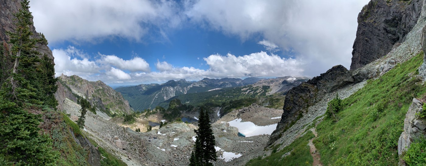
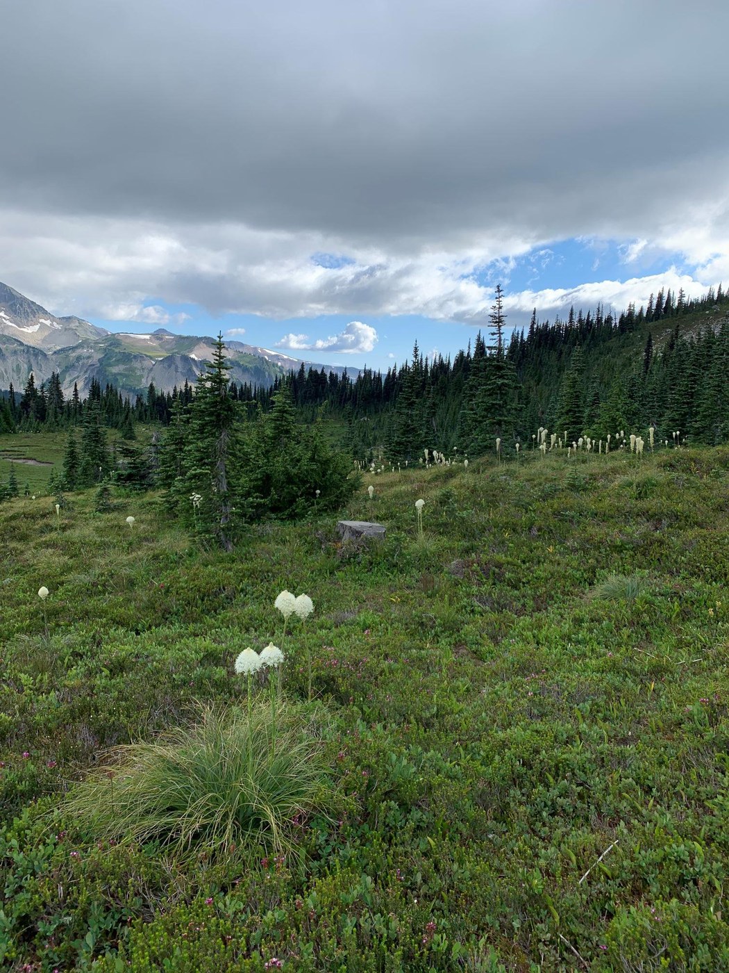
Knapsack Pass - Spray Park Loop, clockwise. Kicked our butts!
This post is for us intermediate hikers, the 10 mile, 2500 ft EG types, who navigate by GPS track (I use AllTrails). It's a bit of a warning.
Looks pretty innocuous from the stats, 6 miles, 2K elevation according to AllTrails. Knapsack pass section unmaintained but supposedly reasonably well trodden. Stats by the time we finished were ~8 miles, 2100 ft EG (net, but this hike has some significant ups and downs), 6.5 hours, and we didn't stray off the track.
Not many trip reports for this loop -- but most remark on the boulder fields you need to traverse coming down from Knapsack pass into the Mist Park basin. Not sure why I discounted the difficulties people mentioned, maybe because they were delivered in typically understated fashion ("The trail down the east side of the pass crosses some tricky loose talus and a few easy snow fields." "We lost the trail 10-15 mins in, due to snow, but just kept going straight across the boulder field" "The rocky stretch east of the pass is a doozy", "Once you clear this monster of an obstacle you have a pretty easy route"), anyway, I should have paid more attention.
We took the clockwise route because it was said to be easier to navigate the boulder field this way, but we still found it very challenging. The trail is not marked through the boulders, this stretch is pretty long, through ups and downs, and the connection with the trail beyond the boulder field is not visible from where you start. The boulders are sharp and not always stable, there are loose scree fields to avoid and the small remaining snowfields seemed untrustworthy and best to avoid as well. If you stop and listen, you'll hear the sounds of talus and scree falling around the basin, which gives you a different perspective on the field you're crossing.
The whole time I kept thinking what a mess we'd be in if either of us got injured in this section. It was a beautiful day, but there were no hikers here. We had passed only 2 other parties, at the beginning of the hike over on the Mowich side of Knapsack, going the other way. We were roughly in the middle of the hike, and both forward and back would require a lot of effort.
We made a number of false starts, following what looked like cairns and social trails. And by the end of that section we were pretty rattled. Parts of the subsequent trail through the basin were very clear, other parts not so much. As my traveling companion said, longest 3 miles she's ever hiked.
And then ... the AllTrails track took us up the Mt. Pleasant ridge (rather than the less challenging route down over the saddle into Spray Park). But the section down from Mt. Pleasant to the saddle before Hessong Rock was incorrectly tracked on AllTrails. The actual trail, which descended off on the Spray Park side, was very obvious so we were able to follow it, but since this was our first time on this trail, and we couldn't see more than a few feet ahead at any time, we didn't know for sure that it would take us to the right place.
The steep trail down from Knapsack into the basin, and the equally steep trail down from Mt. Pleasant to Spray park are filled with loose scree. There was a lot of sliding. I was glad we came down these, rather than up from the other direction.
So, just a heads up that this is a glorious trail, but it's more than a typical day hike, and much more challenging than the stats suggest.


Comments
Mary&Mollie on Knapsack Pass, Spray Park
This is a very tough trail. Usually only attempted by advanced hikers or climbers attempting Mother Mountain.
Navigation (AllTrails is NOT navigation) is needed regardless if there is a snowfield or not.
Unfortunately, I believe too many people think AllTrails is a form of navigation. AllTrails is a crowdsourced program. Meaning, it is tracking the person or persons who went on a trail in the area prior you. If that person or people before you have been lost and are recording their wandering track, AllTrails counts that wandering course as the "trail".
It is not a true trail map.
I have run into 4 different groups over the last year, lost on this trail because they are following an AllTrails downloaded crowd sourced map. Two were in significant trouble and did not have a form of a PLB with them.
I happened to do the trail CCW, which I rarely do last fall. If I hadn't, I believe one of the two groups could have been in severe trouble as the road to Mowich was closing that evening and nobody else would have been up there.
Both groups were lost between Mt Pleasant and the boulder field. Neither knew the other group was struggling. Nobody had seemed to pick up their head and survey the area. One individual had their foot stuck between a couple of boulders was in a severe panic.
Snowfields make this trail much easier as one doesn't have to travel the boulder field. As you stated, the boulders/scree moves significantly. This trail moves from Hard to Very Difficult once the snowfield melts. Most who love and hike this trail frequently, will not attempt this hike after the snowfield melts.
I know AllTrails has become a way of life with most of the younger and newer hikers. Unfortunately, it is leading folks into areas that they are not prepared for and can get into severe trouble.
If you haven't had a map reading/navigation course, it is well worth it! Knowledge is gained on actual navigation tools and how to use a map if electronic navigation fails.
Happy Trails!
Posted by:
Mary&Mollie on Jul 24, 2023 06:23 PM
moxbox on Knapsack Pass, Spray Park
@Mary&Mollie - thanks for the info, I feel very lucky we had good weather, and lots of daylight, as well as the ability to navigate by sight to supplement that AllTrails track. To be fair, Gaia shows the same track as AllTrails, and the section where AllTrails was wrong could not have been the result of crowdsourced routes -- the track would have had you dancing on the tippytips of the rocky points of Mt. Pleasant down to the saddle. It's not really possible for a human to do that.
But bottom line, you're really right that folks are being led into areas they're not prepared for.
Posted by:
moxbox on Jul 24, 2023 09:08 PM
Mary&Mollie on Knapsack Pass, Spray Park
Gaia's base map shows the connector trail from Knapsack to Spray Park as a "no access" trail. It is clearly defined from Knapsack Pass, past the Mt Pleasant trail on to Spray Park.
However, Gaia does allow the ability to pull up another hiker's track.
If you choose another person's track from Gaia, then yes, there is a track from Knapsack to Mt Pleasant to Spray Park. Understanding the electronic map one is using is critical. Is it a base map or is it another hiker's track?
That is where a navigation course from Mountaineers, REI, etc. can help a ton. They teach how to use electronic navigation. So many recent SAR missions are due to people not understanding how to use electronic navigation and mistakenly following other's tracks.
Posted by:
Mary&Mollie on Jul 25, 2023 02:25 AM
Mary&Mollie on Knapsack Pass, Spray Park
One last tip: Take a look at a map (electronically or on a physical map) and map/track out your course before you leave your house.
I will get off my soapbox now. Sorry! We have seen so many people and increasing over the last two years, getting into severe trouble following a preset track from a hiker they do not know or do not know the skills of the hiker who laid the track they are following.
Posted by:
Mary&Mollie on Jul 25, 2023 03:44 AM
moxbox on Knapsack Pass, Spray Park
@Mary&Mollie, I agree. I did spend a fair amount of time looking at a paper map at home first, and reading through the trip reports. I've crossed boulder fields before. I had spoken with the ranger at Mowich about the conditions of this route before we started up -- and he encouraged us to take it. Brought up the map on his phone and gave some pointers about traversing the basin.
Both AllTrails and Gaia show the trail from Knapsack to Spray Park as "No Access" -- but *only if you zoom in close*. We only zoomed in like that once we were on the trail itself. It was unnerving to see it at that point -- I wasn't sure how to interpret it, didn't understand why the trail descriptions failed to mention it, and there was nothing I could do about it then.
In retrospect, I can see that WTA doesn't have an entry for this loop. AllTrails does; though it shows the basin section as "No Access", it still routes you across it.
Maybe it would be better for WTA to have an entry, and use the entry to clarify that this route is dangerous and not recommended unless you have class X scrambling skills.
Posted by:
moxbox on Jul 25, 2023 11:42 AM
happylittlehiker on Knapsack Pass, Spray Park
Grueling and confusing but we love it. It's an annual trek. GAIA is a blessing for keeping us on the six mile route.
Posted by:
happylittlehiker on Jul 24, 2023 07:00 PM
siddi on Knapsack Pass, Spray Park
I had a similar experience on this trail going from Spray Park to the parking lot. Navigating the boulders was OK, it was just taking a long time. But once I looked up at the pass and the scree slope, it was scary - I can imagine coming down would be even worse. I went up the slope that had some vegetation, so I could hold on to the plants.
Finding the trail wasn't the problem, just navigating the loose rocks was hard and scary.
Another time we had a tough time was going from Heather Pass in the North Cascades to Lewis Lake. However, everyone else on the trail was casually hopping the car sized boulders with huge backpacks, one person even had a dog.
That's when I realized most trip report authors of less frequently traveled trails are expert hikers, you have to go through a lot of reports to make sure what you are signing up for.
Posted by:
siddi on Jul 24, 2023 07:56 PM