Finally hiked the Mink Lake Trail from Sol Duc Resort all the way to Little Divide in one long afternoon. The Resort parking lot was large, and crowded with cars for the bathers. Finding the trailhead, and hiker parking, involved taking a right turn at the back of the large parking lot and driving 200' down a single lane to the marked trailhead.
The trail is in generally good shape, had few hikers, and climbs steadily and efficiently through increasingly grand, dark, north-facing forest tracts. At about 2 miles, the trail begins to climb a greener, sunnier ridge that parallels the course of Mink Creek, with pleasant views in spots down to the creek itself. Just before arriving at Mink Lake the trail sidehills a dark forest, and several examples of pinedrops (pterospora andromeda) protrude from the deep humus trailside, several of them 2-3' tall (pictured). Perhaps due to the lack of heavy foot traffic, and respectful hikers, the remarkable sticky red-stemmed flowering lances were undisturbed and breathtaking.
Mink Lake lies in a beautiful quiet flat area, and has a unique almost Amazonian beauty, with lush green vegetation having filled in much of its surface area. The small shelter there is at the end of a lakeside waytrail that does not reconnect to the main trail. The shelter is in a small forested glade near the lake and quite well-preserved with three or four slat "beds". Bugs were present near the lake, but tolerable, and were largely kept at bay with only a light application of a non-DEET flower oil cream.
Following quick snacks and pictures at the lake, my hiking companion and I continued upward on a pleasant, moderate trail that continued to sidehill past the barely visible "Intermittent Lake" (which at this late August viewing was but a boggy green meadow). The trail crossed one sizeable brook in this sidehill, the only spot at which we could conveniently fill our water jugs going and returning. The trail then comes round the upper end of this cirque that lies above Mink and "Intermittent" Lakes. At this point the trail crosses to the other side of the cirque by means a small footbridge over the main creek that feeds those "lakes". At this time of year, the creek was just a trickle and unattractive. We noted, however that there is small, rather hidden campsite on a small rise to the west of this little bridge, and a nice meadow and small pond a bit further up. This is useful to recall if one wanted to choose due to lateness or weariness to bivouac here. Bivuoac, that is, because what lies ahead, we were to learn, was a relatively short, but still steep and taxing climb just ahead of this spot, up to the ridge crest separating the Solduc watershed from the Bogachiel.
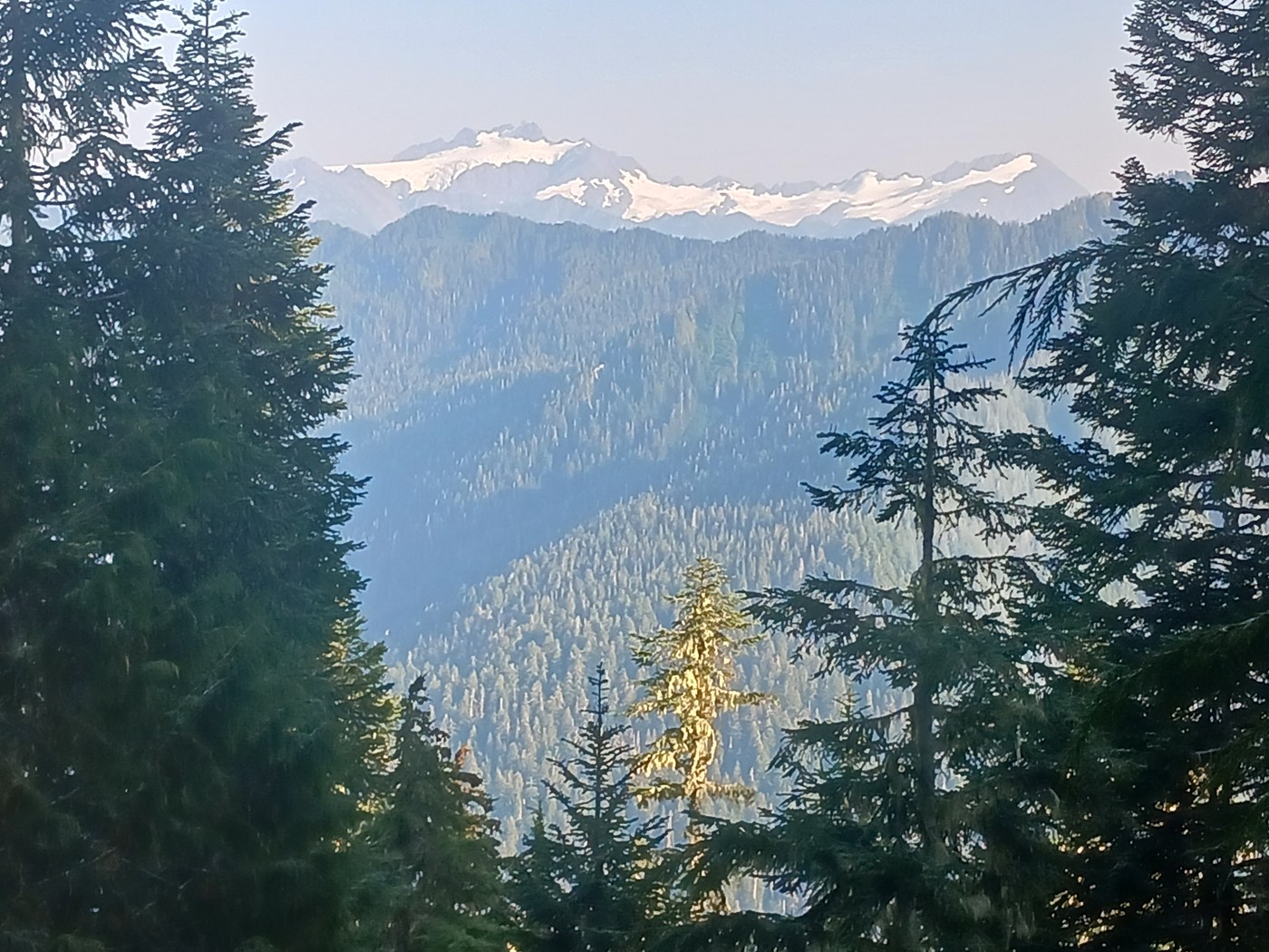
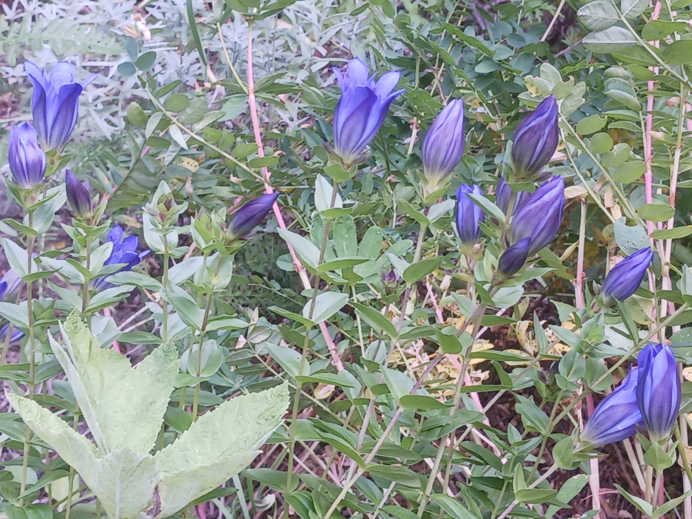
The climb up is steep, as mentioned, but punctuated with reasonably efficient and well-planned and maintained switchbacks. We sweated our patience and packs out, even so. At the top, the Mink Lake Trail ends at a "tee" with the Bogachiel Trail. There are no "grand vistas" close by. The ridge is covered thickly with gnarled alpine hemlocks and firs, yellow cedars and a few much larger trees, perhaps silver firs. There are a few small, primitive, little used, but useful campsites sprinkled around the ridge crest. We made use of one of these hidden back in the forest duff. We then spent the rest of our trip exploring this seldom-visited section of the Upper Bogachiel Trail. To the west (right) from the ridge crest the trail meanders gradually along the ridge and ultimately down towards Slide Pass, whereupon it dives down into the upper reaches of the North Fork of the Bogachiel. A few miles further on, 21-Mile Camp and Hyak Creek both look worth exploring further next trip. There is one small, and one grand, meadow on this part of the trail. These both open up views to the south and east. Mt Olympus and Mt Tom are beautifully in view, as is the mysterious uppermost main branch of the Bogachiel where neither trail nor road appear ever to have allowed human access. Another bright point on this walk were several large patches of mountain bog (blue) gentians growing right in and along the trail, on a side hill that at first glance seemed much too arid and full of talus to support these 6"- 8" beauties, but there they were: untrampled botanical wonders, tipped in an unearthly blue (pictured).
To the east (left) from the ridge crest, the trail also meanders along the Solduc-Bogachiel ridge, at times threading a narrow near "catwalk" between the Solduc and Bogachiel drainages. About a mile down the trail through the "Little Divide," as this section is called, there is a deep cleft that cuts through the ridge at an angle that is worth exploring in its spooky depths. This ridgetop gash is perhaps is the result of faulting, or perhaps is a "slump depression" as described by Roland Tabor in GUIDE TO THE GEOLOGY OF OLYMPIC NATIONAL PARK. In his remarkable work, Tabor describes other places in the steep sided Olympics where steep hillside slopes slide valleyward over time leaving deep rifts up top. Interestingly, this particular rift here seems to broaden out further as one continues east. One arrives into a fairly wide and lush ridgetop meadow, featuring several bogs and tarns where water was available even this late in a very dry summer season. Good to note on this otherwise very dry Ridge. Beyond this little scale, the Little Divide trail starts downhill through a deep forest, where it eventually comes out just above Deer Lake at the head of the Canyon Creek Trail.
We saw almost no one on any of the trails during our 3 day trek. A delightful surprise upon returning to our car at trip's end was to find my favorite, classic, Grand Canyon National Park Cap pinned to the trail board by one of those rare hikers we encountered. I had dropped hat on the way in and ardently sought it on the way out, and there it was, carefully placed for me to find. Thank you, kind hiker! A perfect end to a terrific hike to this modest, underused, and quietly enchanting area.
Alki Dan


Comments