After finding too much snow on the road to the West Fork Foss, I backtracked and hiked at Necklace Valley on a gorgeous New Year's Day. While this hike doesn't provide big views, the mossy forest is peaceful and there are some scenic destinations if you're willing to work for them. I saw two people on the trail in the first 15 minutes of my hike, and no one else for the rest of the day.
ROAD / TH: The Foss River Road is entirely snow-free until you reach the Tonga Ridge Junction, where there probably a 150' long section of road covered with snow and ice. It's flat and the snow is only a few inches deep, so I think most cars could make it through here. The road beyond this point is clear again with just a few potholes. Once you arrive at the Necklace Valley Trailhead, you will find about an inch of two of hard-packed snow covering the parking lot. It's not a problem at all if you have snow tires or all-wheel drive, but without those, you might want to park along the road next to the lot so you don't get stuck. The bathroom is locked for the season.
TRAIL / SNOW: The trail is almost entirely snow-free up to the wilderness boundary about 1.5 miles in. At this point, the snow becomes intermittent for the next couple of miles, with more snow in the open areas, and long stretches of bare trail.
You'll start to encounter more snow as you venture farther, but I wouldn't say it gets "deep" until you get to the clearing at about 3.5 miles. Enough people have walked in the trail that there is a firm, though crude, boot path that you can walk in. If you're unsteady on your feet, you might want spikes, just know you'll be wearing them on a lot of bare dirt and a bit of rock as well.
The brushy clearings at 3.5 miles, 3.8 miles. and especially the one at 4 miles have pretty deep snow, and in most cases there are lots of deciduous trees that have been weighted down over the trail. Most are not too hard to get through, but there are some that require a brief detour off the trail. Unfortunately, there is really not enough snow off-trail to completely cover everything so it's a bit of a snow + brush bash at times. At least there are no leaves, so you can see where you're going!
At this time, I would recommend bringing snowshoes if you plan to go beyond the clearing about 3.5 miles in. I went quite a bit farther without them on the way in, but they really helped on the way back out, despite the firm and uneven snow. They greatly reduced the amount of postholing through the brushy parts of the trail, especially when having to detour around vine maples or other brush in the way.
I never did put on spikes or gaiters, but I would suggest bringing both. The spikes are useful if the trail gets really icy, and the gaiters if the snow softens up.
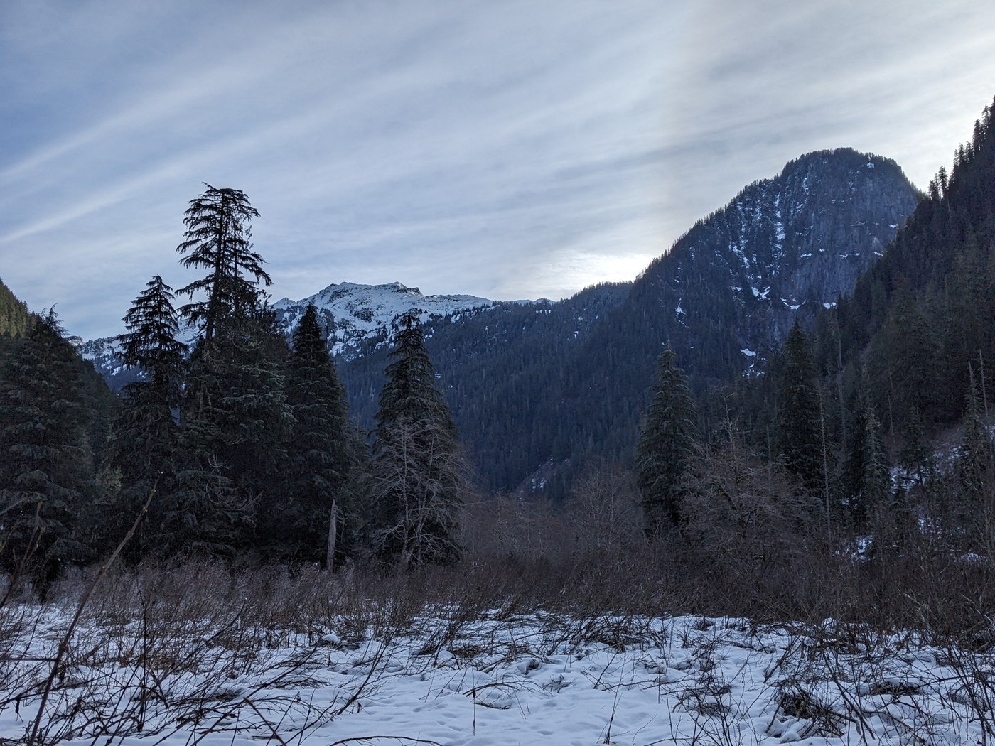
In the clearings, there are pretty nice views of Bald Eagle Mountain to the west, and the impressive cliffs at the foot of Shroud Mountain to the east. If you make it all the way to the big clearing 4 miles in on a clear day, you will be treated to a nice view of Mount Hinman.
Most of the camp sites along the route are about 50-75% snow-covered, but I saw a few bare spots too.
BLOWDOWNS: There is one very large (18-24") maple tree across the trail that you'll encounter a few minutes from the car. Best way to get through is up and over on the right (west) side. There are three or four small trees across the rest of the trail up to the river crossing - they're all step-overs less than 12' in diameter.
WATER CROSSINGS: The first crossing of Burn Creek has a nice solid bridge. it can be a bit slippery when it's icy, but otherwise it's fine. Unfortunately, this is the only "real" bridge on this entire trail (at least until you get closer to Jade Lake).
The first issue is some rotting puncheon bridge about 2.4 miles in. One or two planks have collapsed and are underwater. The gap isn't too hard to hop over, but be careful as the boards are very slippery. There are more failing puncheons along the way, though most have some snow on them now, which actually helps with traction.
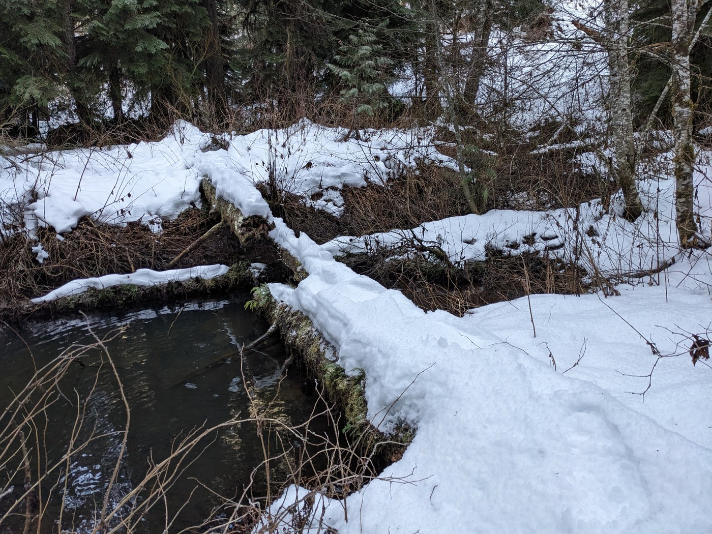
The crux of the hike now seems to be the failed bridge over a bog about 4.4 miles in. This bridge has been broken for a while, I suspect, but it's especially dicey with snow on it - see picture #3. This was originally a double-log bridge about 20 feet in length. However, the larger of the two logs rotted in half with one side falling into the bog, resulting in a bridge that is at two different levels, with neither side really wide enough to properly walk along. I did manage to get across with my snowshoes on, but it was pretty hairy. Apparently, the people who had made the tracks before me (not the same day) turned around here, as there were no tracks in the snow on the other side of this "bridge".
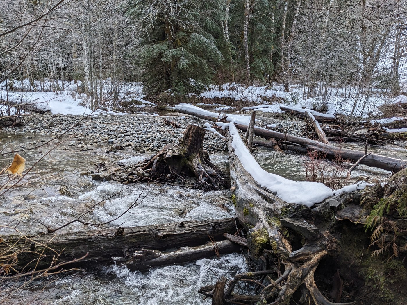
At the East Fork Foss crossing 5 miles in, the regular crossing log is doing fine - see picture #4. I didn't plan to cross the river today, but if I had, I would have probably just forded the river instead of using the log, since the latter is covered in snow and the handrail is long gone. The river is not running very high right now so it wouldn't be difficult to wade across.
STATS: This is a longish hike even on good days, but with the extra snow, progress was a bit slower. It took me just over 5 hours for the round trip of a bit over 10 miles, including a very brief stop for lunch at the big flat camp site by the river. There is hardly any elevation gain, but lots of little ups and downs - my Garmin read about 1200' of cumulative ascent.
I almost forgot, a huge thanks to the WTA crew that brushed out this trail last summer. The first five miles is a massive improvement to what it was when I hiked it last June. Apart from the failing bridge issues mentioned above, the only problem I encountered was a 100' section of clay-filled trail with a creek running down the middle of it. But there was very little water, and it wasn't actually muddy, so not a big deal.


Comments
Traillesstraveled on East Fork Foss - Necklace Valley
Accessibility to this area will soon be VERY difficult due to the up coming snowfall. Watch for 4X4 traffic as this area is popular among the jeep clubs.
Posted by:
Traillesstraveled on Jan 03, 2024 06:09 AM
ALW Hiker on East Fork Foss - Necklace Valley
Agreed! Usually in the winter you can't really get in much beyond the railroad trestle. There were quite a few 4x4s there the day I hiked it doing their thing.
Posted by:
ALW Hiker on Jan 03, 2024 06:24 PM
Traillesstraveled on East Fork Foss - Necklace Valley
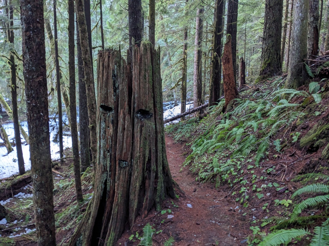
The stump with the notches cut in it are typical of the old days of logging when spring boards (using misery whip saws) were used when falling trees. This was done so the lower often unused portion of the tree remained and another cutting of the tree wasn't required.
Posted by:
Traillesstraveled on Jan 03, 2024 06:32 AM