The Rolls Royce of Washington hiking! Last year, on my first day-hike through the Enchantments, I had stuck to the main route (Colchuck-Snow Lake), not wanting to extend myself more than I already was. This time I wanted to visit the features I had missed last time round: namely Gnome Tarn and Little Annapurna.
To be able to budget enough time to adequately accomplish my goals, I left the house at 3:20am. I was at the trailhead at 5:25am and on the trail by 5:35am. I blew through the first 4.1mi to Colchuck Lake in 1.5hrs (2300ft of gain). Turquoise colored Colchuck Lake was large and beautiful. This early in the morning, it was completely still. On the other side of the lake, reflected deeply in the waters was my first challenge: 7800ft Aasgard Pass. I made my way around Colchuck Lake, to the base of Aasgard Pass, climbing over and around huge boulders, where I paused for the first time since starting, to mentally prepare myself for the climb up to the Enchantments.
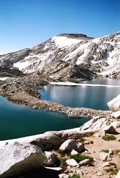
I was at the top of Aasgard Pass by 9:00am, to reach heaven. Lakes Freya and Brynhild are the first to greet you. Lake Brynhild, particularly, is spectacular, ringed on half its circumference by the back of Dragontail Peak and Little Annapurna. Witches Tower rises sharply up from the lake waters. After spending a bit of time prowling around the 2 lakes, I made way down from the austere upper Enchantments basin towards the lower Enchantments basin. Along the way are the lovely little Brasingamen Lakelets, interconnected by streams and waterfalls.
Somewhere around the Brisingamen Lakelets was to be the way up 8,440ft Little Annapurna. I followed the direction of generally sticking to the left and picked the best route I could to climb up the 1000ft or so. I reached the top to awesome views! The entire Enchantments basin was spread out before me. Crystal Lake was really impressive, perched at the end of a cliff face that dropped down into the Ingalls Creek valley. Mount Rainier, Mount Adams, Mount Stuart, Glacier Peak, Mount Baker, the Ingalls Creek valley, etc. were all larger than life.
By now I was tired. At this point I seriously contemplated cutting out the Gnome Tarn section of the trip, given that I had already done about 5200ft of gain. I put off the decision until I made my way down from Little Annapurna. Naturally, I had talked myself into continuing by the time I got down... So, I made my way further down to the friendlier (greener) lower Enchantments, passing Talisman Lake on the way to Rune Lake. Up ahead, along the main trail were Leprechaun Lake and Lake Vivian but these would have to await another trip.
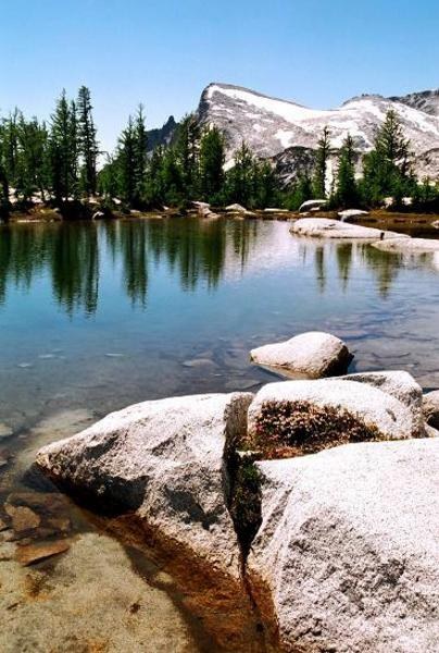
From Rune Lake I made my way up to Prusik Pass and looked down on Shield Lake and Earle Lake. A trail to Gnome Tarn should have been visible on the way up to Prusik Pass, but I had not seen one. However, I was able to pick up another trail from the pass which wound its way around the side of Prusik Peak down to Gnome Tarn. It was 1:45pm by now. Gnome Tarn was nice, but what were nicer were the views of Prusik Peak and Little Annapurna from here. It was worth it, spending the time to locate Gnome Tarn. I had lunch beside the smallish tarn, finished the last of my Gatorade (I still had water left), and finally turned to go back.
The trip back was a tough (just like last year). I was already quite tired, and I still had about 7-8 miles to go. I managed to find the path down from Gnome Tarn to Rune Lake (thankfully, I did not have to climb back up to Prusik Pass first). Then ensued the 2 miles or so up to the upper Enchantments and the top of Aasgard Pass, where I saw a mini avalanche on the Snow Creek Glacier. On the way down, I didn’t try and push at all, just concentrated on keeping my footing. It had taken me 1.25hrs to go up Aasgard Pass, it took me 1.5hrs to go down! I think that half the journey was made on my backside while climbing down over smallish loose rock and gravel that coated larger boulders. The rest of the journey was extremely tiring (though less so than last year), but straight-forward. I finally reached the car at 7:20pm, nearly 15hrs after starting. I had packed a torch, just in case, but didn’t need it. I did need food at this point, so I stopped at a nice Mexican restaurant in Leavenworth, before finally reaching home at 11:00pm.
Stats:
* Distance: 18-19mi
* Elevation gain: 6,200ft
* High point: 8,440ft
* Hiking time: 14hr 45min
* Total trip duration: 19hr 45min


Comments