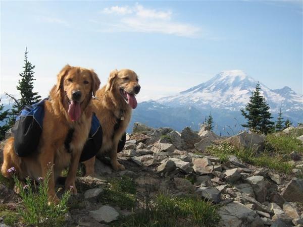
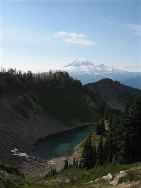
First of all, to call this the ""Bluff Lake Trail"", is a major misnomer. Sure, Bluff Lake is reached via this trail, after 1.5 miles, but it is so minor and anticlimactic, and it pales in comparison to the real rewards offered by this trail, that I think it should be called ""Trail of Awesome Views to Those Who Earn Them"". With my faithful canine companions, my plan was to hike this trail to the vicinity of Lost Lake, then take trail #79 to the PCT, and cross the famous (infamous) knife edge ridge to Old Snowy. I have climbed Old Snowy from the South (Snowgrass Flats approach), but had not been on this particular portion of the PCT. My plans, however, changed, but it was still a great hike. I followed directions as spelled out in 100 Hikes in Washington's South Cascades and Olympics. It is reached off Highway 12, just east of Packwood. The roads are well signed, but the trail head itself is not. Just look in the woods to the right for trail head marker as road 4612 takes a hairpin turn to the left. A piece of orange survey tape has ""Bluff Lake Trail"" written on it, elevation 3000 ft. The trail immediately enters the Goat Rock Wilderness and immediately starts to climb. It ascends through forest, and reaches Bluff Lake in 1.5 miles. It is pretty, and serves as a good watering spot for dogs, but greater rewards lie ahead. Persevere up, and up, and up, still in trees, with views starting to show you Mt Rainier, Tahoma and the Tatoosh. Around 5000', the trail levels and there is a little grassy meadow, but if it is mosquito season, DON'T STOP! You'll be eaten alive! Keep going. The trees start to thin, and around the 5700 ft level, you enter an area that has been burned by a forest fire several years ago. The ghostly trees really add a lot of magic to the surroundings, and the views really open up, with Beargrass Butte to the west and wildflowers galore. The trail pretty much traverses at this level, gradually climbing to a junction. The flowers and views have been excellent ever since the trees thinned out (and little help from the forest fire), but just wait! A junction at about six miles bears a sign that points down (to the right) to Lost Lake trail #78, or straight ahead (to the left-ish) to trail 76 (Clear Lost). At this point, I decided against descending to Lost Lake, for fear of losing the views and gaining the bugs! A good stiff breeze up high was keeping them away. Taking the left fork, I continued to ascend briefly, and topped the crest at 6400 feet and had awesome views of the Goat Rocks, with Mt Adams peaking behind them, Mt St Helens and Mt Rainier. Looking straight down to the east, I could see Coyote Lake. Following trail #76 as it switchbacks down the slopes, I ran into lovely little Lost Hat Lake, my home for the night. About 7 miles from the car. Over night, the clouds rolled in and the air became heavy with moisture (sometimes rain). In the morning, being optimistic, I thought the clouds would lift and the sun would break through, so I carried on with my plan to get to the PCT. Heading back up the slope (trail #76), to the signed junction, I headed toward Lost Lake. I felt like I was in a fairy land with the mystical fog blowing past the sparse alpine trees and lush green vegetation and wildflowers. Just as I approached Lost Lake, a beautiful bull elk was standing in a clearing. Unfortunately, by the time I got my camera out, he had gone into the trees. Lost Lake was nice, but I was really glad I had changed my original plans and camped up higher. It looks a lot more heavily used than I imagined, and frequently visited by horse campers (though no one was there that day...in fact, I saw no one the entire trip...and no other cars at the trail head...the joys of midweek hiking!). Shortly after Lost Lake, the trail junctions again. I took trail #79, called the Coyote trail. This ascended again, and obtained high ridges with what would have been views to knock my socks off. Instead, the clouds and occasional rain kept the views hidden. Finally admitting to myself that the clouds were there to stay for the day, I turned around, probably just shy of Packwood Saddle. I returned to camp (spotting two mountain goats along the way) and decided to pack up rather than spend another damp night. Of course, as I headed back to my car, the sun did break through, but thankfully, the higher elevations remained socked in and I felt OK about the decision to head home (for a shower and a warm, comfy bed). However, I definitely will return when the forecast for clear skies is more certain. This hike, once the initial climb through the forest is over, is definitely a winner in my book, but be prepared to work for your rewards. PS: lots of fresh scat told me there were lots of bears in the vicinity (but I didn't see any) and probably cougar and coyotes. There was some blowdown, especially along the first few miles of trail #65 (Bluff Lake), but nothing my dogs and I couldn't walk over or around.
Trip Report
Bluff Lake, Clear Lost Trail to Lost Lake Lookout — Friday, Aug. 11, 2006
 South Cascades > Goat Rocks


Comments