Trip Report
Barnaby Buttes — Thursday, Jun. 21, 2007
 Eastern Washington > Okanogan Highlands/Kettle River Range

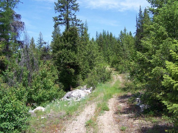
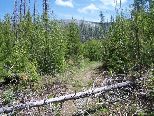
On Friday, June 22, 2007, I hiked alone up Forest Road 680 (which is now part of the Barnaby Buttes Trail No. 7). I spent my time clearing the occasional blowdowns along the easy, lower stretch of the trail, so I only got to the 3-1/2 mile point. The 7-mile-long trail is blocked off to non-motorized traffic, which surprising since the route is quite wide in most spots along the old jeep trail. After my trail maintanance along the lower 3-1/2 miles of the trail, it's in fine shape with no blowdowns or obstructions.
The condition of the steep upper part of the trail (on the south flank of Barnaby Buttes) is unknown by me. Perhaps you can file a trail report on its condition. I could see that the forest up the south slope of Barnaby Buttes was burned in the big, 20,000-acre White Mountain Fire of 1988. There are still lots of standing dead snags up there (19 years later), but the vistas must be great with little to obscure the view.
The wind was blowing on this pleasant (75-degree) June day, and in the higher gusts there was this eerie sound caused by the loose bark on the snags. It sounded like screeching tires off in the distance at times, and at other times it sounded like a crowd of people cheering. There was lots of poop droppings along the trail, which I believe to be Mule Deer and Black Bear. I made lots of noise as I hiked so as not to ""surprise"" any big animals. I saw one Mule Deer and a grouse, but (thankfully) no bears.
The lower stretch (at least) is a great trail for Mountain Biking, horseback riding, and dog walking. I have included two photos of the Forest Road 680/ Barnaby Buttes Trail No. 7 for your reference.
Here's what's printed on the trail information card stapled to the trailhead post:
""BARNABY BUTTE TRAIL #7""
""Begins: 3440 ft. elevation at the junction of Road 680 [and Forest Road 600] in the north fork of the Sanpoil River drainage.""
""Ends: 6275 ft. elevation at the junction with the South Kettle Crest #13.""
""Access: From Hwy 20 turn onto Road 99 the to Road 600. Road 600 is long and fairly steep."" [NOTE: It's 12.9 miles from Hwy 20 southeastward to the trailhead. Forest Road 600 is a bit narrow and brushy in places; it might scratch your paint finish. Access is MUCH EASIER coming up Hall Creek Road from the southeast through the Colville Indian Reservation; it's about 19.1 miles from the Inchelium Ferry area on Lake Roosevelt.]
""Considerations: The Barnaby Butte trail [No. 7] follows a closed jeep trail for about three miles. Several camping sites with water nearby are along the way. The trail crosses many streams along the first five miles."" [NOTE: I crossed two nice running creeks on the lower stretch, so you don't have to haul lots of water.]
""Opportunities: The trail goes through a variety of forest environments from the lush lower land to the cool, breezy higher crest. The abundant vegetation near the streams offers a vivid contrast with the areas burnt in the 1988 White Mountain fire. Hiking in the area gives a feeling of remoteness and tranquility. Wildlife is abundant (grouse, deer, bears, beavers) and wildflowers bring colorful contrast to the green grasses and clovers of the meadows. Wild strawberries and huckleberries can be found along the way."" [NOTE: I didn't see any, because they were out of season.]


Comments