Trip Report
Two Mouth Lakes from east side of Selkirk Crest — Wednesday, Jul. 25, 2007

Two Mouth Lakes lie in the middle of the Selkirk Crest a few miles east of Priest Lake in the north Idaho panhandle. The area gets some day hikers and huckleberry pickers but the majority of visitors don’t venture far beyond the lake during the summer months. The land between the lake and the Crest is managed by the Idaho Department of Lands whose main duties are timber management. The trails are no longer maintained and maps are constantly out of date due to logging roads being added, opened or closed. Consequently, access to trail heads can be an adventure in itself. The Crest has seen little of this activity, probably due to its impressive rocky ridges and few marketable trees at this elevation. This isolation has enabled a small heard (30 or less) of woodland caribou to barely hang on and only with the help of transplants from Canada. To add to the mix, grizzly bears roam here as well.
Here on my first backpacking trip in the summer of ’71 (ouch!), I saw an old sign marking a trail to Two Mouth Lakes. We headed up to our planned camp at one of the Standard Lakes, but that sign I never forgot. Now, #$%* years later, I read in “100 Hikes in the Inland NW” (a mountaineers book) by Rich Landers, a caribou was found dead by these lakes and “being devoured by another endangered species—a grizzly.” There is a trail on the east side, managed, I think, by the USFS, but the west side….
On July 26th, while on family vacation at Priest Lake, my son and I stopped by the Idaho Department of Lands to see what they knew about getting to the lakes from their side. They knew nothing about the condition of my old trail (the Two Mouth Cr. trail) but they assured me access to the trailhead was open. As an alternate route I found a trail on an older version of a map Idaho uses. It starts from an old lookout site (Squawman) in an area called the Wigwams. They didn’t know about this trail until I showed them on their map. They did think that the gate two-thirds of the way up the old lookout road was open. As we headed for the door we heard, “Let us know what you find.”
Almost an hour later we found the road I specifically asked about blocked by a large berm with only fourwheeler tracks after that. (When I returned the next day with our trail report, they said, “Oh ya, we heard one of our guys got carried away up there”). This meant 3 miles flat trail/road plus 3 miles & 2000 ft. possible bushwacking. Giving this a little more thought, I realized the huckleberries were at this same level this week and the bears would most likely be here too. Time to go high.
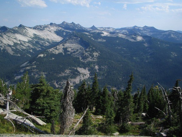
Heading up road #32 we found the gate to the Wigwams open. The road got steeper and all-wheel drive with good clearance was mandatory. One map said the road goes all the way to the top, but with 2 miles to go the road ends at about 5800 ft. (Two Mouth Lakes are at the same elevation). We left the lower end of Priest Lake about 2 hrs. earlier, and it felt very good to be putting our boots on. The trail climbs steadily, crossing the South Fork of Lion Cr., early on. Just below the saddle there is a good view north and straight down into a large cirque, with only a few small patches of snow. About an hour into the hike we reached a saddle just below 7000ft. and two small peaks (Wigwams?). Like most peaks in the Selkirks, they have a sheer drop off on one side. Squawman, to the south, is short and easy to climb. There are great views here. The flies and flying ants found my son attractive, while ignoring me. He blamed it on his scented deodorant. I was thinking, “The attitude of a 14 yr. old would get the attention of all kinds of pests.” The peak to the NE is a little taller and has an impressive overhang. We couldn’t quite scramble to the top.
This saddle must be where the trail ends for most people. Here we found a bit of a trail east, but it quickly ended. The map shows the trail making a beeline to the lakes, paralleling the ridge fairly close to the top in an easterly direction, 3mi. as the crow flies. We spent a good ½ hr. or more clunking around before heading back. Without some kind of a trail we would quickly run out of time. We dropped down about 100yd. and bang, there it was: a perfectly straight trail.
The trail dropped steadily along the south facing slope, through sub-alpine fir and whitebark pine with little undergrowth. The huckleberries were nowhere near ripening. No signs of bear. One small deer had come up earlier. There was another animal that had gone down this trail probably that morning. The tracks were too short for a moose, and too wide for an elk. We were thinking caribou. We didn’t see or hear anything, so we couldn’t say for sure. A quick 1½ mi. later, we entered a large drainage, and brush began to claim the trail. From here, the trail rose through fir, hemlock, and white pine. Alder about 3ft. high shaded our feet most of the way. Sturdy boots and long pants came in handy. We found some downed trees, but detours were not necessary. Cairns marked the way across rock slopes and old red tape hung where the trail began again. This really saved time as the brush thickened. At some points we just had to trust the tape and go for it. After we crossed one particular section of rock, the trail ended. I’m standing next to alder 5ft. high and nowhere to go. I looked up and saw several pieces of tape tied on tree branches above the brush. Trusting the tape, we headed on through. In only 10ft. of bushwacking we found the trail and the lakes.
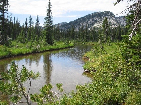
It took us 1hr. 20min. from the time we found the trail to the lower Two Mouth Lake. This lower lake is in an open area with mostly marsh and some rock on the east side. Along the marsh, there were some smaller plants I hadn’t seen before. We filtered some water below a small waterfall. The water was almost warm and tasted like a rubber tire for some reason. A 10min. walk along a water thoroughfare brought us to the deeper larger upper lake surrounded by trees, with a possible campsite on the other side. We went back to the lower lake, found a little shady spot with a breeze to keep the bugs off my son, and had lunch. There wasn’t much going on this time of day, up here. There was a light gray Sandpiper-type bird that didn’t like our presents and some birds back in the trees I hadn’t heard before. A few frogs jumped in the water and even fewer fish came to the surface. In the mud were the tracks of a moose, a deer, a coyote, and that “caribou.”
The hike back went quickly. The brush didn’t seem so bad. We only stopped to take some pictures of the peaks to the south, making notes of possible scrambles for next year. A few minutes after crossing the spot where we found the trail that morning, we began climbing in a series of about 7 very faint switchbacks to the “Wigwam” saddle. A couple of times we walked right off the trail as it turned around. Time from the lakes to the saddle: 1hr. 40min. In another 45min. we were at the trailhead, then a careful drive back to the cabin with plenty of time for a swim before dark.
Rich Landers points out how fragile this area is and that there may be restrictions in the future because of the grizzlies. I’m tempted, though, to go back and cleanup the trail a little so the red markers could come down. I’d also like to try the lower “Two Mouth Cr.” trail. It might be good when the berries are gone and the bears have moved on. This area makes for a great day hike. There just needs to be reasonable access from the west side.


Comments