Trip Report
Nordic Pass - Hyak, Windy Pass - Mount Catherine Snowshoe — Saturday, Mar. 1, 2008
 Snoqualmie Region > Snoqualmie Pass

Nice weather, fresh snow and good company made for a great trip on the Nordic Pass Trail and Mt. Catherine Loop. By using the Common Corridor (see below) and the Nordic Pass Trail, we could ski (or snowshoe) the loop without purchasing a ski area trail pass. (For more information about the Nordic Pass Trail go to http://www.kuresman.com/2006/Trip_Reports/Nordic_Pass/Report_Nordic_Pass.html)
We started at the Hyak SnoPark Lot and instead of skiing the Iron Horse Trail towards Lake Keechelus, we skied the reverse direction toward the Snoqualmie Tunnel. At the tunnel we climbed out of the railroad grade, skied up to the Hyak entrance and then took off our skis and walked to the Nordic Pass Trailhead (N47:23.774,W121:24.158) for a total distance of 0.8 mi.
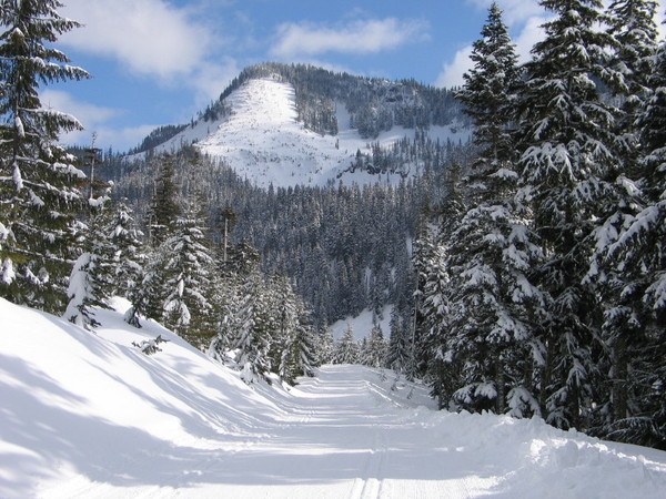
Skiing the Nordic Pass Trail was delightful. It’s all off road, marked by blue diamonds. It’s in beautiful forest most of the way, there are no snowmobiles and no avalanche danger. We took advantage of a snow bridge across the creek at the trailhead and we kept our climbing skins in our packs since our skis climbed nicely on the fresh snow. We popped out at the wooden pole power lines and crossover trail (N47:23.704 W121:25.086) and jogged to the right (west) to pick up the trail on the other side (N47:23.694 W121:25.135). We then finished climbing up to a pretty meadow and just beyond was Hyak Lake, 1.5 miles from the Nordic Pass Trailhead.
The trail then climbs up to a road crossing (N47:23.460 W121:25.329). The road is groomed by the ski area. Continuing on we broke out to the metal tower power line corridor and old clearcut (N47:23.375 W121:25.356), 2.5 miles from the Nordic Pass Trailhead.
Trees in the old clearcut are getting rather large, but not large enough to reliably display the blue diamond trail markers. Whether diamonds are nailed to the trunks or hung from the limbs like Christmas ornaments, they tend to get completely covered with snow. That was certainly true today. To pick up the trail, follow a true bearing of 221 deg for 0.2 mi. and you’ll be on the other side of the clearcut (N47:23.260 W121:25.498) where you can see a diamond on a large tree.
From the far side of the clearcut we followed the trail into the forest about 0.1 mi. where we found a Nordic Pass Trail sign (N47:23.211 W121:25.592). The trail proceeded to go along the side of a ridge until the terrain got more gentle on the flanks of Nordic Knob (aka Radio Mt). This is the general area where the old trail from Rockdale Lake comes in.
At 3.6 miles we reached Dick’s Creek (N47:22.861 W121:26.162) by a lovely meadow area.
We continued to Nordic Pass (N47:22.467 W121:26.451), 4.2 miles from the Nordic Pass Trailhead, 5 miles from the Hyak SnoPark. The pass was delightful with widely spaced trees and plenty of sunshine. There were a few views out through the trees including Silver Peak. The trip today got my official “sandwich” rating. Had I reached for my jacket before my sandwich, it would have gotten a “jacket” rating.
After lunch we skied past the snow gauge and then dropped steeply to the Windy Pass area and another Nordic Pass Trail sign (N47:22.345 W121:26.675).
At a total distance of 4.6 miles from the Nordic Pass Trailhead, we had reached the other end of the trail at the Cold Creek (Windy Pass) Road. This is also the end of the Common Corridor. The Common Corridor is a stretch of the groomed Cold Creek Road that backcountry skiers and snowshoers can use without buying a trail pass. Snowshoers should stay out of the set ski tracks, but can walk along either side of the tracks.
The groomed road was a little icy and irregular today, but still fun and fast to ski. We were soon down to the yurt (7.7 miles from Hyak SnoPark) that the ski area set up for their paying customers.
We finally reached the start of the Common Corridor (N47:22.485 W121:23.735) beyond which we would need a trail pass to ski on the ski area’s groomed road. But we turned right and headed down the steep, 1/8th mile long Connector Trail. Many people wisely choose to take off their skis and walk this stretch. The other end of the Connector Trail (N47:22.446 W121:23.643) literally dumped us off onto the Iron Horse Trail. To find the Connector Trail from Hyak, ski 1.2 miles and look for the trail on the right. There is a blue diamond a tree or two into the woods and usually there are ski, snowshoe and/or boot tracks in the snow. A way to find the trail without a GPS is to count power poles and look for the turn after pole #1142. Pole #1142 is missing its number, so you have to watch for pole #1143 before it.
Our happy group of skiers skied the level Iron Horse Trail back to our cars at the Hyak SnoPark. The loop totaled 10.4 miles with an elevation gain of 1500 ft.


Comments
Thank you for GPS coordinates!!!
Posted by:
SJ on Jan 08, 2010 03:12 PM