Trip Report
Wildside Trail-De Leo Wall, Coal Creek Falls & Cave Hole — Saturday, Apr. 12, 2008
 Issaquah Alps > Cougar Mountain

Sunday's weather wasn't quite as glorious as Saturday, but I had free time for a hike and was looking for something close-in, so Cougar Mountain it was. If you're looking for a nice outing in the foothills, Cougar doesn't have quite the crowds that Tiger Mountain has. And you can get to the trail by bus or bike, making it an especially ""green"" hike! See the end of the report for more details.
The maze of trails is confusing at Cougar, so be sure to pick up one of the printed maps at the trailhead or download one from here before you go.
I started at the Red Town Trailhead just off the Newcastle Golf Club Road. I started up the Wildside Trail (W1) with a brief detour to the old mine shaft and kiosk on the coal mining history of the are just a few hundred yards up the trail. Then continuing up W1, saw plenty of wildflowers in bloom right now. Saw my first trilliums of the season, plus evergreen violet, red-flowering currant and miner's lettuce. The bleeding heart should be in full bloom in about a week.
I then turned off to the De Leo Wall Trail (W9) and the forest changed from western red cedar, ferns and alder to salal, Douglas-fir and madrona. The viewpoint was a pleasant spot for lunch although I preferred the view of the madronas and pink flowers of the currant bushes to the vantage on Renton and the nearby suburbs.
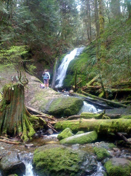
Heading back down, I branched off on the Indian Trail (W7) and took a right uphill on the Quarry Trail (C6). Then it was left on the Coal Creek Falls Trail (C4), to the falls, which are running quite nicely now. Then it was down the Cave Hole Trail (C3) to the trailhead. All told, the hike was about 2 hours and approximately 5-6 miles of hiking. Trail was in good shape, only one blowdown and a few patches of mud.
And the neat thing was: I didn't burn a drop of gas to get to the trailhead. This is a great hike to bike or bus to!
From Seattle, you can take the Sound Transit 550 to the South Bellevue Park & Ride, then connect to the M240, which heads out on Coal Creek Parkway. Request a stop at Coal Creek and 119th. You'll have to hike an additional 4 miles round trip on the Coal Creek Trail to get the Red Town Trailhead. Or pop you bike on the bus and complete the trip along Newcastle Golf Club Road to the trailhead.
Biking from Seattle requires about 2 hours one-way and it's a very pleasant ride. I found my way to the paved I-90 trail, crossed the lake, then headed south on the Lake Washington Trail. Cross over I-405 on Lake Washington Blvd. and head up over the hill on SE 68th St. Take the Newcastle Golf Club Road (which becomes Newcastle-Coal Cree Road) to the Red Mountain Trailhead. On the return, head back on Newcastle Golf Club Road to Coal Creek Parkway, then you can take the wide bike lane all the way back down the hill to the Lake Washington bike trail and I-90. If don't have a copy of the King County bike map, pick up a copy at any King County library or print sections from it here. Total, it was about a 6-hour journey and it felt good not to add a single drop of carbon to the atmosphere!


Comments