Great Summer Hikes on the Olympic Peninsula
From the wild coast to gentle river hikes, wildlife-packed meadows to lofty views of snow-capped mountains, the Olympic Peninsula has some incredible summertime hiking and backpacking. You'll find a handful of coast, river and mountain hikes below to get you started.
Before you go: Check Trip Reports and with the Olympics rangers about trail and road conditions. If you're backpacking, brush up on your backpacking basics and research the rules, regulations and tidetables on the peninsula. You may need a backcountry reservation or permit. Note that dogs are not allowed on trails in Olympic National Park, so if you hike with a pup, stick to Olympic National Forest and Washington State Parks.
_________________________________________________________
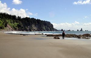
Third Beach
Round Trip: 3.6 miles
Elevation Gain: 280'
Hike It: Read recent Trip Reports and get more info in our Hiking Guide.
A coastal favorite, this nearly level trail is just over 1 1/2 miles long, reaching a wide sandy Pacific beach. If you're staying overnight, campsites are partly protected from the wind in a creek ravine. But the wind does blow in from the ocean, creating the magical surf. The adventure is in climbing over giant driftwood logs and exploring the shore and those enormous roaring waves. This is a great hike for kids, who will love the tide pools, playing in the sand, and watching for gray whales and eagles.
_________________________________________________________
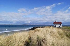
Fort Worden State Park - Point Wilson
Location: Near Port Townsend, Olympics
Round Trip: 5 miles
Elevation Gain: none
Hike It: Read recent Trip Reports and more info in our Hiking Guide.
On the shore of the Strait of Juan de Fuca, you can walk a fine sandy beach between high bluffs and two access points to reach the Point Wilson Lighthouse. On a clear day, there are excellent of Mount Baker, Vancouver Island, the San Juan Islands, and the Cascades behind them. Follow the beach to the red-roofed Coast Guard lighthouse at Point Wilson. It is not open for visitors, but there are picnic tables available for a lunch stop out of the wind.
_________________________________________________________
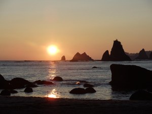
South Coast Wilderness Trail: Toleak Point - Third Beach to Oil City Traverse
Round Trip: 17 miles (2-4 day backpack)
Elevation Change: 3000'
Hike It: Read recent Trip Reports and get more info in our Hiking Guide.
Experience one of the wildest - and most beautiful - stretches of coastline in the contiguous United States on this 17 mile traverse. But beware: this isn't just any leisurely beach walk. The going is tough. You'll be climbing ladders with your backpack on, scrambling along muddy headland trails, waiting out high tides and fording creeks. Up and down you'll go on this demanding trail. But it is entirely worth it for the ocean sunsets, the unexpected encounters with wildlife, the incredible sea stacks and the constantly crashing surf. This trail is in Olympic National Park and does not allow dogs.
_________________________________________________________
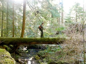
Lower Grey Wolf River
Location: Olympics - East
Round Trip: 8.4 miles
Elevation Gain: 800 ft
Hike it: Read recent trip reports and get more info in our Hiking Guide.
Start off heading downhill on this gentle hike outside Sequim. You'll roll up and down through lush forest and along the river bottom where the Gray Wolf crashes and bubbles next to the trail. You'll spot birds, fungi, mosses and even a few forest views. Because it's on National Forest land, it's also a nice trail for hikers with dogs to explore the Olympics.
_________________________________________________________
Upper Dungeness River
Location: Olympics - East
Distance: 6.8 miles roundtrip to Camp Handy
Elevation: 600 feet gain to 3100 feet
Hike it: Read recent trip reports and get more info in our Hiking Guide.
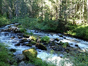
Take an easy summer stroll along the Upper Dungeness River trail, where the roaring river will keep you company almost the entire hike. It makes a great hike for families, and the views (or shelter) at Camp Handy make for a good lunch destination on clear or rainy days. This trail features a magnificent forest canopy with old growth Douglas-fir more than 200 feet high and hundreds of years old. For backpackers who want a longer hike, there are plenty of options for continuing your hike from the National Forest into the Olympic National Park (with permits, of course).
_________________________________________________________
Slab Camp Creek and Grey Wolf River

Round Trip: 5.6 miles
Elevation Gain: 1100'
Hike it: Read recent Trip Reports and get more info in our online Hiking Guide.
Thick green forests and the swollen Grey Wolf river will keep you company and keep you cool from summer heat on this day hike or short backpacking trip on the eastern side of the Peninsula. There are three well established, large camping spots at Duncan Flats about 2.5 mi. in (one’s just across the bridge). Slide Creek Camp is about another 1.5 mi. from there. Both have water year round.
_________________________________________________________
Grand Valley
Round Trip: 9.8 mile loop
Elevation Gain: 2400' to 6450'
Hike it: Read trip reports and get more info our Hiking Guide .
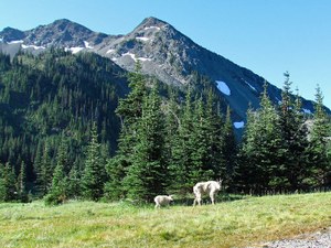
Blooming wildflowers, a string of alpine lakes, abundant wildlife and spectacular views are the rewards of this 9.8 mile loop in Olympic National Park. You can make it as a long day hike or plan ahead, get your permits and spend a night or two in some of the most spectacular scenery that Olympic National Park has to offer.
_____________________________________________________
Mount Townsend

Round Trip: 12 miles
Elevation Gain: 2000' to 5200'
Best Season: Mid-June - Aug.
Hike it: Read trip reports and get more info in our Hiking Guide.
This trail showcases the Coast Rhododendron (Washington's State flower) along its lower reaches in late June and early July. And for those who proceed, they'll be treated to an enjoyable field of phlox atop the mountain (and some sweet views of the Buckhorn Wilderness too).
Sunrise Ridge
Round Trip: 5.2 miles
Elevation Gain: 1000' to 5500'
Best Season: July - August
Hike it: Read trip reports and get more info in our Hiking Guide
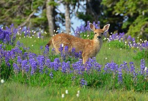
You can't go wrong finding wildflowers at Hurricane Ridge in Olympic National Park. While the hordes head up the paved path to Hurricane Hill, solitude seekers climb up the Mount Angeles trail and branch off to attain Sunrise Ridge. Phlox, penstemon, lupine, bistort, larkspur and more greet hikers here.

