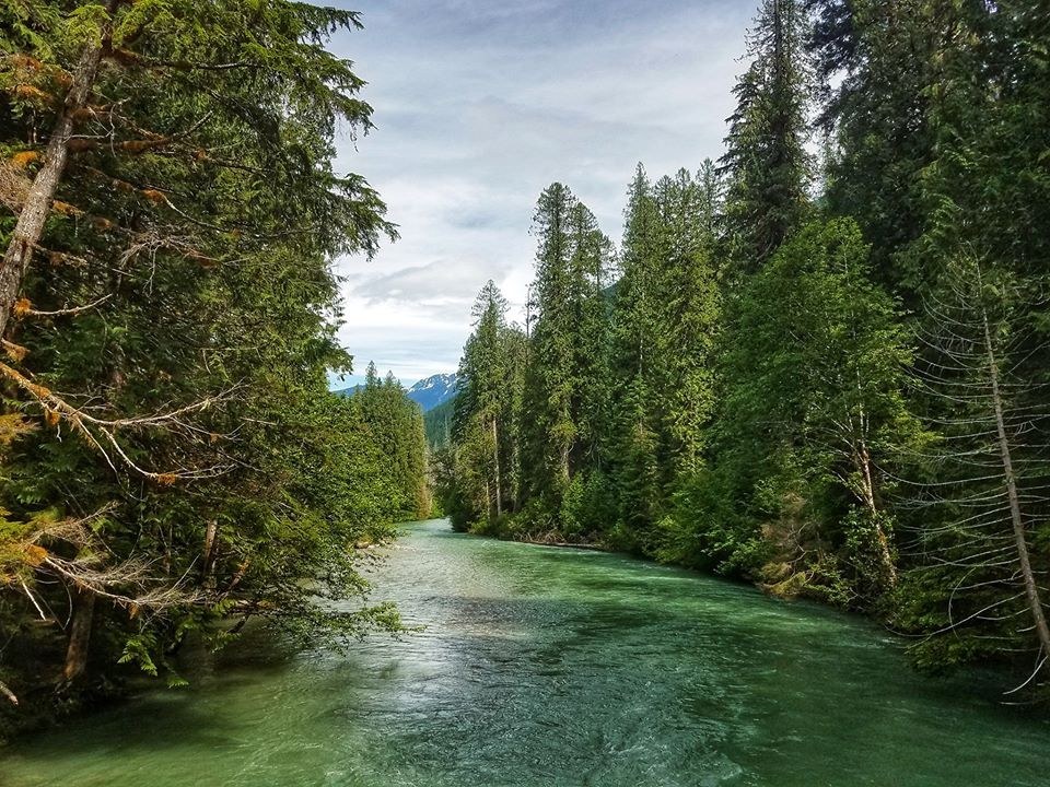
A pale green creek, big old trees, a variety of understory, and peek-a-boo views of snow-capped peaks. Day-hikers should take it easy, as the joy here is in the journey not the destination. Backpackers, however, may disagree. Families and first-time backpackers will enjoy beautiful camps just two miles from the trailhead. Experienced backpackers will note that Thunder Creek is a gateway to an extensive network of trails.
The trail begins at a small parking lot near the amphitheater. Quickly enter a nice forest of old cedars, Douglas firs, and giant ferns. Wide and not too rocky, this section of trail is accessible to hikers of all ages.
Almost immediately, pass an unsigned junction with a trail on your right that heads backwards and uphill. Take note of this trail, because it could be confusing on the way out. Shortly after this junction, come to a signed fork for a nature loop on your right. Continue straight along the creek, enjoying periodic views of the pale green water. Fine glacial sediment is responsible for this color.
Soon you will come to a sturdy bridge over Thunder Creek. Cross the bridge and find yourself in Thunder Camp. If you are ready for a break, there are some nice rocks to sit on next to the creek.
The trail narrows and walking side-by-side will no longer be an option. At 2.1 miles, come to a well signed junction. The trail left leads to Fourth of July Pass. There are views from Fourth of July Camp, but the steep 2.5 mile ascent represents a change in destination rather than a short side-trip. The best views are from a couple of camp sites, which are less likely to be occupied on Sunday afternoon than on Saturday.
Continue right, cross a small stream, and quickly arrive at another well signed junction. The trail to the right heads to Neve Camp, with space for five tents. This is a great destination for a family or a first-time backpacker.
The main trail begins to climb high above the creek. Be careful with kids on the steep side-slope. The forest opens up a little, giving you views of the peaks across the valley. After about a mile, the trail turns away from the creek. Notice the silence for the next half-mile: a small hill is between you and the creek.
It will be another few miles before the trail and creek are at the same elevation. At this point, the creek is much narrower than before, and the creek edges are much rockier. Keep your eyes open –- there is a nice overlook of the creek. This is a fine spot for a break or to turn around.
If your destination is McAllister Camp, continue on. An impressive washout at a bend in the creek is the signal that you are getting close. Pass the horse camp and look for a well signed junction, with McAllister Hiker Camp to the right. Cross the creek on a sturdy bridge, pausing to appreciate the green water rushing through the narrow canyon. Continue another half mile to the camp, where McAllister Creek joins Thunder Creek. At an elevation of only 1900 feet, this camp makes a good early-season camping destination.
Thunder Creek

-
Length
- 12.0 miles, roundtrip
-
Elevation Gain
- 1,300 feet
-
Highest Point
- 1,900 feet
-
Calculated Difficulty
About Calculated Difficulty
- Moderate/Hard

 Full-size image
-
Established campsites
-
Good for kids
-
Old growth
-
Ridges/passes
-
Rivers
Parking Pass/Entry Fee
None
A pale green creek, big old trees, a variety of understory, and peek-a-boo views of snow-capped peaks. Day-hikers should take it easy, as the joy here is in the journey not the destination. Backpackers, however, may disagree. Families and first-time backpackers will enjoy beautiful camps just two miles from the trailhead. Experienced backpackers will note that Thunder Creek is a gateway to an extensive network of trails.
Continue reading 
Hiking Thunder Creek

WTA worked here in 2024 and 2023!
Hike Description Written by
Mike On A Hike,
WTA Correspondent
Map & Directions
 Trailhead
Before You Go
A backcountry permit is required to camp overnight in the North Cascades National Park Complex (incl. Ross Lake National Rec Area and Lake Chelan National Rec Area). They are $10 per person plus a $6 non-refundable reservation fee. Permits must be picked up at the Wilderness Information Center in Marblemount. See the National Park Service website for more details on permits.
Parking Pass/Entry Fee
NoneWTA Pro Tip: Save a copy of our directions before you leave! App-based driving directions aren't always accurate and data connections may be unreliable as you drive to the trailhead.
Getting There
From I-5, head east on Hwy 20 for approximately 46 miles to Marblemount. Pass the North Cascades National Park Wilderness Information Center, where you can get permits if you are planning an overnight trip. Continue another 25 miles, and then turn right into Colonial Creek Campground, just past milepost 130. Follow signs to the trailhead near the amphitheater. Restrooms with running water are available.
More Hike Details
Trailhead
North Cascades > North Cascades Highway - Hwy 20
North Cascades National Park
Guidebooks & Maps
Day Hiking: North Cascades (Romano - Mountaineers Books)
The Disabled Hiker’s Guide to Western WA and OR (Syren Nagakyrie)
You can improve or add to this guidebook entry!


