 Washington Trails
Association
Trails for everyone, forever
The U.S. Forest Service uses a variety of trail and road signs. Check out our guide on what they mean and how they help us get outside. By Jessi Loerch
If you’ve spent any time hiking on U.S. Forest Service land, you’ve undoubtedly seen many road and trail signs. Some you could probably call to mind — the iconic shape of a “Welcome to ...” national forest sign, for instance. Some you probably see without ever thinking twice about them. But, if you know a bit about the design of those signs, you can get information about the road or trail ahead at a single glance.
The Forest Service has a massive document (it’s 681 pages!) called “Sign and Poster Guidelines for the Forest Service.” It’s an unexpected dorky delight to scroll through it. Here are some of the useful highlights of road and trail signs. (I’ll save you reading 681 pages.)

Signs with horizontal road numbers indicate roads with a higher level of maintenance than vertical signs. Photo by WTA staff photo.
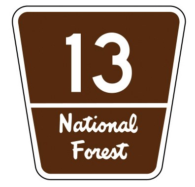
Distinctive route markers: These iconic trapezoidal signs are used to mark more major, highly traveled roads. These are roads that are likely to show up on regional maps.
 U.S. Forest Service road sign.
Horizontal route markers: These signs are used to indicate lesser-traveled routes. The Forest Service calls them local or minor collector roads. These roads include paved, dirt or gravel roads and are intended to be OK for a standard passenger vehicle. The direction of travel arrow might be integrated into the sign or posted below it.
Vertical route markers: These signs are used to indicate roads with what the Forest Service calls maintenance levels 1 and 2. Level 2 roads are only passable by high-clearance vehicles. These roads likely won’t have traffic-control signs. Level 1 are old roads that are not maintained for vehicles. Level 1 roads are considered to be in storage and are not intended for vehicle use. They may not show up on maps.

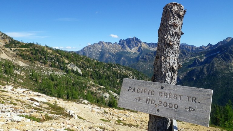
In wilderness areas, signs are simple, made out of wood and don’t include distances to destinations. Photo by Cody Sherrodd
Informational signs: Trail signs usually indicate direction of travel and the distance to the signed destinations. Distances are in miles — except for cross-country skiing trails which are measured in kilometers. Distances are show to the nearest quarter mile for distance up to 3 miles. After 3 miles, distances are rounded to the nearest mile.
Wilderness: Wilderness-area trails have fewer signs and the signs will have directional arrows but will not include distances. Unlike in non-wilderness areas, specific destinations or geographic features are not signed.

U.S. Forest Service trail sign for wilderness areas.
Materials: Forest Service signs for nonmotorized routes are made out of wood and are typically posted either on wooden posts or attached to trees.
Blazes: On primitive trails, blazes (small sections of bark removed from trees to leave a visible mark) may be used in some cases as a reassurance to hikers that they are on the right trail. On more developed trails, signs may be used to reassure hikers they are on the right route.
Reflective: On hiking trails, signs are not required to be reflective, although they sometimes are for added emphasis. In wilderness areas, trails signs are never reflective.